Dunning Mountain
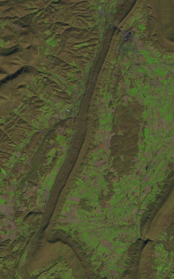 Photo: James Stuby based on USGS/Landsat image, Public domain (via Wikimedia Commons)
- 2,279 ft
- summit
- Jun–Oct
- best months
Dunning Mountain is a summit in Pennsylvania, rising to 2,279 feet about 2 miles from the town of Sproul. It is a straightforward objective for anyone exploring this corner of the state, with the nearest town close enough to make it an easy addition to a day spent in the area. For comfortable weather, aim for late spring or early fall. Typical averages from a nearby weather station in Altoona show May highs around 71°F and September highs around 74°F, with July the warmest month at about 83°F. That station sits roughly 800 feet lower than the summit, so temperatures on top run cooler. Several other outdoor spots lie within a short drive. Yellow Creek, a canoeing route, is about 4.5 miles away, and the MTB Trail is about 6 miles off. Hikers can head to the Sawmill Trail or the Three Springs Trail, both a little over 6 miles from the mountain.
Conditions and forecast
Daily highs and lows, wind and the chance of precipitation at the summit for the next 7 days, from the Open-Meteo model.
- Summit elevation
- 2,279 ft
Elevation from USGS 3D Elevation Program terrain data (about 10 m resolution).
We don't know of a mapped trail or route to the summit of Dunning Mountain. Plan the approach with local maps, a guidebook or a local guide, and check conditions before you go.
Questions about Dunning Mountain
How tall is Dunning Mountain?
2,279 ft (695 m).
Is there a trail to the top of Dunning Mountain?
We don't know of a mapped trail or route to the summit. Plan the approach with local maps, a guidebook or a local guide.
 Blue Knob3,152 ft · Pennsylvania1 route6.8 mi awayPhoto: Calzarette, CC BY 3.0 (via Wikimedia Commons)
- Terrace Mountain1,973 ft · Pennsylvania1 route20 mi away
- Horse Knob1,973 ft · Pennsylvania1 route20 mi away
- Bald Knob2,304 ft · Pennsylvania4 routes23 mi away
- King Knob2,104 ft · Pennsylvania1 route23 mi away
- Fisher Point2,297 ft · Pennsylvania1 route23 mi away
- Yellow CreekCanoeing4.5 mi
- MTB TrailMountain biking5.9 mi
- Sawmill TrailHiking6.2 mi
- Three Springs TrailHiking6.4 mi
- Mountain View TrailMountain biking6.4 mi
- Mountain View Trail - MTB TrailMountain biking6.6 mi
- Mountain View Connector - MTB TrailMountain biking6.6 mi
- Lookout Loop - MTB TrailHiking6.7 mi
Source: Roamze catalog (indexable pages within 10 miles, PostGIS distance)
- Blue KnobSummit · ~12 min drivePhoto: Calzarette, CC BY 3.0 (via Wikimedia Commons)
 Butler KnobSummit · ~44 min drivePhoto: Joe Calzarette, CC BY-SA 3.0 (via Wikimedia Commons)
 Savage MountainSummit · ~50 min drivePhoto: Nyttend, Public domain (via Wikimedia Commons)
 Big MountainSummit · ~58 min drivePhoto: Calzarette at en.wikipedia, Public domain (via Wikimedia Commons)
 Clarks KnobSummit · ~1h 8m drivePhoto: Calzarette at en.wikipedia, Public domain (via Wikimedia Commons)
- Spruce KnobSummit · ~10 min drive
- Terrace MountainSummit · ~35 min drive
- Horse KnobSummit · ~35 min drive
- Bald KnobSummit · ~39 min drive
- King KnobSummit · ~39 min drive
Best time to visit Dunning Mountain
Best months: June–October. Best months have typical highs of 55–85 °F, lows of 30 °F or warmer (32 °F where the station doesn't record snow), at most one snowy day and no more than 12 wet days.
Jan
35° / 21°
11 wet
Feb
39° / 23°
10 wet
Mar
48° / 30°
12 wet
Apr
61° / 40°
13 wet
May
71° / 50°
14 wet
Jun
79° / 58°
12 wet
Jul
83° / 62°
12 wet
Aug
81° / 60°
11 wet
Sep
74° / 53°
10 wet
Oct
63° / 43°
11 wet
Nov
50° / 34°
10 wet
Dec
40° / 26°
11 wet
Typical high / low (°F) and days with rain or snow, 1991–2020. Measured at Altoona Blair Co Ap, PA, 7.6 mi away at 1,480 ft. The station sits about 800 ft lower than this place, so expect it a little cooler here. This station doesn't record snowfall. Source: NOAA NCEI U.S. Climate Normals 1991–2020.