Tamarack Self-Guided Nature Trail
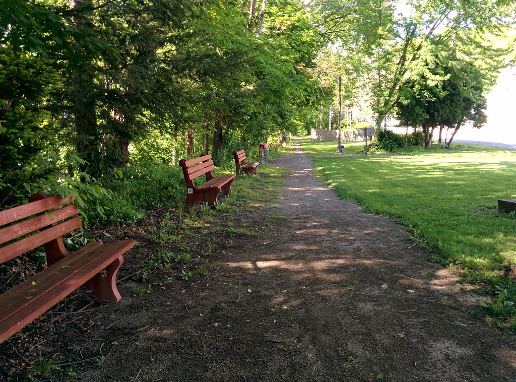
 Photo: BuzzWeiser196, CC BY-SA 4.0 (via Wikimedia Commons)
- 0.3 mi
- round trip
- 129 ft
- climb
- 1,234 ft
- high point
- Out and back
- route
- Jun–Oct
- best months
Tamarack Self-Guided Nature Trail is a short, easy hike in Twin Lakes County Park in Pennsylvania. The route runs 0.3 miles each way as an out-and-back, making about a 0.6-mile round trip that suits a quick walk or a first outing with kids. The trail starts at about 1,164 feet and tops out near 1,234 feet, a gain of about 70 feet one way and roughly 130 feet over the full round trip. Most of that climbing comes early. The steepest stretch is close to the start, around 0.05 miles in, where the grade reaches about 8 percent. After that the walk eases off, and the return leg gives back the same elevation. September and October are the most comfortable months. Typical averages from the Mt Pleasant weather station, about 7 miles away and a couple hundred feet lower, show highs of about 75°F in September and 64°F in October, with fewer wet days than most of the year. To make a longer visit, Horse Trail starts just 0.3 miles away and Ferrier Family Life Trail is 0.5 miles off. Little Crabtree Creek Trail is about 1.7 miles away, and Sewickley Creek, roughly 6.6 miles out, offers canoeing.
Local outfitters
- Paddler's Lane Retreat34 mi away
- Venture Outdoors34 mi away
Not on Roamze yet. Their page has how to reach them.
- Horse TrailHikingPhoto: BuzzWeiser196, CC BY-SA 4.0 (via Wikimedia Commons)0.3 mi
- Ferrier Family Life TrailHikingPhoto: BuzzWeiser196, CC BY-SA 4.0 (via Wikimedia Commons)0.5 mi
- Little Crabtree Creek TrailHiking1.7 mi
- Bell Memorial TrailHiking4 mi
- Tall Grass TrailHiking4.6 mi
- Sewickley CreekCanoeing6.6 mi
- Bush Recreation AreaCamping8.7 mi
- Loyalhanna Lake PavilionsCamping9.9 mi
Source: Roamze catalog (indexable pages within 10 miles, PostGIS distance)
- Horse TrailHiking · Next doorPhoto: BuzzWeiser196, CC BY-SA 4.0 (via Wikimedia Commons)
- Ferrier Family Life TrailHiking · Next doorPhoto: BuzzWeiser196, CC BY-SA 4.0 (via Wikimedia Commons)
- Don Harrison Trail - Blue TrailHiking · ~22 min drive
- Coronary TrailHiking · ~22 min drive
 Stone Lodge TrailHiking · ~11 min drivePhoto: NewAlexPA, CC BY-SA 4.0 (via Wikimedia Commons)
- McCune Run TrailHiking · ~12 min drivePhoto: NewAlexPA, CC BY-SA 4.0 (via Wikimedia Commons)
- Davis Run TrailHiking · ~12 min drivePhoto: NewAlexPA, CC BY-SA 4.0 (via Wikimedia Commons)
 West Penn Trail - Saltsburg to Kiski Section ConnectionHiking · ~20 min drivePhoto: Margaret Luzier, U.S. Army Corps of Engineers, Public domain (via Wikimedia Commons)
 West Penn Trail - Dick Mayer SectionHiking · ~20 min drivePhoto: Margaret Luzier, U.S. Army Corps of Engineers, Public domain (via Wikimedia Commons)
 West Penn Trail - Kiski ExtensionHiking · ~21 min drivePhoto: hhm8, CC BY 2.0 (via Flickr)
Best time to visit Tamarack Self-Guided Nature Trail
Best months: June–October. Best months have typical highs of 55–85 °F, lows of 30 °F or warmer (32 °F where the station doesn't record snow), at most one snowy day and no more than 12 wet days.
Jan
37° / 21°
15 wet · 6 snow
Feb
41° / 21°
12 wet · 5 snow
Mar
50° / 28°
13 wet · 3 snow
Apr
62° / 36°
14 wet
May
71° / 47°
14 wet
Jun
79° / 56°
12 wet
Jul
82° / 60°
12 wet
Aug
81° / 59°
11 wet
Sep
75° / 51°
10 wet
Oct
64° / 40°
11 wet
Nov
52° / 31°
12 wet · 2 snow
Dec
42° / 25°
14 wet · 4 snow
Typical high / low (°F) and days with rain or snow, 1991–2020. Measured at Mt Pleasant, PA, 7.1 mi away at 1,003 ft. Source: NOAA NCEI U.S. Climate Normals 1991–2020.
Map and trail data © OpenStreetMap contributors
