West Penn Trail - Dick Mayer Section
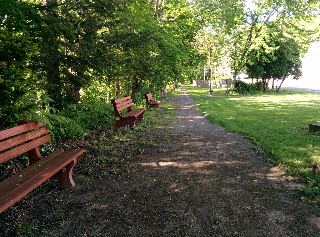
 Photo: Margaret Luzier, U.S. Army Corps of Engineers, Public domain (via Wikimedia Commons)
- 1.6 mi
- round trip
- 491 ft
- climb
- 1,207 ft
- high point
- Out and back
- route
- Jul–Oct
- best months
Clear at last check
Weather is good · OpenWeather · checked 21 h ago
The Dick Mayer Section of the West Penn Trail is a short hike on State Game Land 328 in western Pennsylvania, on land managed by the state fish and wildlife agency. Rated easy, it covers 1.57 miles one way, making for a round trip of about 3.1 miles as an out-and-back. The terrain is rolling rather than one sustained climb. You start at the route's low point of about 965 feet and top out near 1,207 feet. That works out to about 313 feet of climbing one way and roughly 490 feet over the full round trip. The steepest stretch, around 9 percent, comes near the one-mile mark. September is a comfortable time to go. Typical averages from the nearby Loyalhanna Lake weather station run to highs around 76°F and lows near 51°F that month, with May similarly mild at highs around 72°F. Conemaugh Lake Pavilions sits about 1.4 miles away. Loyalhanna Lake Pavilions is roughly 3.2 miles off. To keep walking the West Penn Trail, the Saltsburg to Kiski Section Connection and the Kiski Extension are both within about 3 miles.
Local outfitters
- Venture Outdoors34 mi away
- Paddler's Lane Retreat45 mi away
Not on Roamze yet. Their page has how to reach them.
- Conemaugh Lake PavilionsCamping1.4 mi
 West Penn Trail - Saltsburg to Kiski Section ConnectionHikingPhoto: Margaret Luzier, U.S. Army Corps of Engineers, Public domain (via Wikimedia Commons)2.9 mi
 West Penn Trail - Kiski ExtensionHikingPhoto: hhm8, CC BY 2.0 (via Flickr)3.2 mi
- Loyalhanna Lake PavilionsCamping3.2 mi
- Bush Recreation AreaCamping3.3 mi
- Keystone Loyalhanna TrailHiking6.6 mi
 McCune Run TrailHikingPhoto: NewAlexPA, CC BY-SA 4.0 (via Wikimedia Commons)6.8 mi
- Beaver RunCanoeing8.6 mi
Source: Roamze catalog (indexable pages within 10 miles, PostGIS distance)
- West Penn Trail - Saltsburg to Kiski Section ConnectionHiking · ~5 min drivePhoto: Margaret Luzier, U.S. Army Corps of Engineers, Public domain (via Wikimedia Commons)
 Horse TrailHiking · ~20 min drivePhoto: BuzzWeiser196, CC BY-SA 4.0 (via Wikimedia Commons)
- Don Harrison Trail - Blue TrailHiking · ~21 min drive
- West Penn Trail - Kiski ExtensionHiking · ~5 min drivePhoto: hhm8, CC BY 2.0 (via Flickr)
- Baker TrailHiking · ~24 min drive
- McCune Run TrailHiking · ~12 min drivePhoto: NewAlexPA, CC BY-SA 4.0 (via Wikimedia Commons)
- Baker TrailHiking · ~25 min drive
- Davis Run TrailHiking · ~12 min drivePhoto: NewAlexPA, CC BY-SA 4.0 (via Wikimedia Commons)
- Stone Lodge TrailHiking · ~12 min drivePhoto: NewAlexPA, CC BY-SA 4.0 (via Wikimedia Commons)
- Ferrier Family Life TrailHiking · ~20 min drivePhoto: BuzzWeiser196, CC BY-SA 4.0 (via Wikimedia Commons)
Best time to visit West Penn Trail - Dick Mayer Section
Best months: July–October. Best months have typical highs of 55–85 °F, lows of 30 °F or warmer (32 °F where the station doesn't record snow), at most one snowy day and no more than 12 wet days.
Jan
37° / 19°
15 wet
Feb
40° / 20°
13 wet
Mar
49° / 27°
14 wet
Apr
62° / 36°
13 wet
May
72° / 46°
14 wet
Jun
80° / 55°
13 wet
Jul
83° / 59°
12 wet
Aug
82° / 58°
11 wet
Sep
76° / 51°
10 wet
Oct
64° / 40°
12 wet
Nov
52° / 30°
13 wet
Dec
41° / 24°
14 wet
Typical high / low (°F) and days with rain or snow, 1991–2020. Measured at Loyalhanna Lake, PA, 3.1 mi away at 990 ft. This station doesn't record snowfall. Source: NOAA NCEI U.S. Climate Normals 1991–2020.
Map and trail data © OpenStreetMap contributors
