Mountain · 1 route
Fish Hook Peak
5,027 ft · Oregon
- Summit
- 5,027 ft
- Routes
- 1 way up
- Season
- June 1 – October 31
Route up Fish Hook Peak
About Fish Hook Peak
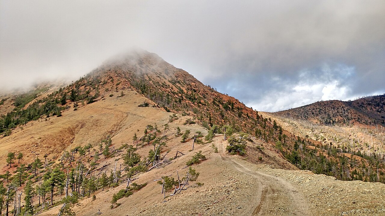
Fish Hook Peak is a summit of 5,027 feet in the Gold Beach Ranger District of the Rogue River-Siskiyou National Forests in southwest Oregon. The nearest town is Selma, about 23 miles away. Summer is the most comfortable time to go. Typical averages from a nearby weather station at Sexton Summit show July and August highs around 77°F with only about two wet days a month, while winter months bring highs in the low 40s and rain on roughly half the days. The Fish Hook Interpretive hike starts less than a mile away, and Grassy Flats campground is about 1.5 miles off. Paddlers can head to Indigo Creek, about 3 miles away, and the Silver Peak - Hobson Horn Trail is about 3.3 miles away.
Forecast on Fish Hook Peak
Daily highs and lows, wind and the chance of precipitation at the summit and route start for the next 7 days, from the Open-Meteo model.
Questions about Fish Hook Peak
How tall is Fish Hook Peak?
5,027 ft (1,532 m).
How many routes go to the summit of Fish Hook Peak?
One: Fish Hook Interpretive.
When is the best time to climb Fish Hook Peak?
June 1 – October 31.
Mountains nearby
- Brandy Peak5,305 ft · Oregon1 route4.8 mi away
- York Butte4,237 ft · Oregon1 route10 mi away
 Pearsoll Peak5,095 ft · Oregon1 route16 mi awayPhoto: Forest Service, Public domain (via Wikimedia Commons)
- Iron Mountain4,073 ft · Oregon1 route16 mi away
- Mislatnah Peak3,127 ft · Oregon1 route17 mi away
- Quosatana Butte3,362 ft · Oregon1 route18 mi away
Facts about this place
When to go
Best time to go: May–Sep. The mildest months here, with typical highs of 61–77°F and lows of 41–54°F.
Typical monthly averages (not a forecast) from the Sexton Summit, OR weather station, 28 mi away. High / low in °F.
- Jan43° high33° low
- Feb44° high33° low
- Mar46° high33° low
- Apr52° high35° low
- May61° high41° low
- Jun68° high46° low
- Jul77° high53° low
- Aug77° high54° low
- Sep70° high51° low
- Oct58° high43° low
- Nov47° high36° low
- Dec41° high32° low
The station sits about 1,200 ft lower than this spot, so expect it to run cooler up here.
Where it is
- Gold Beach Ranger District · Ranger district
- Rogue River-Siskiyou National Forests · National forest
- Nearest town
- Selma, Oregon · 23 mi
Conditions
Active alerts for Rogue River-Siskiyou National Forests as of Oct 9, 2026:
Stage 2 Public Use Fire Restrictions (Wild and Scenic Lower Rogue River)
fire-restriction · posted Sep 3, 2026
Stage 2 Public Use Fire Restrictions (Forest-wide)
fire-restriction · posted Sep 3, 2026
Illinois River Corridor Seasonal Alcohol Prohibition
critical · posted Aug 24, 2026
Occupancy and Use: 14-Day Stay Limit
information · posted Aug 24, 2026
Industrial Fire Precaution Level: Level 3
fire-restriction · posted Aug 24, 2026
Source: USFS forest alerts
Nearby
- Fish Hook InterpretiveHiking0.7 mi
- Grassy FlatsCamping1.5 mi
- Indigo CreekCanoeing3 mi
- HardscrabbleHiking3.3 mi
- Silver Peak - Hobson Horn TraiHiking3.3 mi
- West Fork Indigo CreekCanoeing3.3 mi
- East Fork Indigo CreekCanoeing4.6 mi
- Oak Flat Campground/Gravel BarCamping6.6 mi
Source: Roamze catalog (indexable pages within 10 miles, PostGIS distance)
Is Fish Hook Peak open right now?
Alert in the area
The Forest Service lists 2 alerts for Rogue River-Siskiyou National Forests.
Stage 2 Public Use Fire Restrictions (Wild and Scenic Lower Rogue River)
Agency alert covering Rogue River-Siskiyou National Forests · Order 06-10-01-26-06 · USFS · Rogue River-Siskiyou National Forests
Stage 2 Public Use Fire Restrictions (Forest-wide)
Agency alert covering Rogue River-Siskiyou National Forests · Order 06-10-01-26-03 · USFS · Rogue River-Siskiyou National Forests
As of · Source: USFS · Rogue River-Siskiyou National Forests. Agencies don't list every closure — check before you go.
Best time to visit Fish Hook Peak
Best months: May–October. Best months have typical highs of 55–85 °F, lows of 30 °F or warmer (32 °F where the station doesn't record snow), at most one snowy day and no more than 12 wet days.
Jan
43° / 33°
16 wet
Feb
44° / 33°
15 wet
Mar
46° / 33°
16 wet
Apr
52° / 35°
14 wet
May
61° / 41°
10 wet
Jun
68° / 46°
6 wet
Jul
77° / 53°
2 wet
Aug
77° / 54°
2 wet
Sep
70° / 51°
4 wet
Oct
58° / 43°
9 wet
Nov
47° / 36°
15 wet
Dec
41° / 32°
16 wet
Typical high / low (°F) and days with rain or snow, 1991–2020. Measured at Sexton Summit, OR, 28.3 mi away at 3,832 ft. The station sits about 1,200 ft lower than this place, so expect it a little cooler here. This station doesn't record snowfall. Source: NOAA NCEI U.S. Climate Normals 1991–2020.
Closures we've recorded since August 2026
Stage 2 Public Use Fire Restrictions (Forest-wide)
Rogue River-Siskiyou National Forests · Order dated September 4, 2026; seen Sep 3, 2026, no lift recorded · Forest Service
Stage 3 Public Use Fire Restrictions (Forest-wide)
Rogue River-Siskiyou National Forests · Order dated July 17, 2026; seen Aug 23, 2026 → lifted Sep 3, 2026 · Forest Service
