Lower Canal
- 5.2 mi
- round trip
- 758 ft
- climb
- 5,689 ft
- high point
- Out and back
- route
- May–Oct
- best months
Is Lower Canal open right now?
No closures listed
The Forest Service lists no closures for Fremont-Winema National Forest.
As of · Source: USFS · Fremont-Winema National Forest. Agencies don't list every closure — check before you go.
Lower Canal is a cross-country ski route in the Klamath Ranger District of Oregon's Fremont-Winema National Forest, managed by the Forest Service. The trail is an out-and-back about 5 miles long, with a total climb of roughly 760 feet. It starts at about 5,060 feet and reaches a high point near 5,690 feet. The route is moderate in difficulty, and the climb is front-loaded, with the steepest stretch at the start at about 17% grade. That makes the first part the most demanding, with the downhill mirroring it on the return. Winter is the natural season for skiing here. Typical averages from a nearby weather station at Howard Prairie Dam, about 12.5 miles away, show January highs around 36°F and lows near 23°F, with snow on about nine days that month. Summer there is much drier and warmer, with July and August highs near 79°F and lows in the mid-40s. Petunia, a cross-country ski route, and the Summit hike both start just 0.1 mile away. Fish Lake Campground is about 1.8 miles away. Aspen Campground is a nearby option for more time in the area.
Local outfitters
- Sky Lakes Wilderness Adventures25 mi away
- Pacific Rack Outfitters27 mi away
Not on Roamze yet. Their page has how to reach them.
- PetuniaCross-country skiing0.1 mi
- SummitHiking0.1 mi
- High Lakes BikeHiking0.2 mi
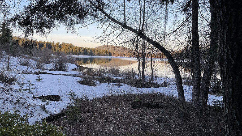 Pct - Oregon Section CHikingPhoto: jfdervin, CC BY-SA 2.0 (via Flickr)0.4 mi
- Fish Lake CampgroundCamping1.8 mi
- Aspen Point CampgroundCamping3.6 mi
- Aspen Point (Lake of the Woods, OR)Camping3.7 mi
- South Fork Little Butte CreekCanoeing6.8 mi
Source: Roamze catalog (indexable pages within 10 miles, PostGIS distance)
 Bull Gap-NordicCross-country skiing · ~51 min drivePhoto: james shaw, CC BY-SA 3.0 (via Wikimedia Commons)
- PetuniaCross-country skiing · Next door
- South RyeCross-country skiing · Next door
- Lollipop Loop NordicCross-country skiing · ~2 min drive
- Mount AshlandDownhill skiing · ~53 min drive
- Crest Loop NordicCross-country skiing · ~52 min drivePhoto: james shaw, CC BY-SA 3.0 (via Wikimedia Commons)
- Fish Lake Tie NordicCross-country skiing · ~3 min drive
- Pitt ViewCross-country skiing · ~2 min drive
- CabinCross-country skiing · ~5 min drive
- Fish Lake Tie NordicCross-country skiing · ~1 min drive
Best time to visit Lower Canal
Best months: May–October. Best months have typical highs of 55–85 °F, lows of 30 °F or warmer (32 °F where the station doesn't record snow), at most one snowy day and no more than 12 wet days.
Jan
36° / 23°
15 wet · 9 snow
Feb
40° / 23°
14 wet · 8 snow
Mar
45° / 26°
16 wet · 8 snow
Apr
50° / 29°
13 wet · 4 snow
May
60° / 36°
11 wet · 1 snow
Jun
68° / 40°
5 wet
Jul
79° / 47°
3 wet
Aug
79° / 46°
2 wet
Sep
72° / 40°
4 wet
Oct
58° / 33°
8 wet · 1 snow
Nov
42° / 28°
13 wet · 5 snow
Dec
35° / 23°
15 wet · 9 snow
Typical high / low (°F) and days with rain or snow, 1991–2020. Measured at Howard Prairie Dam, OR, 12.5 mi away at 4,567 ft. The station sits about 1,100 ft lower than this place, so expect it a little cooler here. Source: NOAA NCEI U.S. Climate Normals 1991–2020.

