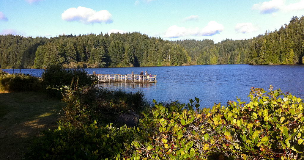
West Fork Millicoma River
 Photo: Finetooth, CC BY-SA 3.0 (via Wikimedia Commons)
- 28.5 mi
- distance
- 1,311 ft
- high point
- Feb–Nov
- best months
West Fork Millicoma River is a paddling route in Oregon on state land managed by the State Land Board. It is a paddling waterway, not a trail, and its location among several other paddling destinations makes it a natural stop for anyone exploring this stretch of the Millicoma River system. The most comfortable paddling weather runs from June through September, when typical averages from a nearby weather station show highs around 70°F and lows near 50°F. That station sits about 14 miles away at sea level, and the river runs higher, so temperatures here run a bit cooler. Winter is cold, with typical highs in the low 50s and lows around 39°F from December through March. Glenn Creek and Johnson Creek are both canoeing routes about 4 miles away. For a longer outing, the East Fork Millicoma River lies roughly 8 miles off. If you want to camp, East Shore Campground OR is about 8 miles away.
- Glenn CreekCanoeing4.1 mi
- Johnson CreekCanoeing4.4 mi
- Big CreekCanoeing6.1 mi
- Matson CreekCanoeing6.7 mi
- Loon Lake Waterfall TrailHiking7.2 mi
- East Shore Campground ORCamping7.8 mi
- Loon Lake Recreation SiteCamping7.9 mi
 East Fork Millicoma RiverCanoeingPhoto: Finetooth, CC BY-SA 3.0 (via Wikimedia Commons)7.9 mi
Source: Roamze catalog (indexable pages within 10 miles, PostGIS distance)
- East Fork Millicoma RiverCanoeing · ~14 min drivePhoto: Finetooth, CC BY-SA 3.0 (via Wikimedia Commons)
- Spinreel Boat LaunchBoat launch · ~21 min drive
 North Fork Coquille RiverCanoeing · ~27 min drivePhoto: Finetooth, CC BY-SA 3.0 (via Wikimedia Commons)
- Doris Place Boat RampBoat launch · ~21 min drive
- Glenn CreekCanoeing · ~7 min drive
- Myrtle Tree Boat RampBoat launch · ~22 min drive
- Johnson CreekCanoeing · ~8 min drive
- Eastside Boat RampBoat launch · ~29 min drive
- Big CreekCanoeing · ~10 min drive
- Noel Ranch Boat LaunchBoat launch · ~29 min drive
Best time to visit West Fork Millicoma River
Best months: February–November. Best months have typical highs of 55–85 °F, lows of 30 °F or warmer (32 °F where the station doesn't record snow), at most one snowy day and no more than 12 wet days.
Jan
54° / 39°
Feb
55° / 39°
Mar
56° / 39°
Apr
59° / 42°
May
62° / 46°
Jun
66° / 49°
Jul
70° / 52°
Aug
70° / 52°
Sep
71° / 50°
Oct
65° / 46°
Nov
58° / 42°
Dec
53° / 39°
Typical high / low (°F) and days with rain or snow, 1991–2020. Measured at Winchester Bay Coast Grd, OR, 14.5 mi away at 8 ft. The station sits about 1,300 ft lower than this place, so expect it a little cooler here. This station doesn't record snowfall. Source: NOAA NCEI U.S. Climate Normals 1991–2020.