Elk Creek
- 3.8 mi
- distance
- 3,195 ft
- high point
- Jun–Sep
- best months
Is Elk Creek open right now?
Closure in the area
There's a closure order in Willamette National Forest. It doesn't name Elk Creek, so check the source for the area it covers.
Cedar Creek Fire Closure
Agency closure covering Willamette National Forest · Order 06-18-10-26-04 · USFS · Willamette National Forest
FIRE CLOSURES: Current wildfire closures on the Willamette National Forest
Agency alert covering Willamette National Forest · USFS · Willamette National Forest
As of · Source: USFS · Willamette National Forest. Agencies don't list every closure — check before you go.
Elk Creek is a 3.8-mile paddling stretch near Idanha, Oregon, on the Sweet Home Ranger District of the Willamette National Forest. The U.S. Forest Service manages the land along it, and the creek flows year-round. The creek's average flow is about 33 cubic feet per second, with a gradient of about 393 feet per mile. That makes it a steady, moderate current for paddlers who want a short outing close to town. Summer is the most comfortable time to go. Typical averages from the Marion Forks Fish Hatchery weather station, about 18 miles away, show July and August highs around 82°F with only about four wet days a month. Winter brings highs in the low 40s and snow on several days each month. Old Miner's Meadow Group Use Area and Yellowbottom Recreation Site are both within about 5 miles for camping. Box Canyon Creek and Quartzville Creek, about 5 to 6 miles away, offer more paddling.
Local outfitters
- Horse Creek Lodge & Outfitters33 mi away
- McKenzie Tackle Guide Service38 mi away
Not on Roamze yet. Their page has how to reach them.
- Old Miner's Meadow Group Use AreaCamping4.3 mi
- Yellowbottom Recreation SiteCamping4.9 mi
- Box Canyon CreekCanoeing5 mi
- Mcquade CreekHiking5.6 mi
 Quartzville CreekCanoeingPhoto: anglerp1, CC BY-SA 2.0 (via Wikimedia Commons)5.7 mi
- Bobcat TrailHiking6.4 mi
- Redneck RivierraRock climbing6.9 mi
- The 4.5 boulderRock climbing7 mi
Source: Roamze catalog (indexable pages within 10 miles, PostGIS distance)
- Quartzville CreekCanoeing · ~10 min drivePhoto: anglerp1, CC BY-SA 2.0 (via Wikimedia Commons)
- Mongold Boat RampBoat launch · ~13 min drive
- Detroit LakeTubing · ~11 min drive
 Crabtree CreekCanoeing · ~19 min drivePhoto: Gary Halvorson, Oregon State Archives, CC BY 4.0 (via Wikimedia Commons)
- Hoover Boat RampBoat launch · ~18 min drive
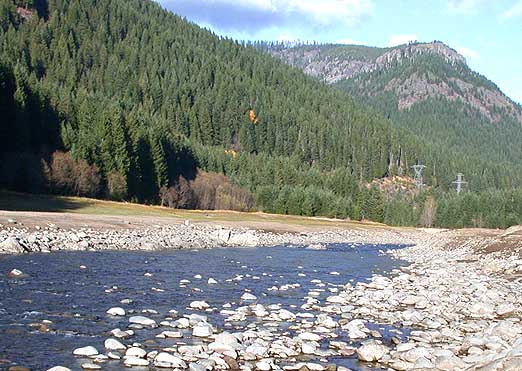 Breitenbush RiverCanoeing · ~20 min drivePhoto: Matthew Trump, CC BY-SA 3.0 (via Wikimedia Commons)
- Paradise Boating SiteBoat launch · ~22 min drive
 South Santiam RiverCanoeing · ~29 min drivePhoto: Peteforsyth, CC0 (via Wikimedia Commons)
- Thistle Creek County Boat RampBoat launch · ~26 min drive
 Elkhorn CreekCanoeing · ~20 min drivePhoto: Bureau of Land Management, Public domain (via Wikimedia Commons)
Best time to visit Elk Creek
Best months: June–September. Best months have typical highs of 55–85 °F, lows of 30 °F or warmer (32 °F where the station doesn't record snow), at most one snowy day and no more than 12 wet days.
Jan
40° / 27°
19 wet · 6 snow
Feb
44° / 27°
16 wet · 5 snow
Mar
49° / 29°
19 wet · 5 snow
Apr
56° / 33°
18 wet · 2 snow
May
64° / 38°
15 wet
Jun
71° / 43°
10 wet
Jul
82° / 47°
4 wet
Aug
82° / 46°
4 wet
Sep
74° / 41°
7 wet
Oct
60° / 35°
14 wet
Nov
46° / 31°
18 wet · 3 snow
Dec
38° / 27°
19 wet · 6 snow
Typical high / low (°F) and days with rain or snow, 1991–2020. Measured at Marion Forks Fish Hatchery, OR, 17.7 mi away at 2,475 ft. The station sits about 700 ft lower than this place, so expect it a little cooler here. Source: NOAA NCEI U.S. Climate Normals 1991–2020.

