Desolation Creek
- 21.5 mi
- distance
- 5,200 ft
- high point
- May–Oct
- best months
Caution today
Agency alerts are in effect for this area; weather is good · USFS, OpenWeather · checked 11 h ago
Is Desolation Creek open right now?
Closure in the area
There's a closure order in North Fork John Day Ranger District. It doesn't name Desolation Creek, so check the source for the area it covers.
Salmon Olive Butte Fire Area Closure
Agency closure covering North Fork John Day Ranger District · Order 06-04-01-26-13 · USFS · North Fork John Day Ranger District
As of · Source: USFS · North Fork John Day Ranger District. Agencies don't list every closure — check before you go.
Desolation Creek is a 21-mile paddling stretch in Oregon's North Fork John Day Ranger District, part of the Umatilla National Forest. It runs year-round, with an average flow of about 71 cubic feet per second and a gradient of roughly 111 feet per mile, according to USGS models. The Forest Service manages the land along the creek, and the nearest town is Long Creek. Summer is the most comfortable time to paddle. Typical averages from a nearby weather station in Long Creek show July and August highs in the mid-80s with only three or four wet days a month, while winter brings highs around 40°F and a few snowy days. Several campgrounds sit within about 10 miles, including Welch Creek Cg/Th at 2.9 miles and Oriental Cg/Th at 6.1 miles. The South Fork Desolation Trail and the Blue Mountain Trail are both hikes about 9.5 miles away.
Local outfitters
- White Pine Outfitters46 mi away
Not on Roamze yet. Their page has how to reach them.
- Welch Creek Cg/ThCamping2.9 mi
- Oriental Cg/ThCamping6.1 mi
- Gold Dredge CgCamping6.4 mi
- Driftwood CgCamping7.8 mi
- Tollbridge CgCamping8.4 mi
- Blue Mountain TrailHiking9.4 mi
- South Fork Desolation TrailHiking9.5 mi
Source: Roamze catalog (indexable pages within 10 miles, PostGIS distance)
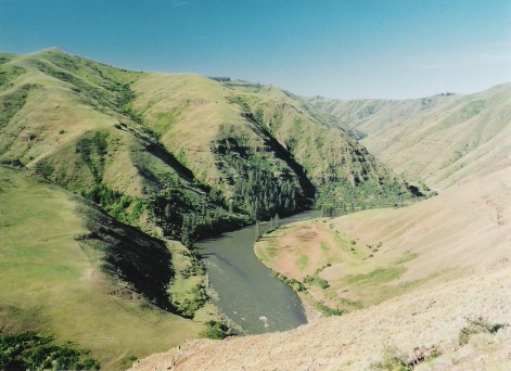 Grande Ronde RiverCanoeing · ~51 min drivePhoto: Dsdugan, Public domain (via Wikimedia Commons)
- Magone Lake Boat LaunchBoat launch · ~44 min drive
 Birch CreekCanoeing · ~1h 19m drivePhoto: Bobjgalindo, CC BY-SA 4.0 (via Wikimedia Commons)
- Grande Ronde Boat LaunchBoat launch · ~49 min drive
 Middle Fork John Day RiverCanoeing · ~30 min drivePhoto: Sam Beebe, CC BY 2.0 (via Wikimedia Commons)
- Anthony Lake Boat LaunchBoat launch · ~50 min drive
- Big CreekCanoeing · ~19 min drive
- Union Creek Boat LaunchBoat launch · ~1h 12m drive
- Lake CreekCanoeing · ~22 min drive
- Mason Dam Boat LaunchBoat launch · ~1h 13m drive
Also worth it near here
Best time to visit Desolation Creek
Best months: May–October. Best months have typical highs of 55–85 °F, lows of 30 °F or warmer (32 °F where the station doesn't record snow), at most one snowy day and no more than 12 wet days.
Jan
40° / 22°
12 wet · 5 snow
Feb
44° / 23°
11 wet · 4 snow
Mar
50° / 27°
13 wet · 4 snow
Apr
56° / 31°
13 wet · 2 snow
May
65° / 37°
12 wet
Jun
73° / 41°
8 wet
Jul
84° / 47°
4 wet
Aug
85° / 46°
3 wet
Sep
76° / 40°
4 wet
Oct
62° / 33°
9 wet · 1 snow
Nov
47° / 27°
11 wet · 3 snow
Dec
39° / 22°
12 wet · 5 snow
Typical high / low (°F) and days with rain or snow, 1991–2020. Measured at Long Creek, OR, 19.5 mi away at 3,740 ft. The station sits about 1,500 ft lower than this place, so expect it a little cooler here. Source: NOAA NCEI U.S. Climate Normals 1991–2020.


