Underwood Hill Trail
- 1.8 mi
- loop
- 492 ft
- climb
- 888 ft
- high point
- Loop
- route
- May–Oct
- best months
Underwood Hill Trail is a 1.8-mile loop hike in Oregon, about 4.6 miles from Old Town. The trail is rated easy, with a total elevation gain of 492 feet and a loss of about 487 feet over the course of the loop. The climb is front-loaded, with the steepest stretch at about 0.28 miles in, where the grade reaches 17%. The high point is 888 feet, and the low point is 566 feet, so the trail starts and ends at nearly the same elevation. Summer is the most comfortable time to go. Typical averages from a nearby weather station show July and August highs around 84°F with only about three wet days a month, while winter months bring highs in the mid-40s and rain on 17 or more days. Several other trails sit close by. Oak Savanna Trail is just 0.1 mile away, Mildred's Forest Trail is 0.4 mile off, and School House Trail is 0.5 mile away. Paddlers can find Oldham Creek about 2.7 miles from the trail.
Local outfitters
- The Big K Guest Ranch20 mi away
- Casey's Riverside RV Resort40 mi away
Not on Roamze yet. Their page has how to reach them.
- Oak Savanna TrailHiking0.1 mi
- Mildred's Forest TrailHiking0.4 mi
- School House TrailHiking0.5 mi
- Fern Woods TrailHiking0.8 mi
- Oldham CreekCanoeing2.7 mi
- Cabin CreekCanoeing4.2 mi
- Calapooya CreekCanoeing6.7 mi
- Elk CreekCanoeing6.8 mi
Source: Roamze catalog (indexable pages within 10 miles, PostGIS distance)
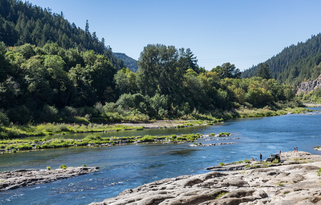 Tyee TrailHiking · ~22 min drivePhoto: Tony Webster, CC BY 2.0 (via Flickr)
 North Umpqua TrailHiking · ~27 min drivePhoto: Bonnie Moreland (free images), Public Domain Mark (via Flickr)
- Cooper Creek TrailHiking · ~13 min drive
- North Gate TrailHiking · ~18 min drive
 Susan Creek Falls TrailHiking · ~36 min drivePhoto: lamblukas, CC BY 2.0 (via Flickr)
 North Umpqua Trail: MottHiking · ~42 min drivePhoto: U.S. Forest Service- Pacific Northwest Region, Public domain (via Wikimedia Commons)
- Middle Ridge TrailHiking · ~21 min drive
- Blacktail Ridge TrailHiking · ~18 min drive
- Emerald TrailHiking · ~36 min drivePhoto: lamblukas, CC BY 2.0 (via Flickr)
- Mace MountainHiking · ~35 min drive
Best time to visit Underwood Hill Trail
Best months: May–October. Best months have typical highs of 55–85 °F, lows of 30 °F or warmer (32 °F where the station doesn't record snow), at most one snowy day and no more than 12 wet days.
Jan
46° / 34°
17 wet
Feb
50° / 34°
15 wet
Mar
56° / 36°
17 wet
Apr
62° / 39°
16 wet
May
70° / 43°
12 wet
Jun
75° / 47°
7 wet
Jul
84° / 50°
3 wet
Aug
84° / 50°
3 wet
Sep
78° / 46°
5 wet
Oct
64° / 41°
11 wet
Nov
51° / 38°
17 wet
Dec
44° / 33°
18 wet
Typical high / low (°F) and days with rain or snow, 1991–2020. Measured at Idleyld Park 4 Ne, OR, 15.6 mi away at 1,080 ft. This station doesn't record snowfall. Source: NOAA NCEI U.S. Climate Normals 1991–2020.

Map and trail data © OpenStreetMap contributors
