Smock Prairie Nature Trail
- 0.7 mi
- round trip
- 231 ft
- climb
- 2,306 ft
- high point
- Out and back
- route
- Mar–Jun, Sep–Oct
- best months
Smock Prairie Nature Trail is a short, easy out-and-back hike in Oregon's White River Wildlife Area, managed by State Fish and Wildlife. The trail is about 1.3 miles long, with a total elevation gain of 231 feet, and it starts at roughly 2,274 feet, reaching a high point of about 2,306 feet before returning to the starting level. The route is steady, with the steepest stretch at about 0.05 miles from the start, where the grade reaches about 4 percent. The climb is gentle enough to fit into a longer day on the surrounding network of trails. Late spring and early fall are the most comfortable times to go. Typical averages from the nearby Dufur weather station show May highs around 72°F and September highs around 79°F, while July and August average in the upper 80s. That station sits well below the trail, so temperatures on the prairie run cooler. The hike takes about half an hour. Within a few miles are the Rock Creek 921 and Rock Creek 916 hikes, Rock Creek Campground (Mt. Hood National Forest, OR), and Rock Creek Reservoir Campground.
Local outfitters
- Imperial River Company14 mi away
- Bike the Gorge43 mi away
Not on Roamze yet. Their page has how to reach them.
- ROCK CREEK 921Hiking2.5 mi
- Rock Creek 916Hiking2.5 mi
- Rock Creek 919Hiking4 mi
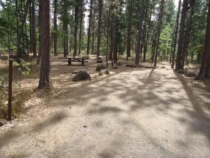 Rock Creek Campground (Mt. Hood National Forest, OR)CampingPhoto: Recreation.gov (RIDB) / public domain4.1 mi
- Rock Creek Reservoir CgCamping4.1 mi
 Rock Creek 923HikingPhoto: Ian Poellet (User:Werewombat), CC BY-SA 3.0 (via Wikimedia Commons)4.2 mi
- Mccubbins GulchCamping6.4 mi
- Badger CreekCanoeing8 mi
Source: Roamze catalog (indexable pages within 10 miles, PostGIS distance)
- Rock Creek 923Hiking · ~7 min drivePhoto: Ian Poellet (User:Werewombat), CC BY-SA 3.0 (via Wikimedia Commons)
 Rock Creek 914Hiking · ~7 min drivePhoto: Forest Service Pacific Northwest Region, Public Domain Mark (via Flickr)
 Rock Creek 911Hiking · ~9 min drivePhoto: Bark for Mt Hood, Public Domain Mark (via Flickr)
- ROCK CREEK 921Hiking · ~4 min drive
- Mccubbins 587Hiking · ~8 min drive
- Rock Creek 916Hiking · ~4 min drive
- Rock Creek 925Hiking · ~10 min drive
- Mccubbins 588: Mineral JaneHiking · ~8 min drive
- Rock Creek 919Hiking · ~7 min drive
- MCCUBBINS 576: BARTON LOOPHiking · ~11 min drive
Best time to visit Smock Prairie Nature Trail
Best months: March–June and September–October. Best months have typical highs of 55–85 °F, lows of 30 °F or warmer (32 °F where the station doesn't record snow), at most one snowy day and no more than 12 wet days.
Jan
41° / 27°
15 wet · 4 snow
Feb
47° / 29°
12 wet · 2 snow
Mar
56° / 31°
12 wet · 1 snow
Apr
63° / 36°
10 wet
May
72° / 41°
8 wet
Jun
79° / 45°
5 wet
Jul
89° / 51°
3 wet
Aug
88° / 50°
2 wet
Sep
79° / 45°
4 wet
Oct
64° / 37°
9 wet
Nov
48° / 31°
14 wet · 1 snow
Dec
39° / 27°
17 wet · 4 snow
Typical high / low (°F) and days with rain or snow, 1991–2020. Measured at Dufur, OR, 23.7 mi away at 1,330 ft. The station sits about 1,000 ft lower than this place, so expect it a little cooler here. Source: NOAA NCEI U.S. Climate Normals 1991–2020.

Map and trail data © OpenStreetMap contributors
