Sand Canyon
- 2.1 mi
- round trip
- 1,091 ft
- climb
- 4,696 ft
- high point
- Out and back
- route
- May–Sep
- best months
Caution at last check
Weather is marginal · OpenWeather · checked 20 h ago
Sand Canyon is a moderate out-and-back hike in central Oregon on Bureau of Land Management land within the Prineville Deschutes Field Office. It covers about 4 miles with a total elevation gain of about 1,090 feet, rising from roughly 3,670 feet to a high of about 4,696 feet. The climb is front-loaded, with the steepest stretch coming within the first mile at about 23% grade, so plan for a steady climb early on. The most comfortable time to go is summer, when typical averages from a nearby weather station at Sunriver run from highs around 72°F in June to about 84°F in July, with September still near 76°F. That station sits a few hundred feet lower than the hike's high point, so expect cooler temperatures up top. The Horse Ridge Trailhead is the trailhead, and the hike takes about two hours. Parkway, a mountain biking trail, starts just 0.1 mile away, and the Escape from Moscow hike is about half a mile off. The Dry River Trail and Badlands Rock Trail lie about 1.6 miles away.
Local outfitters
- Wanderlust Tours15 mi away
- Oregon Adaptive Sports16 mi away
Not on Roamze yet. Their page has how to reach them.
Best time to go · May–Sep
Best time to visit Sand Canyon
Best months: May–September. Best months have typical highs of 55–85 °F, lows of 30 °F or warmer (32 °F where the station doesn't record snow), at most one snowy day and no more than 12 wet days.
Jan
40° / 20°
Feb
43° / 21°
Mar
50° / 24°
Apr
57° / 25°
May
65° / 33°
Jun
72° / 37°
Jul
84° / 41°
Aug
83° / 40°
Sep
76° / 34°
Oct
62° / 28°
Nov
46° / 24°
Dec
37° / 19°
Typical high / low (°F) and days with rain or snow, 1991–2020. Measured at Sunriver, OR, 18.7 mi away at 4,180 ft. The station sits about 500 ft lower than this place, so expect it a little cooler here. This station doesn't record snowfall. Source: NOAA NCEI U.S. Climate Normals 1991–2020.
Keep exploring — more trails worth the drive
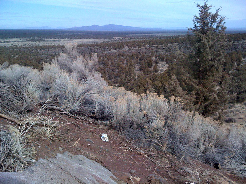 Photo: Sapphireblue, CC BY 2.0 (via Flickr)
Escape from Moscow
Next door
1.48-mile out-and-back trail in Oregon with 683 ft gain.
 Photo: Bureau of Land Management Oregon and Washington, Public domain (via Wikimedia Commons)
Dry River Trail
~3 min drive
8.70-mile point-to-point trail in Oregon with 157 ft elevation gain
 Photo: Bureau of Land Management Oregon and Washington, Public domain (via Wikimedia Commons)
Tumulus Trail
~10 min drive
Out-and-back Oregon trail featuring a notable natural or cultural landmark.
 Photo: Bureau of Land Management Oregon and Washington, Public domain (via Wikimedia Commons)
Sand Lily Trail
~8 min drive
Out-and-back Oregon trail featuring sand lilies and high-desert wildflowers.
Photo: Bureau of Land Management Oregon and Washington, Public domain (via Wikimedia Commons)Mazama Ash Trail
~8 min drive
Out-and-back volcanic terrain hike in Oregon's geothermal landscape.
HIKE
Oregon Desert Trail
~6 min drive
Remote 15.5-mile point-to-point desert trek across Oregon's high sagebrush country.
HIKE
Badlands Rock Trail
~3 min drive
Out-and-back badlands hike with dramatic rock formations and desert views.
Photo: Sapphireblue, CC BY 2.0 (via Flickr)Parkway
Next door
4.27-mile out-and-back trail in Oregon with 1,011 ft elevation gain.
HIKE
Arnold Ice Cave
~17 min drive
Arnold Ice Cave is a 28.95-mile hike in Oregon with 1,758 feet of elevation gain.
HIKE
Ancient Juniper Trail
~3 min drive
Out-and-back high-desert trail featuring ancient juniper trees and sagebrush landscape.

Map and trail data © OpenStreetMap contributors
