Red Trail
- 1.5 mi
- one way
- 125 ft
- climb
- 592 ft
- high point
- Point to point
- route
- May–Sep
- best months
Red Trail is an easy, short loop in Mount Tabor Park in Portland, Oregon. The route is about 1.5 miles long and sits entirely within city land, with the high point of the trail reaching about 592 feet. The trail is a low-impact walk, with a total elevation gain of about 125 feet. The climb is gentle overall, and the steepest stretch occurs around the 0.8-mile mark, where the grade reaches about 21%. The trail starts at an elevation of about 463 feet and ends near its high point at about 592 feet. Summer is the most comfortable time to go. At a nearby weather station, typical July averages run to a high of about 80°F and a low of about 58°F, with only about four wet days in the month. Winter is cooler and wetter, with typical January highs around 47°F and about 19 wet days. The Blue Trail and Green Trail both start within about a third of a mile, so it's easy to pair them together. The Creston Loop is about 1.5 miles away, and mountain bikers can head to Southeast 106th Avenue, roughly 1.9 miles off.
Local outfitters
- Beach Bandit Crab Snares4 mi away
- Wildwood Adventures4 mi away
Not on Roamze yet. Their page has how to reach them.
Conditions and forecast on Mount Tabor
Daily highs and lows, wind and the chance of precipitation at the summit and route start for the next 7 days, from the Open-Meteo model.
- Blue TrailHiking0.3 mi
- Green TrailHiking0.3 mi
- Creston LoopHiking1.5 mi
- Southeast 106th AvenueMountain biking1.9 mi
- m. Joseph Wood Hill ParkRock climbing2.9 mi
- Highball wallRock climbing2.9 mi
- c. Silver Bullet BluffRock climbing3.1 mi
 Fanno CreekCanoeingPhoto: Finetooth, CC BY-SA 3.0 (via Wikimedia Commons)9.3 mi
Source: Roamze catalog (indexable pages within 10 miles, PostGIS distance)
 Elderberry TrailHiking · ~7 min drivePhoto: oregondave, CC BY-SA 3.0 (via Wikimedia Commons)
- Willamette Park to MultnomahHiking · ~8 min drive
 Douglas Fir TrailHiking · ~7 min drivePhoto: mjfmjfmjf, CC BY 2.0 (via Flickr)
- Terwilliger TrailHiking · ~8 min drive
- Cedar Grove TrailHiking · ~8 min drivePhoto: oregondave, CC BY-SA 3.0 (via Wikimedia Commons)
- Hawthorn TrailHiking · ~8 min drivePhoto: mjfmjfmjf, CC BY 2.0 (via Flickr)
- Wildhorse TrailHiking · ~8 min drivePhoto: oregondave, CC BY-SA 3.0 (via Wikimedia Commons)
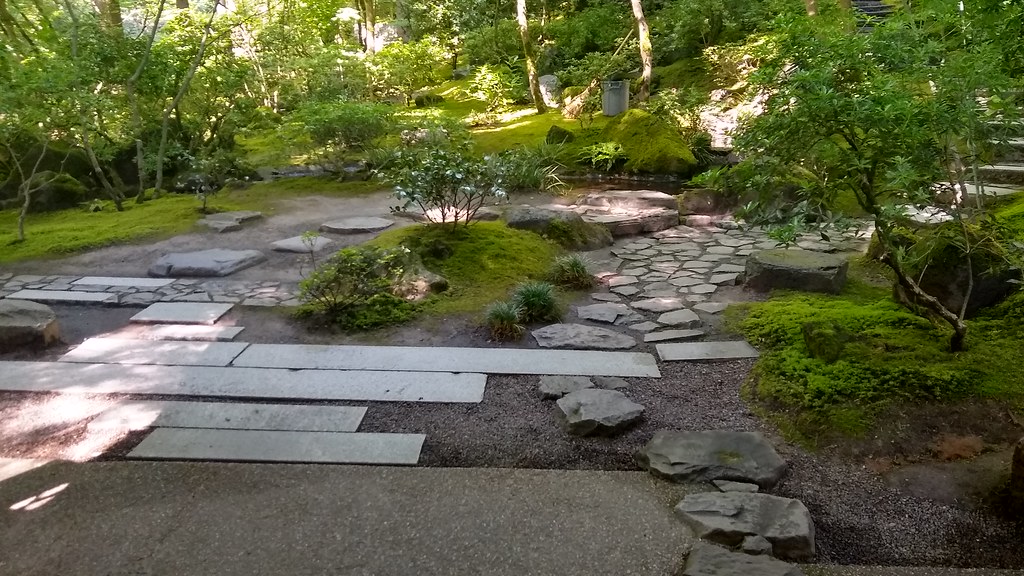 Nature Loop TrailHiking · ~9 min drivePhoto: mjfmjfmjf, CC BY 2.0 (via Flickr)
 Glendoveer Nature TrailHiking · ~7 min drivePhoto: Fotos_Ohio, CC BY 2.0 (via Flickr)
- Forest Edge TrailHiking · ~7 min drivePhoto: mjfmjfmjf, CC BY 2.0 (via Flickr)
Best time to visit Red Trail
Best months: May–September. Best months have typical highs of 55–85 °F, lows of 30 °F or warmer (32 °F where the station doesn't record snow), at most one snowy day and no more than 12 wet days.
Jan
47° / 37°
19 wet · 1 snow
Feb
51° / 39°
16 wet
Mar
56° / 41°
18 wet
Apr
61° / 44°
16 wet
May
68° / 49°
12 wet
Jun
73° / 53°
8 wet
Jul
80° / 58°
4 wet
Aug
81° / 59°
3 wet
Sep
75° / 55°
7 wet
Oct
63° / 48°
13 wet
Nov
52° / 42°
18 wet
Dec
46° / 37°
20 wet · 1 snow
Typical high / low (°F) and days with rain or snow, 1991–2020. Measured at Portland Kgw-Tv, OR, 4.8 mi away at 159 ft. Source: NOAA NCEI U.S. Climate Normals 1991–2020.

Route details
- Distance
- 1.5 mi
- Climbing
- About 125 ft
- Summit
- 643 ft
- Difficulty
- Easy
- Time
- About 0.5 hours
Other routes up Mount Tabor
Questions about this route
How long is the Red Trail on Mount Tabor?
About 1.5 mi.
How much elevation gain is on the Red Trail?
About 125 ft of climbing round trip.
How hard is the Red Trail?
It is rated easy.
How long does the Red Trail take?
About 0.5 hours round trip.
How many routes go up Mount Tabor?
2: Blue Trail and Red Trail.
Map and trail data © OpenStreetMap contributors
