Pronghorn Trail
- 0.4 mi
- round trip
- 61 ft
- climb
- 3,457 ft
- high point
- Out and back
- route
- May–Oct
- best months
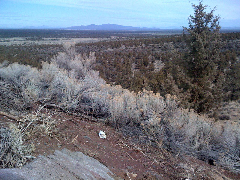
Pronghorn Trail is a short hike on Bureau of Land Management land in the Prineville Deschutes Field Office in central Oregon. The route is about 0.36 miles one way, with a total round trip of roughly 0.72 miles, and the one-way climb is only about 21 feet, so it's an easy outing that takes little time or effort. The trail is natural-surface and rated easy. Horses are allowed, and bikes are not. The climb is flat, with the steepest stretch at about 3% near the start. Summer is the warmest time to visit. Typical averages from a nearby weather station in Bend show July and August highs around 82°F with lows near 49°F, and the trail sits at about the same elevation as that station. Winter is much colder, with typical January highs around 42°F. Several other hikes lie within a mile, including Elk Trail at 0.5 miles and Hawk Trail at 0.6 miles. Climbers can find Castle about 5.3 miles away.
Local outfitters
- Wanderlust Tours10 mi away
- ULLR Backcountry11 mi away
Not on Roamze yet. Their page has how to reach them.
- Elk TrailHiking0.5 mi
- Hawk TrailHiking0.6 mi
- Owl TrailHiking0.8 mi
- Deer TrailHiking0.8 mi
 CastleRock climbingPhoto: Bureau of Land Management Oregon and Washington from Portland, America, Public domain (via Wikimedia Commons)5.3 mi
- The Drive InRock climbing5.6 mi
- Stevens CaveRock climbing7.8 mi
- Central OregonRock climbing9.1 mi
Source: Roamze catalog (indexable pages within 10 miles, PostGIS distance)
 Mazama Ash TrailHiking · ~6 min drivePhoto: Bureau of Land Management Oregon and Washington, Public domain (via Wikimedia Commons)
- Sand Lily TrailHiking · ~6 min drivePhoto: Bureau of Land Management Oregon and Washington, Public domain (via Wikimedia Commons)
 Tumulus TrailHiking · ~10 min drivePhoto: Bureau of Land Management Oregon and Washington, Public domain (via Wikimedia Commons)
 Dry River TrailHiking · ~13 min drivePhoto: Bureau of Land Management Oregon and Washington, Public domain (via Wikimedia Commons)
 Perimeter TrailHiking · ~12 min drivePhoto: m01229, CC BY-SA 2.0 (via Flickr)
- Arnold Ice CaveHiking · ~14 min drive
 ParkwayHiking · ~14 min drivePhoto: Sapphireblue, CC BY 2.0 (via Flickr)
- Escape from MoscowHiking · ~14 min drivePhoto: Sapphireblue, CC BY 2.0 (via Flickr)
- Bobcat TrailHiking · ~2 min drive
- Elk TrailHiking · Next door
Also worth it near here
 Black Lava TrailMountain biking · ~6 min drivePhoto: Bureau of Land Management Oregon and Washington from Portland, America, Public domain (via Wikimedia Commons)
- Reynolds PondLake fishing · ~8 min drive
- CastleRock climbing · ~9 min drivePhoto: Bureau of Land Management Oregon and Washington from Portland, America, Public domain (via Wikimedia Commons)
 Pilot ButteSummit · ~16 min drivePhoto: Cacophony, CC BY-SA 3.0 (via Wikimedia Commons)
Best time to visit Pronghorn Trail
Best months: May–October. Best months have typical highs of 55–85 °F, lows of 30 °F or warmer (32 °F where the station doesn't record snow), at most one snowy day and no more than 12 wet days.
Jan
42° / 24°
8 wet
Feb
45° / 25°
6 wet
Mar
51° / 28°
6 wet
Apr
57° / 31°
7 wet
May
65° / 38°
7 wet
Jun
72° / 43°
5 wet
Jul
82° / 49°
3 wet
Aug
82° / 49°
2 wet
Sep
74° / 42°
3 wet
Oct
62° / 34°
5 wet
Nov
48° / 28°
7 wet
Dec
40° / 23°
8 wet
Typical high / low (°F) and days with rain or snow, 1991–2020. Measured at Bend 7 Ne, OR, 7.1 mi away at 3,358 ft. This station doesn't record snowfall. Source: NOAA NCEI U.S. Climate Normals 1991–2020.
