Owl Trail
- 0.7 mi
- round trip
- 25 ft
- climb
- 3,430 ft
- high point
- Out and back
- route
- May–Oct
- best months
Owl Trail is a short, easy outing on Bureau of Land Management land in Oregon's Prineville Deschutes Field Office, about 670 yards from its start. The route is an out-and-back of about 1.3 miles, with a flat profile and only about 25 feet of elevation gain and loss, so it's a quick walk for a few minutes or a stop on the way to other trails. The trail sits at roughly 3,415 feet, and the path is natural surface. Horses are allowed, but bikes are not. The climb is so slight that it works well as a short break or a leg stretcher before or after another outing. Summer is the most comfortable time to go. Typical averages from a nearby weather station in Bend show July and August highs around 82°F with only two or three wet days a month, while winter highs sit in the low 40s with lows near 20°F. Several other trails start close by. Deer Trail is about 0.1 mile away and Hawk Trail about 0.3 mile. Elk Trail and Falcon Trail are each within a mile. For climbers, Castle is about 5.5 miles off.
Local outfitters
- Wanderlust Tours11 mi away
- ULLR Backcountry11 mi away
Not on Roamze yet. Their page has how to reach them.
- Deer TrailHiking0.1 mi
- Hawk TrailHiking0.3 mi
- Elk TrailHiking0.6 mi
- Falcon TrailHiking0.7 mi
 CastleRock climbingPhoto: Bureau of Land Management Oregon and Washington from Portland, America, Public domain (via Wikimedia Commons)5.5 mi
- The Drive InRock climbing5.6 mi
- Stevens CaveRock climbing8.4 mi
- Central OregonRock climbing9.8 mi
Source: Roamze catalog (indexable pages within 10 miles, PostGIS distance)
 Mazama Ash TrailHiking · ~6 min drivePhoto: Bureau of Land Management Oregon and Washington, Public domain (via Wikimedia Commons)
- Sand Lily TrailHiking · ~6 min drivePhoto: Bureau of Land Management Oregon and Washington, Public domain (via Wikimedia Commons)
 Tumulus TrailHiking · ~10 min drivePhoto: Bureau of Land Management Oregon and Washington, Public domain (via Wikimedia Commons)
 Dry River TrailHiking · ~14 min drivePhoto: Bureau of Land Management Oregon and Washington, Public domain (via Wikimedia Commons)
 Perimeter TrailHiking · ~13 min drivePhoto: m01229, CC BY-SA 2.0 (via Flickr)
- Arnold Ice CaveHiking · ~16 min drive
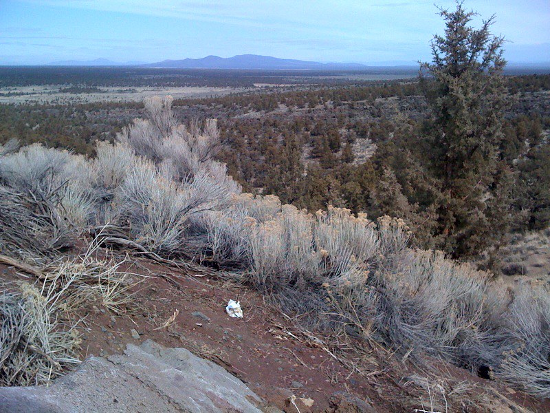 ParkwayHiking · ~15 min drivePhoto: Sapphireblue, CC BY 2.0 (via Flickr)
- Escape from MoscowHiking · ~15 min drivePhoto: Sapphireblue, CC BY 2.0 (via Flickr)
- Bobcat TrailHiking · ~1 min drive
 Huntington Wagon Road TrailHiking · ~15 min drivePhoto: Bureau of Land Management Oregon and Washington, Public domain (via Wikimedia Commons)
Also worth it near here
 Black Lava TrailMountain biking · ~6 min drivePhoto: Bureau of Land Management Oregon and Washington from Portland, America, Public domain (via Wikimedia Commons)
- Reynolds PondLake fishing · ~7 min drive
- CastleRock climbing · ~9 min drivePhoto: Bureau of Land Management Oregon and Washington from Portland, America, Public domain (via Wikimedia Commons)
 Pilot ButteSummit · ~16 min drivePhoto: Cacophony, CC BY-SA 3.0 (via Wikimedia Commons)
Best time to visit Owl Trail
Best months: May–October. Best months have typical highs of 55–85 °F, lows of 30 °F or warmer (32 °F where the station doesn't record snow), at most one snowy day and no more than 12 wet days.
Jan
42° / 24°
8 wet
Feb
45° / 25°
6 wet
Mar
51° / 28°
6 wet
Apr
57° / 31°
7 wet
May
65° / 38°
7 wet
Jun
72° / 43°
5 wet
Jul
82° / 49°
3 wet
Aug
82° / 49°
2 wet
Sep
74° / 42°
3 wet
Oct
62° / 34°
5 wet
Nov
48° / 28°
7 wet
Dec
40° / 23°
8 wet
Typical high / low (°F) and days with rain or snow, 1991–2020. Measured at Bend 7 Ne, OR, 7.2 mi away at 3,358 ft. This station doesn't record snowfall. Source: NOAA NCEI U.S. Climate Normals 1991–2020.
