Parrette Mountain River Trail
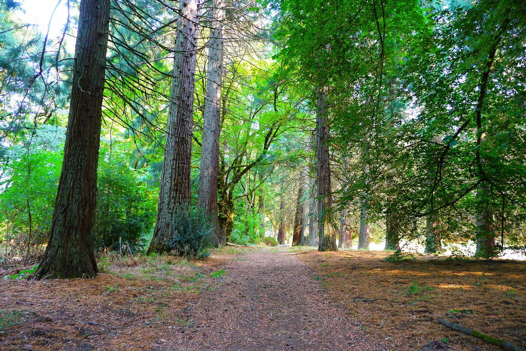 Photo: Rick Obst, CC BY 2.0 (via Flickr)
- 0.4 mi
- round trip
- 83 ft
- climb
- 104 ft
- high point
- Out and back
- route
- May–Sep
- best months
Parrette Mountain River Trail is a short, easy hike on Bureau of Land Management land in Oregon, within the Willamette River unit. The trail is about 0.36 miles long, and the round trip adds up to roughly 0.72 miles with a total elevation gain of about 83 feet. The climb is gentle, with the steepest stretch at about 0.18 miles in, and the trail is an out-and-back. Summer is the most comfortable time to go. Typical averages from a nearby weather station show July and August highs around 81°F with only about four wet days a month, while winter brings highs in the mid-40s and rain on most days. Townsite Trail is about 0.2 miles away, and Town Site Trail is about 0.9 miles away. Champoeg Bike Path is about 2.5 miles off, and Hess Creek Canyon Loop is about 4.5 miles away.
Local outfitters
- Wildwood Adventures21 mi away
- Cascadia Wild21 mi away
Not on Roamze yet. Their page has how to reach them.
Best time to go · May–Sep
Best time to visit Parrette Mountain River Trail
Best months: May–September. Best months have typical highs of 55–85 °F, lows of 30 °F or warmer (32 °F where the station doesn't record snow), at most one snowy day and no more than 12 wet days.
Jan
45° / 35°
19 wet
Feb
50° / 36°
16 wet
Mar
55° / 38°
17 wet
Apr
61° / 41°
15 wet
May
66° / 47°
12 wet
Jun
72° / 51°
8 wet
Jul
81° / 56°
4 wet
Aug
81° / 56°
4 wet
Sep
75° / 52°
7 wet
Oct
62° / 45°
13 wet
Nov
51° / 39°
18 wet
Dec
44° / 34°
20 wet
Typical high / low (°F) and days with rain or snow, 1991–2020. Measured at Rex 1 S, OR, 3.3 mi away at 515 ft. Source: NOAA NCEI U.S. Climate Normals 1991–2020.
Keep exploring — more trails worth the drive
Photo: Rick Obst, CC BY 2.0 (via Flickr)Champoeg Bike Path
Next door
Easy 1.13-mile paved out-and-back bike path in Champoeg, Oregon.
HIKE
Guadalupe Loop
~16 min drive
3.55-mile loop in Oregon with 1,146 ft elevation gain and loss.
Photo: Rick Obst, CC BY 2.0 (via Flickr)Town Site Trail
~2 min drive
0.82-mile out-and-back hike in Oregon with 153 ft of elevation gain.
HIKE
Tualatin River Trail
~20 min drive
Easy riverside walk along the Tualatin River in Oregon's Willamette Valley.
 Photo: Mike Byrnes, Public domain (via Wikimedia Commons)
Champoeg Bike Path
~4 min drive
Easy paved out-and-back bike path through historic Champoeg State Heritage Area.
 Photo: Kurt Minard, CC BY-SA 3.0 (via Wikimedia Commons)
Legacy Creek Trail
~9 min drive
0.7-mile out-and-back hike on Legacy Creek Trail in Oregon with 162 ft of elevation gain.
Photo: Kurt Minard, CC BY-SA 3.0 (via Wikimedia Commons)Tonquin Trail
~10 min drive
Easy 1.48-mile out-and-back hike in Oregon's Tonquin area.
Photo: Kurt Minard, CC BY-SA 3.0 (via Wikimedia Commons)Ice Age Tonquin Trail
~11 min drive
Short out-and-back hike featuring glacial geology and alpine views.
 Photo: amy.z, CC BY 2.0 (via Flickr)
Harvey Creek Trail
~11 min drive
Easy 1-mile out-and-back creek walk in Oregon.
 Photo: Ian Poellet (User:Werewombat), CC BY-SA 3.0 (via Wikimedia Commons)
Pennisula Trail
~16 min drive
1.26-mile out-and-back trail in Oregon with 502 ft elevation gain

Map and trail data © OpenStreetMap contributors
