Mt. Mcloughlin Trail
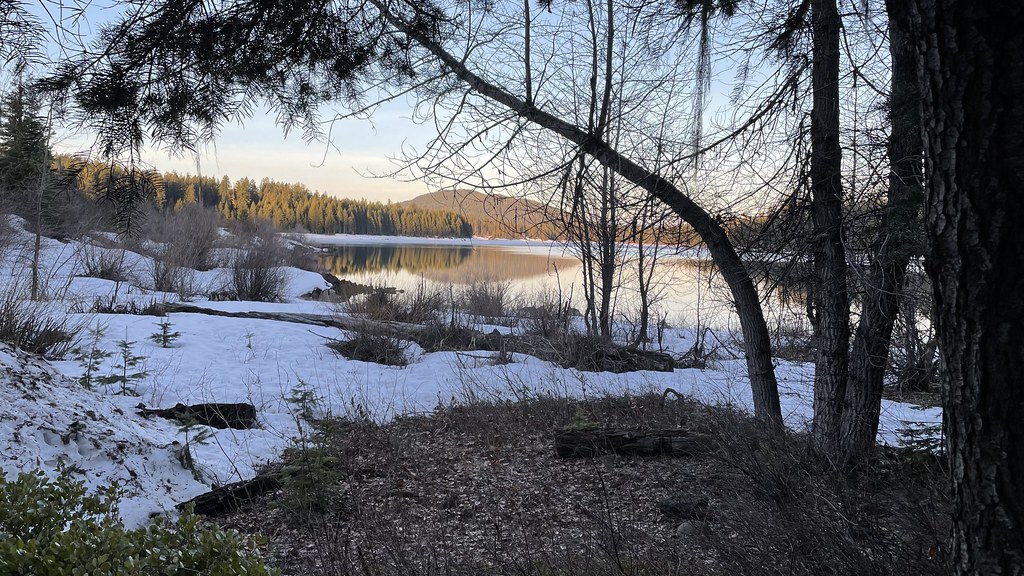
 Photo: ex_magician, CC BY 2.0 (via Flickr)
- 4.3 mi
- one way
- 3,237 ft
- climb
- 9,494 ft
- high point
- Point to point
- route
Is Mt. Mcloughlin Trail open right now?
No closures listed
The Forest Service lists no closures for Fremont-Winema National Forest.
As of · Source: USFS · Fremont-Winema National Forest. Agencies don't list every closure — check before you go.
Mt. Mcloughlin Trail is a hard hike in Oregon's Sky Lakes Wilderness, part of the Klamath Ranger District of the Fremont-Winema National Forest. The route is a point-to-point climb of about 4.3 miles, rising from roughly 6,200 feet to the summit of Mt. Mcloughlin at about 9,500 feet, with a total elevation gain of about 3,200 feet. The trail is not wheelchair accessible, and bikes and horses are not allowed. The trail starts at a lower point of about 5,590 feet and ends at the high point of about 9,490 feet. The climb is rolling, and the route is rated hard. Plan for about three hours on foot. Freye Lake is about 0.4 miles away, and the Upper Canal cross-country ski area is about 0.8 miles off. South Ridge and Twin Ponds Trail are both about 1.6 miles away. Fourmile Lake Campground is about 1.7 miles from the trail.
Local outfitters
- Sky Lakes Wilderness Adventures23 mi away
- Momentum River Expeditions28 mi away
Not on Roamze yet. Their page has how to reach them.
Conditions and forecast on Mount McLoughlin
Daily highs and lows, wind and the chance of precipitation at the summit and route start for the next 7 days, from the Open-Meteo model.
- Freye LakeHikingPhoto: ex_magician, CC BY 2.0 (via Flickr)0.4 mi
- Upper CanalCross-country skiing0.8 mi
 South RidgeHikingPhoto: R6, State & Private Forestry, Forest Health Protection, Public domain (via Wikimedia Commons)1.6 mi
- Twin Ponds TrailHiking1.6 mi
- Fourmile Lake CampgroundCamping1.7 mi
- Fish Lake CampgroundCamping3.9 mi
- Aspen Point CampgroundCamping4 mi
- South Fork Little Butte CreekCanoeing9.3 mi
Source: Roamze catalog (indexable pages within 10 miles, PostGIS distance)
- Freye LakeHiking · Next doorPhoto: ex_magician, CC BY 2.0 (via Flickr)
 Upper Canal Nordic TrailHiking · ~3 min drivePhoto: Holzwerk, CC BY 2.0 (via Flickr)
- BADGER LAKEHiking · ~4 min drivePhoto: Holzwerk, CC BY 2.0 (via Flickr)
 Pct - Oregon Section CHiking · ~5 min drivePhoto: jfdervin, CC BY-SA 2.0 (via Flickr)
- Bull Swamp TrailHiking · ~3 min drivePhoto: R6, State & Private Forestry, Forest Health Protection, Public domain (via Wikimedia Commons)
- Rye Spur TrailHiking · ~3 min drivePhoto: Holzwerk, CC BY 2.0 (via Flickr)
 Twin Ponds TrailHiking · ~5 min drivePhoto: ex_magician, CC BY 2.0 (via Flickr)
 FISH LAKE SNOMOHiking · ~9 min drivePhoto: U.S. Forest Service- Pacific Northwest Region, Public domain (via Wikimedia Commons)
 Rye LoopHiking · ~5 min drivePhoto: Holzwerk, CC BY 2.0 (via Flickr)
- Badger Lake TrailHiking · ~3 min drivePhoto: Holzwerk, CC BY 2.0 (via Flickr)
Also worth it near here
Route details
- Distance
- 4.3 mi
- Climbing
- About 3,237 ft
- Summit
- 9,497 ft
- Difficulty
- Hard
- Time
- About 3 hours
Questions about this route
How long is the Mt. Mcloughlin Trail on Mount McLoughlin?
About 4.3 mi.
How much elevation gain is on the Mt. Mcloughlin Trail?
About 3,237 ft of climbing round trip.
How hard is the Mt. Mcloughlin Trail?
It is rated hard.
How long does the Mt. Mcloughlin Trail take?
About 3 hours round trip.
Map and trail data © OpenStreetMap contributors
