Freye Lake
 Photo: ex_magician, CC BY 2.0 (via Flickr)
- 0.4 mi
- round trip
- 87 ft
- climb
- 6,292 ft
- high point
- Out and back
- route
Is Freye Lake open right now?
No closures listed
The Forest Service lists no closures for Fremont-Winema National Forest.
As of · Source: USFS · Fremont-Winema National Forest. Agencies don't list every closure — check before you go.
Freye Lake is a short, easy hike in the Sky Lakes Wilderness, part of the Klamath Ranger District of the Fremont-Winema National Forest in southern Oregon. The trail is about 0.4 miles long, with a total elevation gain of 87 feet, and it makes an out-and-back trip from a low point of 6,231 feet to a high of 6,292 feet. The Forest Service manages the land, and the route is natural-surfaced and not accessible. The hike is open from June 1 to October 31, and it takes about half an hour to complete. Bikes are not allowed on this trail. Mt. Mcloughlin Trail lies about 0.4 miles away, and Twin Ponds Trail is about 1.7 miles off. For an overnight stay, Fourmile Lake Campground is about 1.9 miles away and Fish Lake Campground is about 3.6 miles away.
Local outfitters
- Sky Lakes Wilderness Adventures23 mi away
- Momentum River Expeditions28 mi away
Not on Roamze yet. Their page has how to reach them.
Keep exploring — more trails worth the drive
Photo: ex_magician, CC BY 2.0 (via Flickr)Mt. Mcloughlin Trail
Next door
Point-to-point ascent of a prominent Cascade volcanic peak with expansive views.
 Photo: R6, State & Private Forestry, Forest Health Protection, Public domain (via Wikimedia Commons)
South Ridge
~3 min drive
1.40-mile out-and-back trail in Oregon with 212 ft elevation gain
 Photo: Holzwerk, CC BY 2.0 (via Flickr)
BADGER LAKE
~4 min drive
9.54-mile out-and-back trail to Badger Lake in Oregon with 1,508 ft gain/loss.
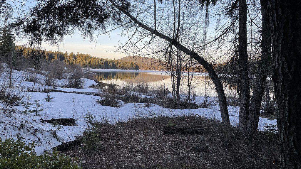 Photo: jfdervin, CC BY-SA 2.0 (via Flickr)
Pct - Oregon Section C
~5 min drive
73.78-mile point-to-point trail in Oregon with 5,925 ft gain.
Photo: Holzwerk, CC BY 2.0 (via Flickr)Upper Canal Nordic Trail
~3 min drive
13.76-mile out-and-back route in Oregon with 2,214 ft elevation gain and loss.
Photo: R6, State & Private Forestry, Forest Health Protection, Public domain (via Wikimedia Commons)Bull Swamp Trail
~4 min drive
0.84-mile out-and-back trail in Oregon with 184 ft elevation gain.
 Photo: ex_magician, CC BY 2.0 (via Flickr)
Twin Ponds Trail
~5 min drive
2.52-mile out-and-back trail in Oregon with 258 ft elevation gain.
 Photo: U.S. Forest Service- Pacific Northwest Region, Public domain (via Wikimedia Commons)
FISH LAKE SNOMO
~9 min drive
17.8-mile out-and-back trail in Oregon with 3,377 ft gain/loss and 4,999 ft max elevation.
Photo: Holzwerk, CC BY 2.0 (via Flickr)Rye Spur Trail
~4 min drive
12.08-mile out-and-back trail in Oregon with 3,077 ft elevation gain and loss.
Photo: ex_magician, CC BY 2.0 (via Flickr)Twin Ponds
~5 min drive
0.66-mile out-and-back trail with 68 ft elevation gain at Twin Ponds, Oregon.


