Olallie Campground
Campground
Campground · 0.4 mi from the trail
Closure in the area
There's a closure order in Willamette National Forest. It doesn't name Mckenzie River National Recreation Trail, so check the source for the area it covers.
Cedar Creek Fire Closure
Agency closure covering Willamette National Forest · Order 06-18-10-26-04 · USFS · Willamette National Forest
FIRE CLOSURES: Current wildfire closures on the Willamette National Forest
Agency alert covering Willamette National Forest · USFS · Willamette National Forest
As of · Source: USFS · Willamette National Forest. Agencies don't list every closure — check before you go.
The McKenzie River National Recreation Trail is a 13.3-mile out-and-back hike in Oregon's Willamette National Forest, within the McKenzie River Ranger District. The trail is managed by the Forest Service and is rated expert, with a total elevation gain of 1,826 feet. The route starts at about 1,950 feet and climbs to a high point of 3,142 feet, with the steepest stretch at about 2 miles in, where the grade reaches 20 percent. Summer is the most comfortable time to go. Typical averages from a nearby weather station at Belknap Springs show July highs around 83°F with only about four wet days, while winter months bring highs in the mid-30s and rain on 17 or more days. That station sits roughly 1,000 feet lower than the trail's high point, so temperatures up top run cooler. Olallie Campground is just 0.4 miles away, and Trail Bridge Campground is about 2 miles off. The Benson and Lost Creek hikes lie within about 4.5 miles, and paddlers can reach the McKenzie River about 5.5 miles away.
Olallie Campground
Campground
Clearwater Gallery
Gallery
Places © OpenStreetMap contributors, Places © Overture Maps Foundation
More in SistersNot on Roamze yet. Their page has how to reach them.
 Olallie CampgroundCampingPhoto: Bonnie Moreland (free images) — Public Domain Mark 1.0 (via Flickr)0.4 mi
 Lost CreekHikingPhoto: theslowlane, CC BY 2.0 (via Flickr)4.4 mi
 McKenzie RiverCanoeingPhoto: Bob Heims, U.S. Army Corps of Engineers, Public domain (via Wikimedia Commons)5.5 mi
Source: Roamze catalog (indexable pages within 10 miles, PostGIS distance)
 Scott MountainHiking · ~11 min drivePhoto: U.S. Forest Service- Pacific Northwest Region, Public domain (via Wikimedia Commons)Benson Lake Trail #3502Hiking · ~11 min drivePhoto: U.S. Forest Service- Pacific Northwest Region, Public domain (via Wikimedia Commons)
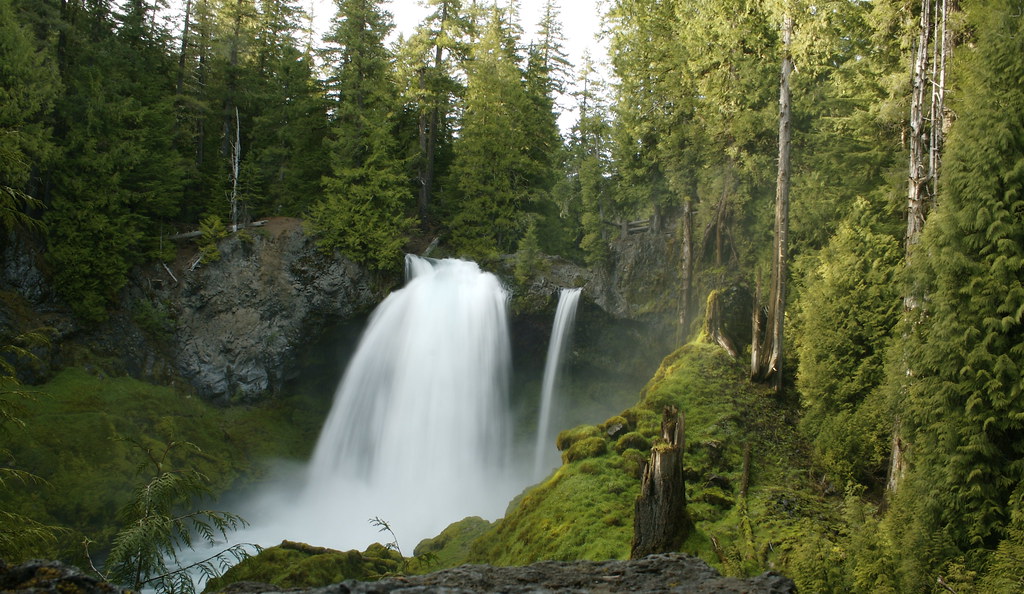 WaterfallsHiking · ~12 min drivePhoto: acaben, CC BY-SA 2.0 (via Flickr)Hand LakeHiking · ~14 min drivePhoto: U.S. Forest Service- Pacific Northwest Region, Public domain (via Wikimedia Commons)
 FrisselHiking · ~12 min drivePhoto: theslowlane, CC BY 2.0 (via Flickr)
 Proxy Falls Trail #3532Hiking · ~14 min drivePhoto: Robert Ashworth from Bellingham, WA., USA, CC BY 2.0 (via Wikimedia Commons)
 ISAAC NICKERSON LOOPHiking · ~15 min drivePhoto: Bonnie Moreland (free images), Public Domain Mark (via Flickr)
 Scott Trail #3531Hiking · ~15 min drivePhoto: Bonnie Moreland (free images), Public Domain Mark (via Flickr)
Best months: June–October. Best months have typical highs of 55–85 °F, lows of 30 °F or warmer (32 °F where the station doesn't record snow), at most one snowy day and no more than 12 wet days.
Jan
37° / 29°
17 wet
Feb
42° / 29°
15 wet
Mar
48° / 31°
18 wet
Apr
55° / 34°
17 wet
May
65° / 41°
14 wet
Jun
72° / 46°
9 wet
Jul
83° / 50°
4 wet
Aug
82° / 49°
3 wet
Sep
75° / 45°
6 wet
Oct
60° / 38°
12 wet
Nov
44° / 33°
17 wet
Dec
36° / 30°
18 wet
Typical high / low (°F) and days with rain or snow, 1991–2020. Measured at Belknap Springs 8 N, OR, 2.5 mi away at 2,152 ft. The station sits about 1,000 ft lower than this place, so expect it a little cooler here. This station doesn't record snowfall. Source: NOAA NCEI U.S. Climate Normals 1991–2020.
