High Desert Trail
- 2.5 mi
- one way
- 63 ft
- climb
- 3,554 ft
- high point
- Point to point
- route
- May–Oct
- best months
High Desert Trail is a 2.5-mile point-to-point hike on Bureau of Land Management land in Oregon's Prineville Deschutes Field Office. It's a short walk with a low climb, rising about 63 feet from a low point of 3,503 feet to a high of 3,554 feet. The route is rated easy, and the trail runs almost flat, with the steepest stretch at about 4% grade around the half-mile mark. Summer is the most comfortable time to go. Typical averages from a nearby weather station in Bend show July and August highs around 82°F with lows near 49°F, and only a couple of wet days a month. Winter is cold, with January highs around 42°F and lows near 24°F. The trail is open to horses, and bikes are not allowed. The trip takes about an hour. Tumulus Trail is about 1.5 miles away, and Sand Trail is roughly 2.9 miles away. Climbers can find The Drive In about 2.2 miles off, and the Castle climbing area is about 3.2 miles away.
Local outfitters
- Wanderlust Tours17 mi away
- Oregon Adaptive Sports17 mi away
Not on Roamze yet. Their page has how to reach them.
Best time to go · May–Oct
Best time to visit High Desert Trail
Best months: May–October. Best months have typical highs of 55–85 °F, lows of 30 °F or warmer (32 °F where the station doesn't record snow), at most one snowy day and no more than 12 wet days.
Jan
42° / 24°
8 wet
Feb
45° / 25°
6 wet
Mar
51° / 28°
6 wet
Apr
57° / 31°
7 wet
May
65° / 38°
7 wet
Jun
72° / 43°
5 wet
Jul
82° / 49°
3 wet
Aug
82° / 49°
2 wet
Sep
74° / 42°
3 wet
Oct
62° / 34°
5 wet
Nov
48° / 28°
7 wet
Dec
40° / 23°
8 wet
Typical high / low (°F) and days with rain or snow, 1991–2020. Measured at Bend 7 Ne, OR, 14.1 mi away at 3,358 ft. This station doesn't record snowfall. Source: NOAA NCEI U.S. Climate Normals 1991–2020.
Keep exploring — more trails worth the drive
 Photo: Bureau of Land Management Oregon and Washington, Public domain (via Wikimedia Commons)
Tumulus Trail
~3 min drive
Out-and-back Oregon trail featuring a notable natural or cultural landmark.
 Photo: Bureau of Land Management Oregon and Washington, Public domain (via Wikimedia Commons)
Dry River Trail
~6 min drive
8.70-mile point-to-point trail in Oregon with 157 ft elevation gain
 Photo: Bureau of Land Management Oregon and Washington, Public domain (via Wikimedia Commons)
Sand Lily Trail
~8 min drive
Out-and-back Oregon trail featuring sand lilies and high-desert wildflowers.
HIKE
Oregon Desert Trail
~14 min drive
Remote 15.5-mile point-to-point desert trek across Oregon's high sagebrush country.
Photo: Bureau of Land Management Oregon and Washington, Public domain (via Wikimedia Commons)Mazama Ash Trail
~8 min drive
Out-and-back volcanic terrain hike in Oregon's geothermal landscape.
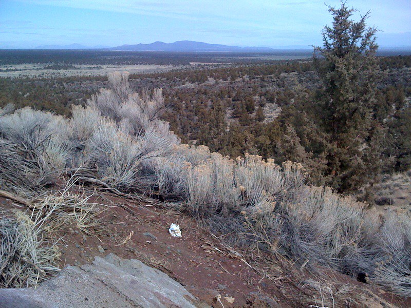 Photo: Sapphireblue, CC BY 2.0 (via Flickr)
Escape from Moscow
~8 min drive
1.48-mile out-and-back trail in Oregon with 683 ft gain.
Photo: Sapphireblue, CC BY 2.0 (via Flickr)Parkway
~8 min drive
4.27-mile out-and-back trail in Oregon with 1,011 ft elevation gain.
HIKE
Sand Trail
~5 min drive
2.87-mile point-to-point trail in Oregon with 103 ft gain
HIKE
Nighthawk Trail
~6 min drive
Out-and-back trail offering scenic Oregon hiking with moderate challenge.
HIKE
social trail
~5 min drive
1.96-mile out-and-back trail in Oregon with 174 ft elevation gain

Map and trail data © OpenStreetMap contributors
