Floras Lake Trail
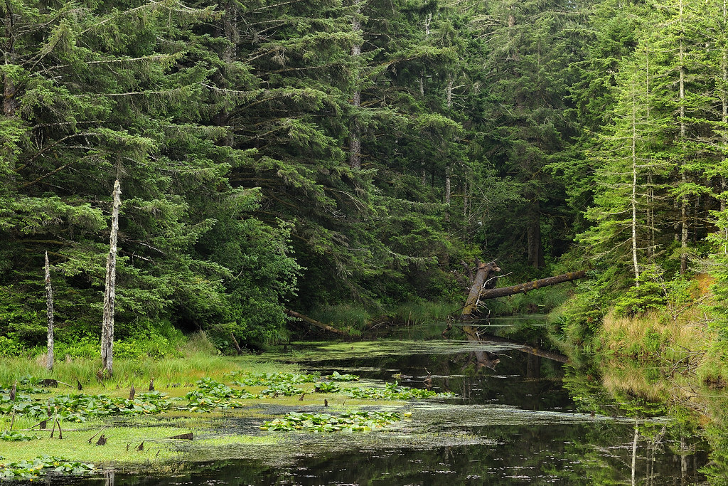
 Photo: BLM Oregon & Washington, CC BY 2.0 (via Flickr)
- 1.4 mi
- round trip
- 548 ft
- climb
- 170 ft
- high point
- Out and back
- route
- May–Oct
- best months
Floras Lake Trail is an easy out-and-back hike of about 2.8 miles in Oregon's Floras Lake State Natural Area, a city-managed unit on city land. The trail climbs from a low point of 44 feet to a high of 170 feet, with a total gain of 548 feet over the round trip. That makes for a gentle, short outing that fits easily into a half day. Summer is the most comfortable time to go. Typical July and August highs reach about 70°F with only three wet days a month, according to averages from a nearby weather station at Langlois. Winter months bring highs around 55°F and rain on 20 or more days. The trail takes about an hour to complete, so plan for a short, easy walk. Edson Creek Campground is about 7.6 miles away, and the Ridge Trail lies about 7.9 miles off. Crystal Creek, about 5.5 miles away, offers canoeing.
Local outfitters
- Remote Outpost RV Park33 mi away
- John Carl Guide Service33 mi away
Not on Roamze yet. Their page has how to reach them.
- Crystal CreekCanoeing5.5 mi
 Edson Creek Campground (OR)CampingPhoto: Recreation.gov (RIDB) / public domain7.6 mi
 Ridge TrailHikingPhoto: Bureau of Land Management, Public domain (via Wikimedia Commons)7.9 mi
- Unnamed BLM TrailHikingPhoto: Bureau of Land Management, Public domain (via Wikimedia Commons)7.9 mi
- Edson CreekCanoeing8.2 mi
- Fourmile CreekCanoeing9.7 mi
 New River TrailsHikingPhoto: BLM Oregon & Washington, CC BY 2.0 (via Flickr)9.7 mi
Source: Roamze catalog (indexable pages within 10 miles, PostGIS distance)
- Ridge TrailHiking · ~13 min drivePhoto: Bureau of Land Management, Public domain (via Wikimedia Commons)
- New River TrailsHiking · ~17 min drivePhoto: BLM Oregon & Washington, CC BY 2.0 (via Flickr)
 Humbug Mountain Trail (West)Hiking · ~26 min drivePhoto: AB87, CC BY 3.0 (via Wikimedia Commons)
- Rogue River National Recreation TrailHiking · ~54 min drive
- Unnamed BLM TrailHiking · ~13 min drivePhoto: Bureau of Land Management, Public domain (via Wikimedia Commons)
 Devils BackboneHiking · ~55 min drivePhoto: james shaw, CC BY-SA 3.0 (via Wikimedia Commons)
- Iron MountainHiking · ~42 min drive
- Lower Rogue RiverHiking · ~54 min drive
 Coquille River WalkHiking · ~43 min drivePhoto: Don Henise, CC BY 2.0 (via Flickr)
 Pine GroveHiking · ~56 min drivePhoto: james shaw, CC BY-SA 3.0 (via Wikimedia Commons)
Best time to visit Floras Lake Trail
Best months: May–October. Best months have typical highs of 55–85 °F, lows of 30 °F or warmer (32 °F where the station doesn't record snow), at most one snowy day and no more than 12 wet days.
Jan
55° / 40°
20 wet
Feb
55° / 39°
18 wet
Mar
56° / 40°
20 wet
Apr
58° / 42°
17 wet
May
62° / 46°
12 wet
Jun
65° / 49°
7 wet
Jul
69° / 52°
3 wet
Aug
70° / 52°
3 wet
Sep
69° / 49°
6 wet
Oct
65° / 45°
12 wet
Nov
58° / 42°
18 wet
Dec
54° / 39°
21 wet
Typical high / low (°F) and days with rain or snow, 1991–2020. Measured at Langlois #2, OR, 3.6 mi away at 90 ft. Source: NOAA NCEI U.S. Climate Normals 1991–2020.

Map and trail data © OpenStreetMap contributors
