Winom Creek Cg/Th
- May–Sep
- best months
Caution today
Agency alerts are in effect for this area; weather is good · USFS, OpenWeather · checked just now
Is Winom Creek Cg/Th open right now?
Closure in the area
There's a closure order in North Fork John Day Ranger District. It doesn't name Winom Creek Cg/Th, so check the source for the area it covers.
Salmon Olive Butte Fire Area Closure
Agency closure covering North Fork John Day Ranger District · Order 06-04-01-26-13 · USFS · North Fork John Day Ranger District
As of · Source: USFS · North Fork John Day Ranger District. Agencies don't list every closure — check before you go.
- At 5,000 ft
- North Fork John Day Ranger DistrictUmatilla National Forest
This campground is located along the paved; Blue Mountain Scenic Byway southeast of Ukiah, OR. There are 10 campsites (3 of which are group sites) and 2 accessible toilets. Sites 3 and 4 have log picnic shelters. There is an interpretive sign near the information board and OHV loading dock. There is no water or garbage service, so please pack your garbage home.2018 Winom-Frazier OHV Complex and Desolation OHV Trail System Map ; - June; 3, 2019; (pdf file - 466kb)Trail access: The Tower Loop Trail #3040 connects with the; campground providing; access to; the southern end of the Winom-Frazier OHV Complex with over 100 miles of trail to enjoy. Nearby is the North Fork John Day Wilderness which is accessed via the; North Winom Creek Trail #3160; and; South Winom Creek Trail #3153; which are located across Winom Creek off Forest Service Road; 52-440 just beyond the campground.Available; activities nearby also include hunting, sight-seeing, mushroom picking, huckleberry picking, photography and the Ukiah-Granite Roadside Geology tour.For information about accessible recreation opportunities in Pacific Northwest National Forests, visit http://www.fs.usda.gov/goto/r6/accessiblerecreation
Local outfitters
- Adventure-Fit46 mi away
Not on Roamze yet. Their page has how to reach them.
- Tower Loop TrailHiking0.2 mi
- Big CreekCanoeing0.9 mi
- Big Creek Mdws Cg/ThCamping1 mi
- Oriental Cg/ThCamping5.1 mi
- Umapine CampgroundCamping8 mi
- Gold Dredge CgCamping8.8 mi
- Lehman Trail (No. 3188)Hiking9.9 mi
Source: Roamze catalog (indexable pages within 10 miles, PostGIS distance)
- Peavy CabinCamping · ~34 min drive
- Anthony LakeCamping · ~35 min drive
- Mud Lake CampgroundCamping · ~35 min drive
- Welch Creek Cg/ThCamping · ~20 min drive
- North Fork John Day CampgroundCamping · ~23 min drive
- Frog Heaven Forest CampCamping · ~24 min drive
- Tollbridge CgCamping · ~25 min drive
- Caretakers CabinCamping · ~28 min drive
- Miners RetreatCamping · ~28 min drive
- Congo GulchCamping · ~28 min drive
Also worth it near here
- Warm Mineral SpringHot spring · ~16 min drive
 Sheep RockSummit · ~27 min drivePhoto: Finetooth, CC BY-SA 3.0 (via Wikimedia Commons)
- Meadow Brooks FallsWaterfall · ~27 min drive
 Saddle Camp - Lost Creek tie trailHiking · ~28 min drivePhoto: Forest Service Pacific Northwest Region, Public Domain Mark (via Flickr)
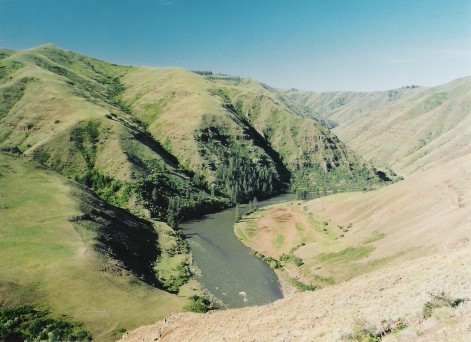 Grande Ronde RiverCanoeing · ~32 min drivePhoto: Dsdugan, Public domain (via Wikimedia Commons)
Best time to visit Winom Creek Cg/Th
Best months: May–September. Best months have typical highs of 55–85 °F, lows of 30 °F or warmer (32 °F where the station doesn't record snow), at most one snowy day and no more than 12 wet days.
Jan
34° / 15°
14 wet
Feb
39° / 18°
12 wet
Mar
46° / 23°
13 wet
Apr
53° / 28°
12 wet
May
62° / 34°
12 wet
Jun
71° / 39°
9 wet
Jul
83° / 43°
5 wet
Aug
83° / 42°
4 wet
Sep
73° / 35°
5 wet
Oct
59° / 28°
7 wet
Nov
42° / 22°
12 wet
Dec
33° / 16°
15 wet
Typical high / low (°F) and days with rain or snow, 1991–2020. Measured at Austin 3 S, OR, 31.1 mi away at 4,213 ft. The station sits about 800 ft lower than this place, so expect it a little cooler here. This station doesn't record snowfall. Source: NOAA NCEI U.S. Climate Normals 1991–2020.
