Little Baldy Trail
- 0.9 mi
- round trip
- 334 ft
- climb
- 1,677 ft
- high point
- Out and back
- route
- Feb–May, Oct–Nov
- best months
Little Baldy Trail is a short, easy out-and-back hike in the Wichita Mountains Wildlife Refuge in Oklahoma, managed by the U.S. Fish and Wildlife Service. The trail is about 0.85 miles long, and the round trip adds up to roughly 1.7 miles with a total elevation gain of about 334 feet. The high point on the route is about 1,677 feet, and the climb is steady, with the steepest stretch at about 0.5 miles in, where the grade reaches about 12 percent. Spring and fall are the most comfortable times to go. Typical averages from a nearby weather station show April highs around 73°F and October highs around 75°F, while July and August average in the mid-90s. The trail sits close to several climbing areas, including Quanah Parker Lake / Little Baldy about 0.3 miles away and Thunderdome Wall and Pumbaa Boulder, each about 0.4 miles off. For more hiking, The Narrows Trail is about 2.1 miles away.
Conditions and forecast on Little Baldy
Daily highs and lows, wind and the chance of precipitation at the summit and route start for the next 7 days, from the Open-Meteo model.
 Quanah Parker Lake / Little BaldyRock climbingPhoto: MARELBU, CC BY 3.0 (via Wikimedia Commons)0.3 mi
 Thunderdome WallRock climbingPhoto: Lm13700, CC BY-SA 3.0 (via Wikimedia Commons)0.4 mi
- Pumbaa BoulderRock climbingPhoto: Lm13700, CC BY-SA 3.0 (via Wikimedia Commons)0.4 mi
- The MeadowsRock climbingPhoto: Lm13700, CC BY-SA 3.0 (via Wikimedia Commons)0.6 mi
 The Narrows TrailHikingPhoto: jonathan c. wheeler, CC BY-SA 3.0 (via Wikimedia Commons)2.1 mi
- Kite TrailHikingPhoto: jonathan c. wheeler, CC BY-SA 3.0 (via Wikimedia Commons)2.3 mi
 Jed Johnson Tower TrailHikingPhoto: duggar11, CC BY 2.0 (via Wikimedia Commons)3 mi
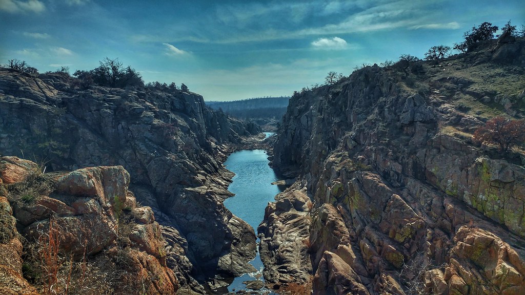 Longhorn TrailHikingPhoto: ToddMorris, CC BY-SA 2.0 (via Flickr)3.1 mi
Source: Roamze catalog (indexable pages within 10 miles, PostGIS distance)
 Burford Lake TrailHiking · ~3 min drivePhoto: jonathan c. wheeler, CC BY-SA 3.0 (via Wikimedia Commons)
 Bison TrailHiking · ~6 min drivePhoto: Larry Smith, CC BY 2.0 (via Wikimedia Commons)
 Charon's Garden TrailHiking · ~9 min drivePhoto: Larry Smith from Lawton, Ok, USA, CC BY 2.0 (via Wikimedia Commons)
- The Narrows TrailHiking · ~4 min drivePhoto: jonathan c. wheeler, CC BY-SA 3.0 (via Wikimedia Commons)
 Elk Mountain TrailHiking · ~8 min drivePhoto: jonathan c. wheeler, CC BY-SA 3.0 (via Wikimedia Commons)
- Kite TrailHiking · ~4 min drivePhoto: jonathan c. wheeler, CC BY-SA 3.0 (via Wikimedia Commons)
- Jed Johnson Tower TrailHiking · ~5 min drivePhoto: duggar11, CC BY 2.0 (via Wikimedia Commons)
- Longhorn TrailHiking · ~5 min drivePhoto: ToddMorris, CC BY-SA 2.0 (via Flickr)
- Elk TrailHiking · ~6 min drivePhoto: Larry Smith, CC BY 2.0 (via Wikimedia Commons)
 Cedar Planting TrailHiking · ~8 min drivePhoto: jonathan c. wheeler, CC BY-SA 3.0 (via Wikimedia Commons)
Best time to visit Little Baldy Trail
Best months: February–May and October–November. Best months have typical highs of 55–85 °F, lows of 30 °F or warmer (32 °F where the station doesn't record snow), at most one snowy day and no more than 12 wet days.
Jan
52° / 29°
4 wet
Feb
55° / 33°
4 wet
Mar
65° / 42°
5 wet
Apr
73° / 50°
6 wet
May
81° / 59°
7 wet
Jun
89° / 68°
6 wet
Jul
95° / 73°
5 wet
Aug
94° / 71°
5 wet
Sep
86° / 63°
6 wet
Oct
75° / 51°
5 wet
Nov
63° / 40°
4 wet
Dec
53° / 31°
4 wet
Typical high / low (°F) and days with rain or snow, 1991–2020. Measured at Wichita Mtn Wr, OK, 4.3 mi away at 1,665 ft. Source: NOAA NCEI U.S. Climate Normals 1991–2020.
Route details
- Distance
- 0.9 mi round trip
- Climbing
- About 334 ft
- Summit
- 1,679 ft
- Difficulty
- Easy
- Time
- About 0.5 hours
Questions about this route
How long is the Little Baldy Trail on Little Baldy?
About 0.9 mi round trip.
How much elevation gain is on the Little Baldy Trail?
About 334 ft of climbing round trip.
How hard is the Little Baldy Trail?
It is rated easy.
How long does the Little Baldy Trail take?
About 0.5 hours round trip.
