Cedar Planting Trail
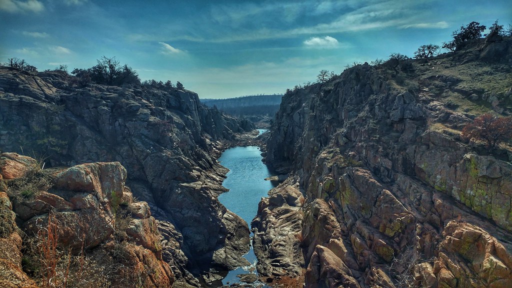
 Photo: jonathan c. wheeler, CC BY-SA 3.0 (via Wikimedia Commons)
- 0.5 mi
- round trip
- 65 ft
- climb
- 1,566 ft
- high point
- Out and back
- route
- Feb–May, Sep–Nov
- best months
Cedar Planting Trail is a short, easy out-and-back hike in the Wichita Mountains Wildlife Refuge in Oklahoma, managed by the U.S. Fish and Wildlife Service. The trail is about half a mile long, with a total elevation gain of about 65 feet, and it takes roughly half an hour to complete. The route starts and ends near 1,565 feet, with the high point at 1,566 feet. The steepest stretch comes about a third of the way in, with a grade of about 3 percent. Spring and fall are the most comfortable times to go. Typical averages from a nearby weather station show April highs around 72°F and October highs around 74°F, while July and August average about 94°F. Jed Johnson Tower Trail lies about 1.6 miles away, and the climbing areas at Jug City (Holy City) and Bad Beta Podcast Studio are each about 1.8 miles off. Little Baldy Trail is about 4.5 miles away.
 Jed Johnson Tower TrailHikingPhoto: duggar11, CC BY 2.0 (via Wikimedia Commons)1.6 mi
 Bad Beta Podcast StudioRock climbingPhoto: MARELBU, CC BY 3.0 (via Wikimedia Commons)1.8 mi
- Jug City (Holy City)Rock climbingPhoto: MARELBU, CC BY 3.0 (via Wikimedia Commons)1.8 mi
- Hunting Horse HillRock climbing2 mi
- Horses Ass boulderRock climbing2 mi
- LETRA Connection TrailHiking4 mi
- Little Baldy TrailHiking4.5 mi
 The Narrows TrailHikingPhoto: jonathan c. wheeler, CC BY-SA 3.0 (via Wikimedia Commons)6.6 mi
Source: Roamze catalog (indexable pages within 10 miles, PostGIS distance)
- Jed Johnson Tower TrailHiking · ~3 min drivePhoto: duggar11, CC BY 2.0 (via Wikimedia Commons)
 Bison TrailHiking · ~13 min drivePhoto: Larry Smith, CC BY 2.0 (via Wikimedia Commons)
 Charon's Garden TrailHiking · ~16 min drivePhoto: Larry Smith from Lawton, Ok, USA, CC BY 2.0 (via Wikimedia Commons)
 LETRA TrailHiking · ~6 min drivePhoto: anyjazz65, CC BY 2.0 (via Flickr)
 Elk Mountain TrailHiking · ~14 min drivePhoto: jonathan c. wheeler, CC BY-SA 3.0 (via Wikimedia Commons)
 Burford Lake TrailHiking · ~10 min drivePhoto: jonathan c. wheeler, CC BY-SA 3.0 (via Wikimedia Commons)
- The Narrows TrailHiking · ~11 min drivePhoto: jonathan c. wheeler, CC BY-SA 3.0 (via Wikimedia Commons)
- Kite TrailHiking · ~12 min drivePhoto: jonathan c. wheeler, CC BY-SA 3.0 (via Wikimedia Commons)
 Longhorn TrailHiking · ~12 min drivePhoto: ToddMorris, CC BY-SA 2.0 (via Flickr)
- Elk TrailHiking · ~13 min drivePhoto: Larry Smith, CC BY 2.0 (via Wikimedia Commons)
Also worth it near here
- Wichita Mountains BywayScenic drive · ~2 min drive
- Bad Beta Podcast StudioRock climbing · ~3 min drivePhoto: MARELBU, CC BY 3.0 (via Wikimedia Commons)
 Mount ScottSummit · ~5 min drivePhoto: Mnizlien, CC BY-SA 3.0 (via Wikimedia Commons)
- Lake Lawtonka - Robinson Landing CampgroundCamping · ~5 min drive
Best time to visit Cedar Planting Trail
Best months: February–May and September–November. Best months have typical highs of 55–85 °F, lows of 30 °F or warmer (32 °F where the station doesn't record snow), at most one snowy day and no more than 12 wet days.
Jan
50° / 31°
Feb
55° / 34°
Mar
64° / 43°
Apr
72° / 50°
May
80° / 59°
Jun
89° / 67°
Jul
94° / 72°
Aug
94° / 72°
Sep
85° / 64°
Oct
74° / 53°
Nov
61° / 41°
Dec
51° / 32°
Typical high / low (°F) and days with rain or snow, 1991–2020. Measured at Medicine Pk 3w Mesonet, OK, 1.6 mi away at 1,597 ft. This station doesn't record snowfall. Source: NOAA NCEI U.S. Climate Normals 1991–2020.
