Scarlet Oak Trail
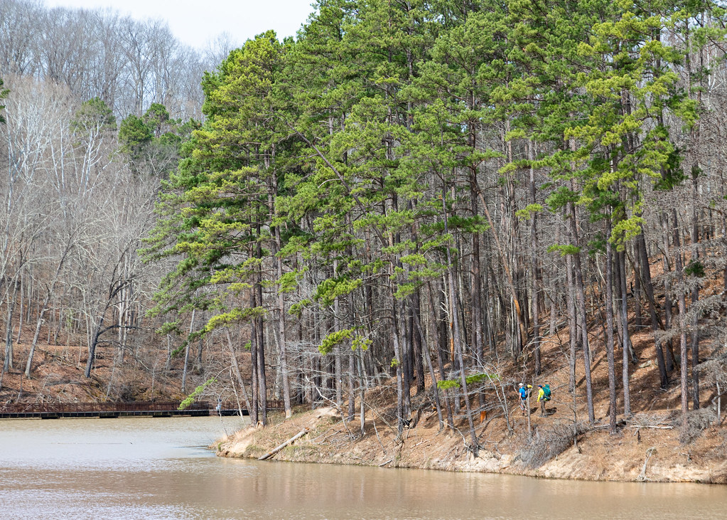 Photo: Wayne National Forest, Public Domain Mark (via Flickr)
- 0.4 mi
- one way
- 223 ft
- climb
- 858 ft
- high point
- Point to point
- route
- Aug–Oct
- best months
Is Scarlet Oak Trail open right now?
Closure in the area
There's a closure order in Wayne National Forest. It doesn't name Scarlet Oak Trail, so check the source for the area it covers.
Lake Vesuvius Area Closure Public Health and Safety
Agency closure covering Wayne National Forest · USFS · Wayne National Forest
Timbre Ridge Lake Closure
Agency alert covering Wayne National Forest · Order 09-14-25-01 · USFS · Wayne National Forest
As of · Source: USFS · Wayne National Forest. Agencies don't list every closure — check before you go.
Scarlet Oak Trail is a short, easy hike in the Ironton Ranger District of Wayne National Forest in Ohio, managed by the Forest Service. The trail is 0.41 miles long, with a total elevation gain of 223 feet from a starting point around 645 feet to a high point of 858 feet. The climb is steepest near the beginning, with a 15% grade at about 0.07 miles, and the trail ends with a small loss of 39 feet. Spring and fall are the most comfortable times to go. Typical averages from a nearby weather station in Waterloo, about 11 miles away, show October highs around 68°F with lows near 40°F, and May highs around 75°F. That station sits roughly 230 feet lower than the trail's high point, so temperatures on the trail run a little cooler. Lake Shore is just 0.1 mile away, and Longbow Archery is 0.2 mile off. Climbers can head to The Rock, about 0.3 mile away, and Lake Vesuvius Recreation Area is also within a third of a mile.
Best time to go · Aug–Oct
Best time to visit Scarlet Oak Trail
Best months: August–October. Best months have typical highs of 55–85 °F, lows of 30 °F or warmer (32 °F where the station doesn't record snow), at most one snowy day and no more than 12 wet days.
Jan
41° / 20°
13 wet
Feb
45° / 22°
12 wet
Mar
54° / 29°
13 wet
Apr
67° / 38°
13 wet
May
75° / 49°
15 wet
Jun
83° / 57°
13 wet
Jul
86° / 62°
12 wet
Aug
85° / 60°
11 wet
Sep
79° / 52°
10 wet
Oct
68° / 40°
10 wet
Nov
55° / 30°
11 wet
Dec
45° / 25°
13 wet
Typical high / low (°F) and days with rain or snow, 1991–2020. Measured at Waterloo, OH, 10.7 mi away at 625 ft. This station doesn't record snowfall. Source: NOAA NCEI U.S. Climate Normals 1991–2020.
Keep exploring — more trails worth the drive
Photo: Wayne National Forest, Public Domain Mark (via Flickr)Lake Shore
Next door
7.40-mile out-and-back trail in Ohio with 1,915 ft elevation gain.
 Photo: Wayne National Forest, Public Domain Mark (via Flickr)
Old Beach
Next door
1.20-mile out-and-back trail in Ohio with 310 ft gain.
 Photo: Wayne National Forest, Public Domain Mark (via Flickr)
Copperhead Trail
~9 min drive
5.42-mile out-and-back hike in Ohio with 1,134 ft elevation gain
HIKE
Michael Tygart Trail
~28 min drive
15.94-mile out-and-back trail in Kentucky with 2,730 ft elevation gain
 Photo: Wayne National Forest, Public Domain Mark (via Flickr)
Vesuvius Backpack Trail
Next door
Challenging 14.46-mile point-to-point backpack route through southeastern Ohio.
 Photo: dok1, CC BY 2.0 (via Wikimedia Commons)
Black Oak Trail
Next door
Black Oak Trail is a 0.30-mile point-to-point trail in Ohio with 114 ft of elevation gain.
 Photo: Wayne National Forest, Public Domain Mark (via Flickr)
Power Line Trail
~9 min drive
7.9-mile out-and-back hike in Ohio with 1,218 ft elevation gain
 Photo: Wayne National Forest, Public Domain Mark (via Flickr)
Vesuvius Main Loop
~2 min drive
59.28-mile loop trail in Ohio with 2,652 ft elevation gain.
Photo: dok1, CC BY 2.0 (via Wikimedia Commons)Rock House Trail
Next door
0.39-mile point-to-point trail in Ohio with 50 ft gain and 177 ft loss.
 Photo: Wayne National Forest, Public Domain Mark (via Flickr)
Wolcot Trail
~17 min drive
6.22-mile out-and-back trail in Ohio with 1,257 ft elevation gain/loss
Map and trail data © OpenStreetMap contributors
