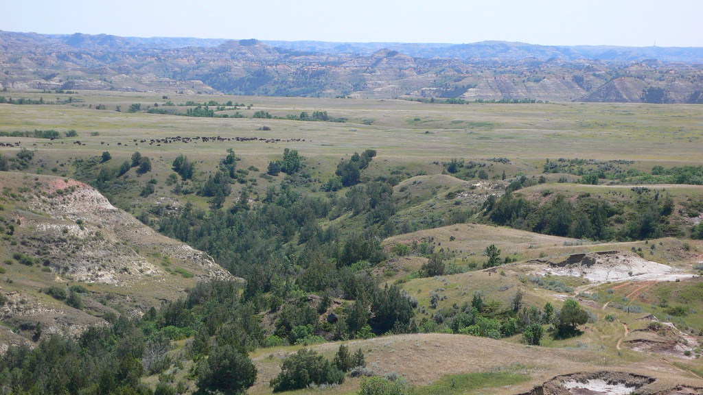
Medora Interstate Rocks
- 2 routes
- 5.9
- Trad · Bouldering
- May–Jun, Aug–Oct
- best months
Caution at last check
Agency alerts are in effect for this area; weather is good · USFS, OpenWeather · checked 14 h ago
Is Medora Interstate Rocks open right now?
Alert in the area
The Forest Service lists 5 alerts for Dakota Prairie Grasslands.
Firewood Use and Possession Restrictions
Agency alert covering Dakota Prairie Grasslands · USFS · Dakota Prairie Grasslands
Road Closure-NFSR 735A-9
Agency alert covering Medora Ranger District · USFS · Medora Ranger District
Little Missouri National Grassland Fire Closure Order # 01-18-00-26-02
Agency alert covering Dakota Prairie Grasslands · USFS · Dakota Prairie Grasslands
South Dakota Grassland Fire Danger Map
Agency alert covering Dakota Prairie Grasslands · USFS · Dakota Prairie Grasslands
North Dakota Burn Restrictions & Fire Danger Maps
Agency alert covering Dakota Prairie Grasslands · USFS · Dakota Prairie Grasslands
As of · Source: USFS · Dakota Prairie Grasslands. Agencies don't list every closure — check before you go.
Medora Interstate Rocks is a climbing area in the Medora Ranger District of the Dakota Prairie Grasslands in North Dakota, managed by the Forest Service. It sits within the Medora Ranger District, about 3.7 miles from the town of Medora. The area has two routes, one a trad climb and the other a boulder. Cal's Crack is the trad route, graded 5.9 on the YDS scale. The boulder is listed at V17 on the V scale. Summer is the most comfortable time to visit. Typical averages from a nearby weather station in Medora show July highs around 86°F with lows near 56°F, while winter highs stay in the 20s and 30s. Buffalo Gap Campground and the Buffalo Gap Loop hike are both about 3.8 miles away. Square Butte Bouldering is roughly 6.9 miles off, and Wannagan Campground is about 8 miles away.
- Buffalo Gap SpurHiking3.4 mi
- Little Missouri National GrasslandLake fishing3.8 mi
- Buffalo GapCamping3.8 mi
- Buffalo Gap LoopHiking3.9 mi
- West Loop TrailHiking4 mi
- Square Butte BoulderingRock climbing6.9 mi
- Square ButteRock climbing6.9 mi
- Wannagan CampgroundCamping8 mi
Source: Roamze catalog (indexable pages within 10 miles, PostGIS distance)
- Square ButteRock climbing · ~12 min drive
- Sentinel ButteRock climbing · ~21 min drive
- North BouldersRock climbing · ~21 min drive
- Sentinel Butte BoulderingRock climbing · ~21 min drive
- South BouldersRock climbing · ~22 min drive
- GronkRock climbing · ~1h 16m drive
- Birth Canal BoulderRock climbing · ~1h 16m drive
- Square Butte BoulderingRock climbing · ~12 min drive
Best time to visit Medora Interstate Rocks
Best months: May–June and August–October. Best months have typical highs of 55–85 °F, lows of 30 °F or warmer (32 °F where the station doesn't record snow), at most one snowy day and no more than 12 wet days.
Jan
28° / 3°
6 wet · 5 snow
Feb
32° / 8°
5 wet · 4 snow
Mar
44° / 18°
6 wet · 3 snow
Apr
55° / 29°
7 wet · 1 snow
May
67° / 41°
10 wet
Jun
77° / 50°
11 wet
Jul
86° / 56°
9 wet
Aug
85° / 53°
7 wet
Sep
74° / 43°
7 wet
Oct
58° / 30°
7 wet · 1 snow
Nov
42° / 18°
5 wet · 3 snow
Dec
31° / 7°
6 wet · 5 snow
Typical high / low (°F) and days with rain or snow, 1991–2020. Measured at Medora, ND, 3.7 mi away at 2,268 ft. Source: NOAA NCEI U.S. Climate Normals 1991–2020.