Little Missouri National Grassland
- May–Jun, Aug–Oct
- best months
Is Little Missouri National Grassland open right now?
Alert in the area
The Forest Service lists an alert for Medora Ranger District.
Road Closure-NFSR 735A-9
Agency alert covering Medora Ranger District · USFS · Medora Ranger District
As of · Source: USFS · Medora Ranger District. Agencies don't list every closure — check before you go.
Little Missouri National Grassland is located in western North Dakota, USA. At 1,033,271 acres (418,150 ha), it is the largest grassland in the country.[1] Enclaved within its borders is Theodore Roosevelt National Park, which is managed by the National Park Service (and therefore not included in the preceding statistics). The Little Missouri National Grassland was once a part of the Custer National Forest, but is now a part of the Dakota Prairie Grasslands, a National Forest unit consisting entirely of National Grasslands. A predominant feature of the grassland is colorful and beautiful badlands and rugged terrain extensively eroded by wind and water. It is a mixed grass prairie, meaning it has both long and short grass.The boundaries of the grasslands on certain maps can be misleading. Within the boundaries of the national grassland are significant portions of state-owned and privately owned land, much of it leased by cattle ranchers for grazing. Overall, in descending order of land area, it is located in parts of McKenzie, Billings, Slope, and Golden Valley counties.White Butte, North Dakota's highest point, is located in the extreme southeast corner of the grassland, south of the town of Amidon.The grassland is administered by the Forest Service as part of the Dakota Prairie Grasslands from offices in Bismarck, North Dakota. There are local ranger district offices in Dickinson and Watford City.
- West Loop TrailHiking0.2 mi
 East Loop TrailHikingPhoto: CLS Rob, CC BY-SA 2.0 (via Flickr)0.7 mi
 Maah Daah HeyHikingPhoto: CLS Rob, CC BY-SA 2.0 (via Flickr)1.8 mi
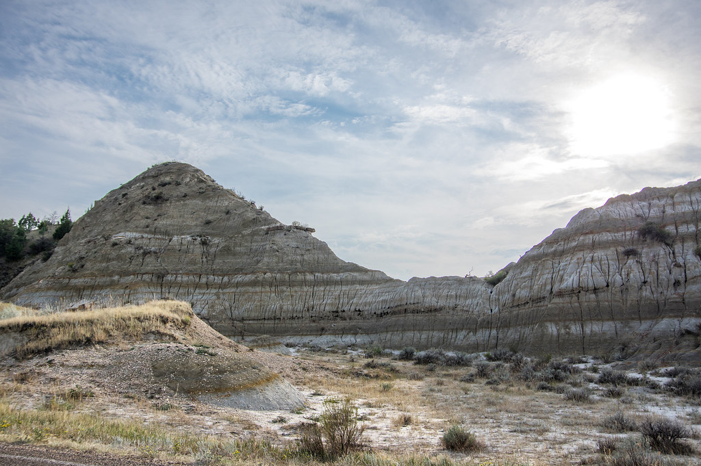 Ridgeline Nature TrailHikingPhoto: RuggyBearLA, CC BY-SA 2.0 (via Flickr)2.8 mi
- Medora Interstate RocksRock climbing3.8 mi
- Buffalo GapCamping7.6 mi
- Square ButteRock climbing9 mi
- Square Butte BoulderingRock climbing9 mi
Source: Roamze catalog (indexable pages within 10 miles, PostGIS distance)
Best time to visit Little Missouri National Grassland
Best months: May–June and August–October. Best months have typical highs of 55–85 °F, lows of 30 °F or warmer (32 °F where the station doesn't record snow), at most one snowy day and no more than 12 wet days.
Jan
28° / 3°
6 wet · 5 snow
Feb
32° / 8°
5 wet · 4 snow
Mar
44° / 18°
6 wet · 3 snow
Apr
55° / 29°
7 wet · 1 snow
May
67° / 41°
10 wet
Jun
77° / 50°
11 wet
Jul
86° / 56°
9 wet
Aug
85° / 53°
7 wet
Sep
74° / 43°
7 wet
Oct
58° / 30°
7 wet · 1 snow
Nov
42° / 18°
5 wet · 3 snow
Dec
31° / 7°
6 wet · 5 snow
Typical high / low (°F) and days with rain or snow, 1991–2020. Measured at Medora, ND, 0.2 mi away at 2,268 ft. Source: NOAA NCEI U.S. Climate Normals 1991–2020.
