Raven Knob
- 1,901 ft
- summit
- 2
- ways up
- Apr, Sep–Nov
- best months
Raven Knob is a summit in North Carolina, rising to 1,901 feet about 4 miles from the town of Lowgap. It sits among a cluster of short trails, with the Orange Trail and Knob Trail both within a quarter mile, so it works well as a destination for a day of hiking on several routes close together. For comfortable weather, aim for late spring or early fall. Typical averages from a nearby weather station show May highs around 72°F and September highs around 76°F, with July the warmest month at about 82°F. That station sits roughly 440 feet higher than the summit, so temperatures on the knob run a little warmer than its figures suggest. The closest trails are the Orange Trail, about 0.1 mile away, and the Knob Trail, about 0.2 mile away. The Lake Trail and Cold Creek Trail are also within a mile. Paddlers can find the Fisher River about 4 miles off.
Conditions and forecast
Daily highs and lows, wind and the chance of precipitation at the summit and route start for the next 7 days, from the Open-Meteo model.
- Summit elevation
- 1,901 ft
Elevation from USGS 3D Elevation Program terrain data (about 10 m resolution).
- Knob TrailModerateabout 1,026 ft of climbing1.2 mi round trip
- Orange TrailHardabout 2,715 ft of climbing10.9 mi round trip
Compare the routes Knob Trail Orange Trail Climbing About 1,026 ft About 2,715 ft Round trip 1.2 mi 10.9 mi Difficulty Moderate Hard Terrain Hike Hike Map © Mapbox © OpenStreetMap contributors Questions about Raven Knob
How tall is Raven Knob?
1,901 ft (579 m).
How many routes go to the summit of Raven Knob?
2: Knob Trail and Orange Trail.
What is the shortest route up Raven Knob?
Knob Trail, about 1.2 mi round trip.
- Warrior Mountain2,101 ft · North Carolina1 route1.6 mi away
- Racoon Mountain2,179 ft · North Carolina2 routes1.8 mi away
- Saddle Mountain3,332 ft · North Carolina1 route5.0 mi away
- Stone Mountain2,300 ft · North Carolina1 route12 mi away
- Green Mountain3,900 ft · North Carolina1 route15 mi away
- Fodder Stack3,616 ft · North Carolina1 route18 mi away
- Orange TrailHiking0.1 mi
- Knob TrailHiking0.2 mi
- Lake TrailHiking0.4 mi
- Cold Creek TrailHiking0.7 mi
- Scout Ridge TrailHiking0.9 mi
- Fisher RiverCanoeing4.3 mi
- Little Fisher RiverCanoeing5.2 mi
- Stewarts CreekCanoeing8.2 mi
Source: Roamze catalog (indexable pages within 10 miles, PostGIS distance)
 Buffalo MountainSummit · ~52 min drivePhoto: Antepenultimate, CC BY-SA 4.0 (via Wikimedia Commons)
 Mount JeffersonSummit · ~59 min drivePhoto: Matthew Applewood, CC BY-SA 3.0 (via Wikimedia Commons)
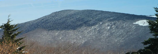 Mount RogersSummit · ~1h 10m drivePhoto: USDA-FS, Public domain (via Wikimedia Commons)
 Three Top MountainSummit · ~1h 11m drivePhoto: James St. John, CC BY 2.0 (via Wikimedia Commons)
- Warrior MountainSummit · ~3 min drive
- Racoon MountainSummit · ~3 min drive
- Saddle MountainSummit · ~9 min drive
- Stone MountainSummit · ~21 min drive
- Green MountainSummit · ~26 min drive
- Fodder StackSummit · ~31 min drive
Best time to visit Raven Knob
Best months: April and September–November. Best months have typical highs of 55–85 °F, lows of 30 °F or warmer (32 °F where the station doesn't record snow), at most one snowy day and no more than 12 wet days.
Jan
43° / 24°
11 wet
Feb
47° / 26°
10 wet
Mar
54° / 31°
11 wet
Apr
64° / 40°
12 wet
May
72° / 49°
14 wet
Jun
79° / 56°
14 wet
Jul
82° / 61°
14 wet
Aug
81° / 60°
14 wet
Sep
76° / 54°
11 wet
Oct
66° / 42°
11 wet
Nov
55° / 32°
9 wet
Dec
47° / 26°
11 wet
Typical high / low (°F) and days with rain or snow, 1991–2020. Measured at Galax Wtp, VA, 13.3 mi away at 2,341 ft. This station doesn't record snowfall. Source: NOAA NCEI U.S. Climate Normals 1991–2020.

