McRowdy Campground
Campground
Campground · 1.2 mi from the trail
 Photo: Mark Clifton, CC BY-SA 2.0 (via Wikimedia Commons)
Closure in the area
There's a closure order in National Forests in North Carolina. It doesn't name Brier Knob, so check the source for the area it covers (2 listed).
Maple Sally Road Closure
Agency closure covering National Forests in North Carolina · USFS · National Forests in North Carolina
Table Rock Road construction starts Nov. 2, 2026
Agency closure covering National Forests in North Carolina · USFS · National Forests in North Carolina
Temporary Closure - The Elk Falls Trail
Agency alert covering National Forests in North Carolina · USFS · National Forests in North Carolina
Rainbow Springs Road closed for reconstruction
Agency alert covering National Forests in North Carolina · USFS · National Forests in North Carolina
Siddie Fields Day Use Area closed for improvements
Agency alert covering National Forests in North Carolina · USFS · National Forests in North Carolina
As of · Source: USFS · National Forests in North Carolina. Agencies don't list every closure — check before you go.
Brier Knob is a summit of 4,091 feet in the Grandfather Ranger District of the National Forests in North Carolina, about a mile from the town of Linville. It sits at a high point in the district, and its elevation makes it a natural anchor for exploring the surrounding trails and climbing areas. Summer is the most comfortable time to visit. Typical averages from the nearby Banner Elk weather station, which sits a few hundred feet lower, show July highs around 77°F with lows near 59°F, while winter highs stay in the low 40s. Several trails lie within a few miles, including Woods Walk Trail at about 2 miles and Flat Rock Trail at about 2.3 miles. Climbers can head to the Upper Tier and Sunken Treasure areas, both about 4 miles away.
McRowdy Campground
Campground
Avery County Musuem
Museum
Places © OpenStreetMap contributors
More in Spruce PineDaily highs and lows, wind and the chance of precipitation at the summit for the next 7 days, from the Open-Meteo model.
Elevation from USGS 3D Elevation Program terrain data (about 10 m resolution).
We don't know of a mapped trail or route to the summit of Brier Knob. Plan the approach with local maps, a guidebook or a local guide, and check conditions before you go.
4,091 ft (1,247 m).
We don't know of a mapped trail or route to the summit. Plan the approach with local maps, a guidebook or a local guide.

 Woods Walk TrailHikingPhoto: Suzie Tremmel, CC BY 2.0 (via Flickr)1.9 mi
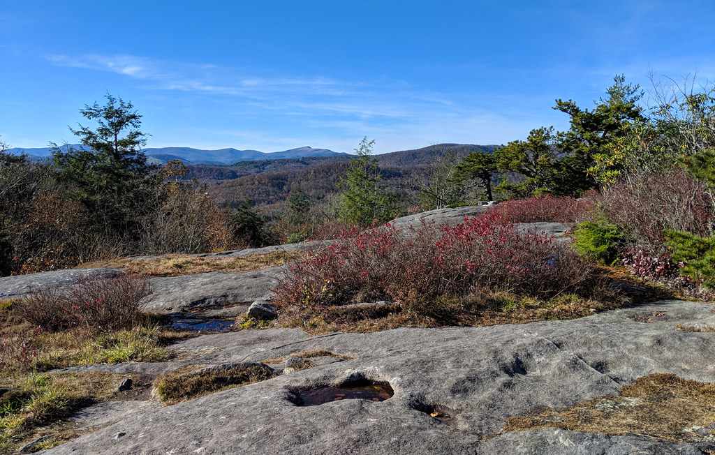 Flat Rock TrailHikingPhoto: pmuellr, CC BY 2.0 (via Flickr)2.3 mi
 Upper TierRock climbingPhoto: pmuellr, CC BY 2.0 (via Flickr)4.2 miSunken TreasureRock climbingPhoto: pmuellr, CC BY 2.0 (via Flickr)4.2 mi
 Wilson CreekCanoeingPhoto: Ken Thomas, Public domain (via Wikimedia Commons)7.2 mi
Source: Roamze catalog (indexable pages within 10 miles, PostGIS distance)
 Pixie MountainSummit · ~2 min drivePhoto: Mark Clifton, CC BY-SA 2.0 (via Wikimedia Commons)Flattop MountainSummit · ~4 min drivePhoto: Mark Clifton, CC BY-SA 2.0 (via Wikimedia Commons)
 Sugar MountainSummit · ~5 min drivePhoto: Mark Clifton, CC BY-SA 2.0 (via Wikimedia Commons)
 Peak MountainSummit · ~7 min drivePhoto: Mark Clifton, CC BY-SA 2.0 (via Wikimedia Commons)Bee MountainSummit · ~8 min drivePhoto: Thomson200, CC0 (via Wikimedia Commons)
 Hanging RockSummit · ~10 min drivePhoto: Thomson200, CC0 (via Wikimedia Commons)
 Beech MountainSummit · ~12 min drivePhoto: Thomson200, CC0 (via Wikimedia Commons)
 Big Yellow MountainSummit · ~15 min drivePhoto: Thomson200, CC0 (via Wikimedia Commons)
 Grassy Ridge BaldSummit · ~20 min drivePhoto: Thomson200, CC0 (via Wikimedia Commons)
 Brown MountainSummit · ~21 min drivePhoto: Thomson200, CC0 (via Wikimedia Commons)
Best months: April and September–October. Best months have typical highs of 55–85 °F, lows of 30 °F or warmer (32 °F where the station doesn't record snow), at most one snowy day and no more than 12 wet days.
Jan
40° / 22°
14 wet
Feb
43° / 24°
12 wet
Mar
50° / 30°
13 wet
Apr
60° / 39°
12 wet
May
68° / 47°
14 wet
Jun
74° / 55°
14 wet
Jul
77° / 59°
15 wet
Aug
76° / 57°
14 wet
Sep
71° / 52°
11 wet
Oct
62° / 40°
10 wet
Nov
52° / 31°
10 wet
Dec
44° / 26°
13 wet
Typical high / low (°F) and days with rain or snow, 1991–2020. Measured at Banner Elk, NC, 5.6 mi away at 3,770 ft. This station doesn't record snowfall. Source: NOAA NCEI U.S. Climate Normals 1991–2020.
