Mountain · 1 route
Flat Rock
4,127 ft · North Carolina
- Summit
- 4,127 ft
- Routes
- 1 way up
Route up Flat Rock
About Flat Rock
Flat Rock is a summit of 4,127 feet in the Grandfather Ranger District of the National Forests in North Carolina, about 1.3 miles from the town of Linville. It sits within the Blue Ridge Parkway corridor, so the parkway makes an easy anchor for a visit. Summer and early fall are the most comfortable times to go. Typical averages from the nearby Banner Elk weather station show July highs around 77°F and September highs near 71°F, with October the driest month at about 10 wet days. The Flat Rock Trail starts just 0.2 miles away. Big Lost Cove Cliffs is about 2.7 miles off, and the Sunken Treasure climbing area is about 4.6 miles away. For an overnight stay, Linville Falls Campground is about 7.1 miles away.
Forecast on Flat Rock
Daily highs and lows, wind and the chance of precipitation at the summit and route start for the next 7 days, from the Open-Meteo model.
Questions about Flat Rock
How tall is Flat Rock?
4,127 ft (1,258 m).
How many routes go to the summit of Flat Rock?
One: Flat Rock Trail.
Mountains nearby
 Bee Mountain2,953 ft · North Carolina1 route2.5 mi awayPhoto: Thomson200, CC0 (via Wikimedia Commons)
- Raven Rocks5,819 ft · North Carolina2 routes4.1 mi away
- Yellow Buck Mountain2,479 ft · North Carolina1 route6.6 mi away
- Gingercake Mountain4,153 ft · North Carolina1 route7.9 mi away
- Joe White Mountain2,823 ft · North Carolina1 route8.3 mi away
- Sitting Bear Mountain4,075 ft · North Carolina1 route8.5 mi away
Facts about this place
When to go
Best time to go: Apr–Oct. The mildest months here, with typical highs of 60–77°F and lows of 39–59°F.
Typical monthly averages (not a forecast) from the Banner Elk, NC weather station, 7.7 mi away. High / low in °F.
- Jan40° high22° low
- Feb43° high24° low
- Mar50° high30° low
- Apr60° high39° low
- May68° high47° low
- Jun74° high55° low
- Jul77° high59° low
- Aug76° high57° low
- Sep71° high52° low
- Oct62° high40° low
- Nov52° high31° low
- Dec44° high26° low
Where it is
- Grandfather Ranger District · Ranger district
- Blue Ridge Parkway · National Park Service
- National Forests in North Carolina · National forest
- Nearest town
- Linville, North Carolina · 1.3 mi
Source: USFS EDW boundaries; NPS Land Resources boundaries; USGS GNIS populated places
Conditions
Active alerts for Grandfather Ranger District as of Oct 9, 2026:
Brown Mountain Alcohol Restrictions- Grandfather Ranger District
information · posted Aug 24, 2026
Curtis Creek and Wiseman's View Alcohol Restrictions - Grandfather Ranger District
information · posted Aug 24, 2026
Source: USFS forest alerts
Nearby
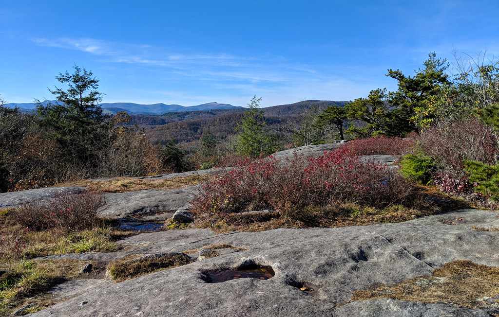 Flat Rock TrailHikingPhoto: pmuellr, CC BY 2.0 (via Flickr)0.2 mi
- Big Lost Cove CliffsHiking2.7 mi
 Sunken TreasureRock climbingPhoto: pmuellr, CC BY 2.0 (via Flickr)4.6 mi
- Little WilsonRock climbing4.6 mi
 Wilson CreekCanoeingPhoto: Ken Thomas, Public domain (via Wikimedia Commons)5.5 mi
- Mortimer CampgroundCamping6.9 mi
- Linville Falls CampgroundCamping7.1 mi
- Linville RiverRiver fishing7.7 mi
Source: Roamze catalog (indexable pages within 10 miles, PostGIS distance)
Best time to visit Flat Rock
Best months: April and September–October. Best months have typical highs of 55–85 °F, lows of 30 °F or warmer (32 °F where the station doesn't record snow), at most one snowy day and no more than 12 wet days.
Jan
40° / 22°
14 wet
Feb
43° / 24°
12 wet
Mar
50° / 30°
13 wet
Apr
60° / 39°
12 wet
May
68° / 47°
14 wet
Jun
74° / 55°
14 wet
Jul
77° / 59°
15 wet
Aug
76° / 57°
14 wet
Sep
71° / 52°
11 wet
Oct
62° / 40°
10 wet
Nov
52° / 31°
10 wet
Dec
44° / 26°
13 wet
Typical high / low (°F) and days with rain or snow, 1991–2020. Measured at Banner Elk, NC, 7.7 mi away at 3,770 ft. This station doesn't record snowfall. Source: NOAA NCEI U.S. Climate Normals 1991–2020.
