West Branch Ausable River
- 3.9 mi
- distance
- 2,021 ft
- high point
The West Branch Ausable River is a 3.9-mile paddling stretch near Lake Placid, New York, about 1.2 miles from the community of Shady Corner Curve. It flows year-round, and USGS models an average flow of about 235 cubic feet per second with a gradient of about 76.2 feet per mile. Summer is the most comfortable time to paddle. Typical averages from a nearby weather station show July highs around 74°F with lows near 54°F, while winter highs stay in the 20s. Several other outdoor spots sit close by. The Northwoods Loop cross-country ski trail is about 1.4 miles away, and the Mount Van Hoevenberg Trail hike is about 1.5 miles off. Climbers can head to Wright Peak, about 4.2 miles away, or Barkeater Cliff, about 5.5 miles away.
Local outfitters
- Cloudsplitter Outfitters19 mi away
- Great Camp Sagamore46 mi away
Not on Roamze yet. Their page has how to reach them.
- Northwoods LoopCross-country skiing1.4 mi
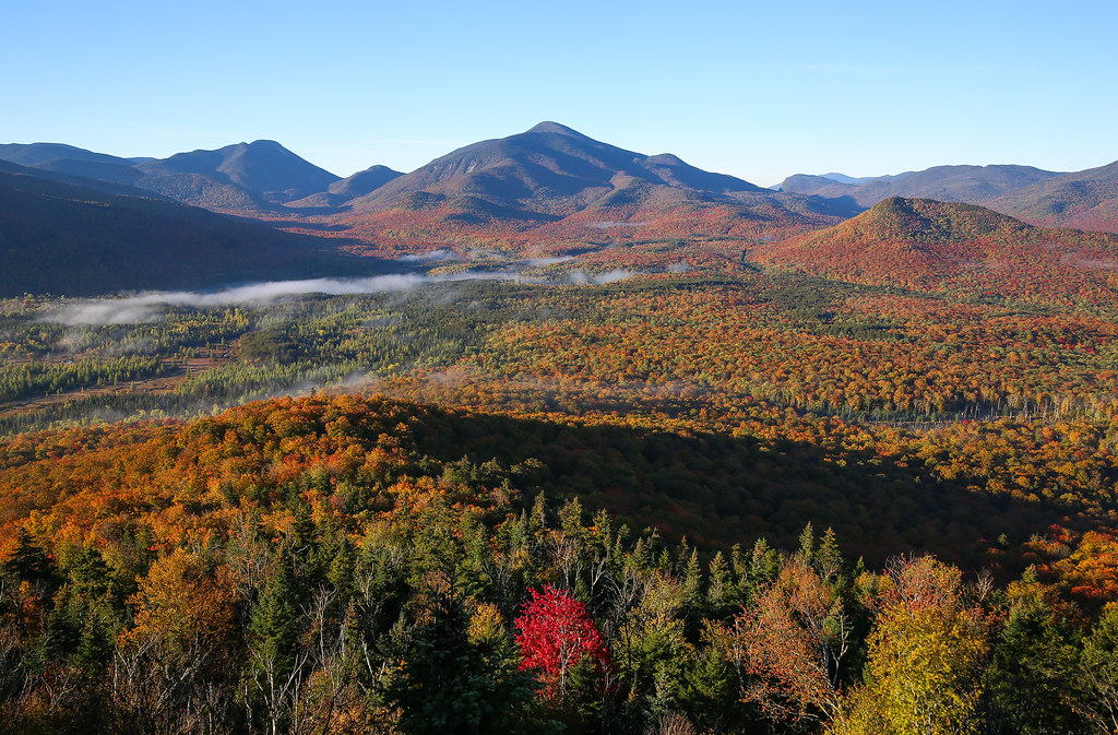 Mount Van Hoevenberg TrailHikingPhoto: Jonathan Miske, CC BY-SA 2.0 (via Flickr)1.5 mi
- Lower RimrockCross-country skiing1.6 mi
- Upper RimrockCross-country skiing1.6 mi
- Wright PeakRock climbing4.2 mi
- Pitchoff Chimney CliffRock climbing4.8 mi
- The Barkeater CliffRock climbing5.5 mi
 Mt ColdenRock climbingPhoto: jbylund, CC BY-SA 2.0 (via Flickr)5.7 mi
Source: Roamze catalog (indexable pages within 10 miles, PostGIS distance)
 Saranac RiverCanoeing · ~47 min drivePhoto: Mwanner, CC BY-SA 3.0 (via Wikimedia Commons)
- Canoe and Kayak LaunchBoat launch · ~7 min drive
 Raquette RiverCanoeing · ~1h 1m drivePhoto: Jondude11 at English Wikipedia, CC BY-SA 3.0 (via Wikimedia Commons)
- Mirror Lake Hand LaunchBoat launch · ~10 min drive
 La ChuteCanoeing · ~1h 3m drivePhoto: Katie Armstrong, Public domain (via Wikimedia Commons)
- Lake Placid Boat LaunchBoat launch · ~11 min drive
- The BranchCanoeing · ~28 min drive
- Lake Flower Boat LaunchBoat launch · ~20 min drive
- Floodwood Pond LoopCanoeing · ~39 min drive
- Second Pond Boat LaunchBoat launch · ~22 min drive
Best time to visit West Branch Ausable River
No month here meets our mild-weather rule. Best months have typical highs of 55–85 °F, lows of 30 °F or warmer (32 °F where the station doesn't record snow), at most one snowy day and no more than 12 wet days.
Jan
23° / 6°
18 wet
Feb
27° / 8°
14 wet
Mar
36° / 16°
14 wet
Apr
49° / 29°
14 wet
May
62° / 40°
15 wet
Jun
70° / 49°
14 wet
Jul
74° / 54°
14 wet
Aug
73° / 52°
13 wet
Sep
66° / 45°
13 wet
Oct
52° / 35°
15 wet
Nov
40° / 25°
16 wet
Dec
28° / 14°
18 wet
Typical high / low (°F) and days with rain or snow, 1991–2020. Measured at Lake Placid 2 S, NY, 6.7 mi away at 1,888 ft. This station doesn't record snowfall. Source: NOAA NCEI U.S. Climate Normals 1991–2020.
