Spanish Loop Trail
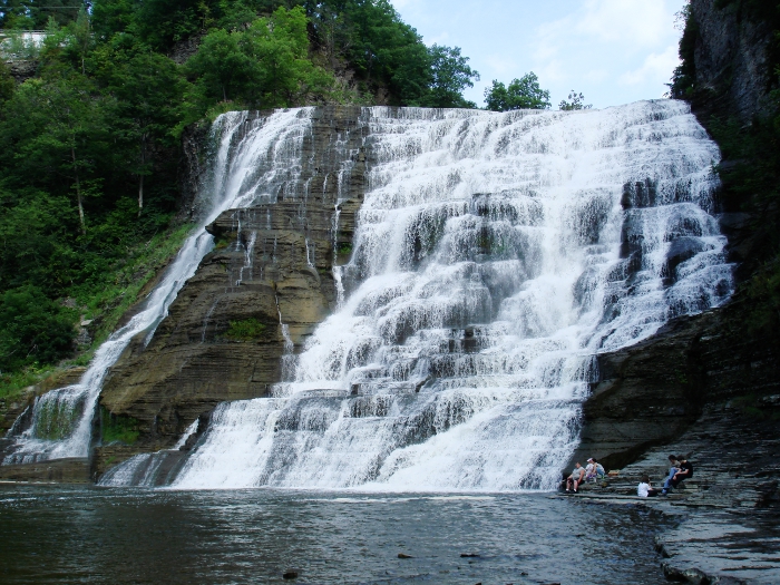
 Photo: javajoe6, CC BY-SA 3.0 (via Wikimedia Commons)
- 3.3 mi
- one way
- 636 ft
- climb
- 1,971 ft
- high point
- Point to point
- route
- Aug–Sep
- best months
The Spanish Loop Trail is a 3.3-mile point-to-point hike in James Kennedy State Forest in New York, managed by the State Department of Conservation. It rises from about 1,387 feet to about 1,971 feet, with a total elevation gain of 636 feet. The route is rated easy, and the trip takes about 1.5 hours. The trail is a straightforward outing, and the climb is spread out along the way. The steepest stretch comes at about 2.7 miles in, with a grade of 21 percent. The trail also has a total descent of 989 feet, so it works well as a loop if you pair it with another nearby route. Summer is the most comfortable time to go. Typical averages from a nearby weather station in Ithaca show July highs around 79°F with lows near 56°F, and the station sits roughly 740 feet lower than the trail's high point, so temperatures on the summit run cooler. Several other loop trails sit within a mile, including the Swedish Loop Trail, the Irish Loop Trail and the Lithuanian Loop Trail. The Virgil Mt. Loop is about 2.4 miles away.
Best time to go · Aug–Sep
Best time to visit Spanish Loop Trail
Best months: August–September. Best months have typical highs of 55–85 °F, lows of 30 °F or warmer (32 °F where the station doesn't record snow), at most one snowy day and no more than 12 wet days.
Jan
30° / 13°
19 wet
Feb
32° / 14°
17 wet
Mar
41° / 22°
17 wet
Apr
54° / 33°
15 wet
May
67° / 43°
14 wet
Jun
75° / 52°
13 wet
Jul
79° / 56°
13 wet
Aug
77° / 54°
12 wet
Sep
70° / 48°
12 wet
Oct
58° / 38°
15 wet
Nov
46° / 29°
15 wet
Dec
35° / 21°
19 wet
Typical high / low (°F) and days with rain or snow, 1991–2020. Measured at Ithaca 13 E, NY, 2.9 mi away at 1,228 ft. The station sits about 700 ft lower than this place, so expect it a little cooler here. This station doesn't record snowfall. Source: NOAA NCEI U.S. Climate Normals 1991–2020.
Keep exploring — more trails worth the drive
 Photo: javajoe6, CC BY-SA 3.0 (via Wikimedia Commons)
Swedish Loop Trail
~1 min drive
3.21-mile point-to-point trail in New York with 383 ft gain
 Photo: javajoe6, CC BY-SA 3.0 (via Wikimedia Commons)
Dabes Diversion Loop
~2 min drive
2.52-mile point-to-point trail in New York with 667 ft elevation gain.
 Photo: seabamirum, CC BY 2.0 (via Flickr)
Cayuga Trail
~20 min drive
Nearly 8-mile point-to-point trail near Cayuga Lake in New York's Finger Lakes.
Photo: javajoe6, CC BY-SA 3.0 (via Wikimedia Commons)Irish Loop Trail
~1 min drive
0.97-mile loop with 641 ft gain in New York
 Photo: vwcampin, CC BY 2.0 (via Flickr)
Lake Treman Trail
~28 min drive
Easy out-and-back hike to a scenic glacial lake in the Finger Lakes.
HIKE
Flt - O1 Morgan Hill Sf South
~37 min drive
6.54-mile out-and-back trail in New York with 1,807 ft gain
Photo: javajoe6, CC BY-SA 3.0 (via Wikimedia Commons)Lithuanian Loop Trail
~2 min drive
0.93-mile loop with 545 ft gain in New York
 Photo: javajoe6, CC BY-SA 3.0 (via Wikimedia Commons)
Abbott Loop
~30 min drive
A 6.77-mile point-to-point trail through New York's natural landscapes.
 Photo: javajoe6, CC BY-SA 3.0 (via Wikimedia Commons)
English Loop East
~2 min drive
0.66-mile point-to-point trail in New York with 128 ft gain.
 Photo: vwcampin, CC BY 2.0 (via Flickr)
Gorge Trail
~34 min drive
3.68-mile out-and-back hike in New York with 1,603 ft elevation gain
Map and trail data © OpenStreetMap contributors
