Free — you'll pick up right here.
Watch this trail
Sign up to watch it — saving subscribes you to gate, closure and report changes.
New York
Cayuga Trail
13.1 mi
Distance
542 ft
Gain
3h 13m
Time
We don't cover this trail yet
No agency boundary, access route or field report is mapped to it — so there is no verdict, and we won't guess. We'll tell you the moment this trail has something to say.
Covered nearby
Trails within 25 miles where we do have a current picture.
Nobody's filed a report here yet — be the first.
Why you'll love it
Here's your day, mapped
Cayuga Trail
AI-suggested draft · review before you go
Meals
Gear for the day
Elevation & route
- Distance
- 13.1 mi
- Elevation gain
- 542 ft
- Elevation loss
- 1,125 ft
- Highest point
- 1,050 ft
- Lowest point
- 834 ft
Photos
Directions & GPX
Permits & access
- Bikes
- no
About this trail
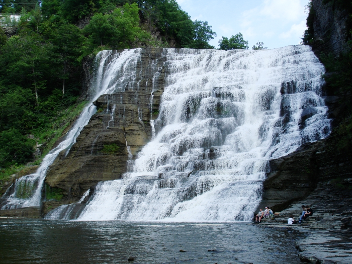
The Cayuga Trail is a scenic point-to-point hike in New York's Finger Lakes region, offering nearly 8 miles of varied terrain along the shores and ridges near Cayuga Lake. This trail showcases the natural beauty of central New York with opportunities to experience lakeside views, woodlands, and the distinctive geology of the Finger Lakes. The point-to-point route provides a rewarding day hike for those seeking moderate exercise with diverse scenery.
Add to a trip & share
Keep exploring — more trails worth the drive
Cayuga Trail Extension
~5 min drive
Short point-to-point connector trail in the Cayuga Trail system.
Cascadilla Gorge Trail
~6 min drive
Short point-to-point hike through a scenic gorge with cascading waterfalls.
Backbone Trail
~31 min drive
11.22-mile out-and-back trail in New York with 1,127 ft elevation gain
East Trail
~8 min drive
East Trail is a 1.70-mile loop in New York with 565 ft of elevation gain.
Campground Trail
~10 min drive
1.04-mile out-and-back campground trail in New York with 202 ft gain
Emilie Jonas Falls Nature Trail
~9 min drive
0.33-mile out-and-back trail to Emilie Jonas Falls in New York.
Lake Treman Trail
~11 min drive
Easy out-and-back hike to a scenic glacial lake in the Finger Lakes.
Owl Creek Trail
~9 min drive
Easy out-and-back creek walk through New York woodland.
Rim Trail
~14 min drive
2.4-mile out-and-back hike in New York with 1,777 ft elevation gain
Phenology Trail
~10 min drive
0.69-mile out-and-back trail in New York with 58 ft elevation gain.
Map and trail data © OpenStreetMap contributors
