Potomac
 Photo: javajoe6, CC BY-SA 3.0 (via Wikimedia Commons)
- 1.7 mi
- round trip
- 325 ft
- climb
- 1,821 ft
- high point
- Out and back
- route
- Aug–Sep
- best months
Is Potomac open right now?
Closure in the area
There's a closure order in Green Mountain and Finger Lakes National Forests. It doesn't name Potomac, so check the source for the area it covers (3 listed).
Klondike Fire Incident Report
Agency closure covering Green Mountain and Finger Lakes National Forests · USFS · Green Mountain and Finger Lakes National Forests
Heavily damaged or closed trails
Agency closure covering Green Mountain and Finger Lakes National Forests · USFS · Green Mountain and Finger Lakes National Forests
Glastenbury fire tower is closed to public use
Agency closure covering Green Mountain and Finger Lakes National Forests · USFS · Green Mountain and Finger Lakes National Forests
Moosalamoo Campground Water System
Agency alert covering Green Mountain and Finger Lakes National Forests · USFS · Green Mountain and Finger Lakes National Forests
As of · Source: USFS · Green Mountain and Finger Lakes National Forests. Agencies don't list every closure — check before you go.
The Potomac hike is an easy out-and-back trail in the Hector Ranger District of the Green Mountain and Finger Lakes National Forests in New York, managed by the Forest Service. The route is about 1.7 miles long, with a total climb of 325 feet, and it is rated easy. The trail is a short, low-effort outing. The steepest stretch comes early, at about 0.2 miles in, with a 10% grade. The high point is around 1,821 feet, and the low point is about 1,692 feet. Bikes are allowed. Summer is the most comfortable time to go. Typical averages from a nearby weather station show July highs around 79°F and lows near 56°F, while winter highs stay around 30°F. Potomac Group Campground sits just 0.1 mile away, and Potomac Ponds is 0.2 mile off. The Backbone Trail is 0.7 mile away, and Blueberry Patch campground is 0.9 mile away.
- Potomac Group CampgroundCamping0.1 mi
 Potomac PondsHikingPhoto: javajoe6, CC BY-SA 3.0 (via Wikimedia Commons)0.2 mi
 Backbone TrailHikingPhoto: javajoe6, CC BY-SA 3.0 (via Wikimedia Commons)0.7 mi
- Blueberry PatchCamping0.9 mi
 HorseHikingPhoto: andyarthur, CC BY 2.0 (via Flickr)1 mi
- Backbone Horse CampCamping1.1 mi
 RavineHikingPhoto: javajoe6, CC BY-SA 3.0 (via Wikimedia Commons)1.5 mi
- Finger Lakes - Hector DistrictLake fishing4.2 mi
Source: Roamze catalog (indexable pages within 10 miles, PostGIS distance)
- Potomac PondsHiking · Next doorPhoto: javajoe6, CC BY-SA 3.0 (via Wikimedia Commons)
- Backbone TrailHiking · ~1 min drivePhoto: javajoe6, CC BY-SA 3.0 (via Wikimedia Commons)
 Burnt HillHiking · ~3 min drivePhoto: javajoe6, CC BY-SA 3.0 (via Wikimedia Commons)
- HorseHiking · ~2 min drivePhoto: andyarthur, CC BY 2.0 (via Flickr)
 Interloken TrailHiking · ~6 min drivePhoto: Seabamirum from Ithaca, CC BY 2.0 (via Wikimedia Commons)
 Indian TrailHiking · ~16 min drivePhoto: Ron Shawley, CC BY 3.0 (via Wikimedia Commons)
- RavineHiking · ~3 min drivePhoto: javajoe6, CC BY-SA 3.0 (via Wikimedia Commons)
 Gorge TrailHiking · ~16 min drivePhoto: Ron Shawley, CC BY 3.0 (via Wikimedia Commons)
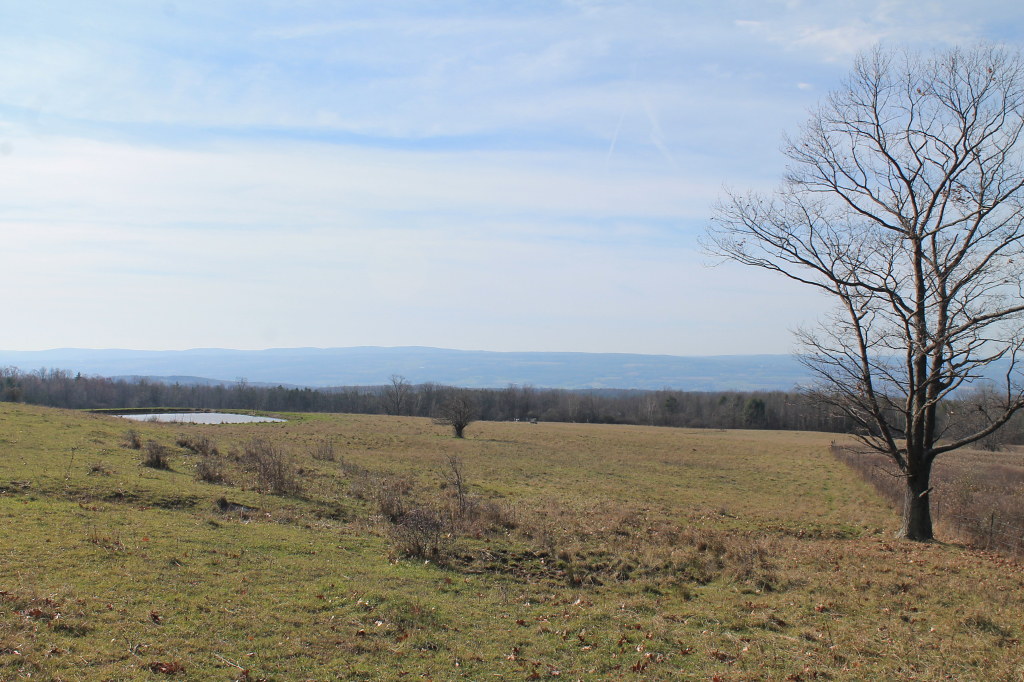 Ravine LoopHiking · ~3 min drivePhoto: andyarthur, CC BY 2.0 (via Flickr)
 Yellow TrailHiking · ~18 min drivePhoto: Russ Nelson, CC BY-SA 2.0 (via Flickr)
Best time to visit Potomac
Best months: August–September. Best months have typical highs of 55–85 °F, lows of 30 °F or warmer (32 °F where the station doesn't record snow), at most one snowy day and no more than 12 wet days.
Jan
30° / 14°
17 wet
Feb
32° / 15°
14 wet
Mar
39° / 21°
15 wet
Apr
53° / 32°
14 wet
May
66° / 43°
14 wet
Jun
74° / 52°
13 wet
Jul
79° / 56°
13 wet
Aug
77° / 55°
12 wet
Sep
71° / 48°
12 wet
Oct
58° / 39°
15 wet
Nov
46° / 30°
14 wet
Dec
35° / 21°
17 wet
Typical high / low (°F) and days with rain or snow, 1991–2020. Measured at Mecklenburg 4sw, NY, 3.8 mi away at 1,510 ft. This station doesn't record snowfall. Source: NOAA NCEI U.S. Climate Normals 1991–2020.
