NYSDEC designated campsite
Campground
Campground · 2.5 mi from the trail
John Pond Trail is an easy hike in New York's Siamese Ponds Wilderness, managed by the State Department of Conservation. The trail is about 4.6 miles long and has a total elevation gain of 162 feet, making it a low-effort outing over a little more than a mile of walking on either side of the high point. The route starts at a low of about 1,673 feet and climbs to roughly 1,826 feet, with the steepest stretch coming at about 1.4 miles in with a 10% grade. The climb is spread out, so the trail is not demanding for anyone looking to spend a few hours in the wilderness. Summer is the most comfortable time to go. Typical averages from a nearby weather station at Indian Lake put July highs around 75°F with lows near 54°F, while September cools to highs around 67°F. Winters are cold, with January highs averaging about 25°F. Clear Pond Trail lies about a mile away, and Big Brook offers canoeing about 2 miles off. Climbers can head to Chimney Mountain, about 2.4 miles away, and Puffer Pond Trail is roughly 3 miles from the trail.
NYSDEC designated campsite
Campground
Log House Restaurant and Pub
Restaurant
Places © OpenStreetMap contributors
More in Schroon LakeNot on Roamze yet. Their page has how to reach them.
No month here meets our mild-weather rule. Best months have typical highs of 55–85 °F, lows of 30 °F or warmer (32 °F where the station doesn't record snow), at most one snowy day and no more than 12 wet days.
Jan
25° / 6°
17 wet
Feb
28° / 7°
14 wet
Mar
36° / 15°
14 wet
Apr
49° / 28°
14 wet
May
63° / 40°
16 wet
Jun
71° / 49°
15 wet
Jul
75° / 54°
15 wet
Aug
73° / 53°
13 wet
Sep
67° / 45°
13 wet
Oct
54° / 35°
16 wet
Nov
41° / 25°
16 wet
Dec
31° / 14°
17 wet
Typical high / low (°F) and days with rain or snow, 1991–2020. Measured at Indian Lake 2sw, NY, 4.2 mi away at 1,670 ft. This station doesn't record snowfall. Source: NOAA NCEI U.S. Climate Normals 1991–2020.
 Photo: USDAgov, Public Domain Mark (via Flickr)
Peaked Mountain Trail
~7 min drive
3.32-mile point-to-point hike in New York with 1,645 ft gain
 Photo: Steve Starer, CC BY 2.0 (via Flickr)
Elm Island Trail
~10 min drive
7.38-mile out-and-back trail in New York with 1,410 ft elevation gain.
HIKE
Botheration Pond Trail #22
~9 min drive
3.01-mile out-and-back hike in New York with 856 ft elevation gain.
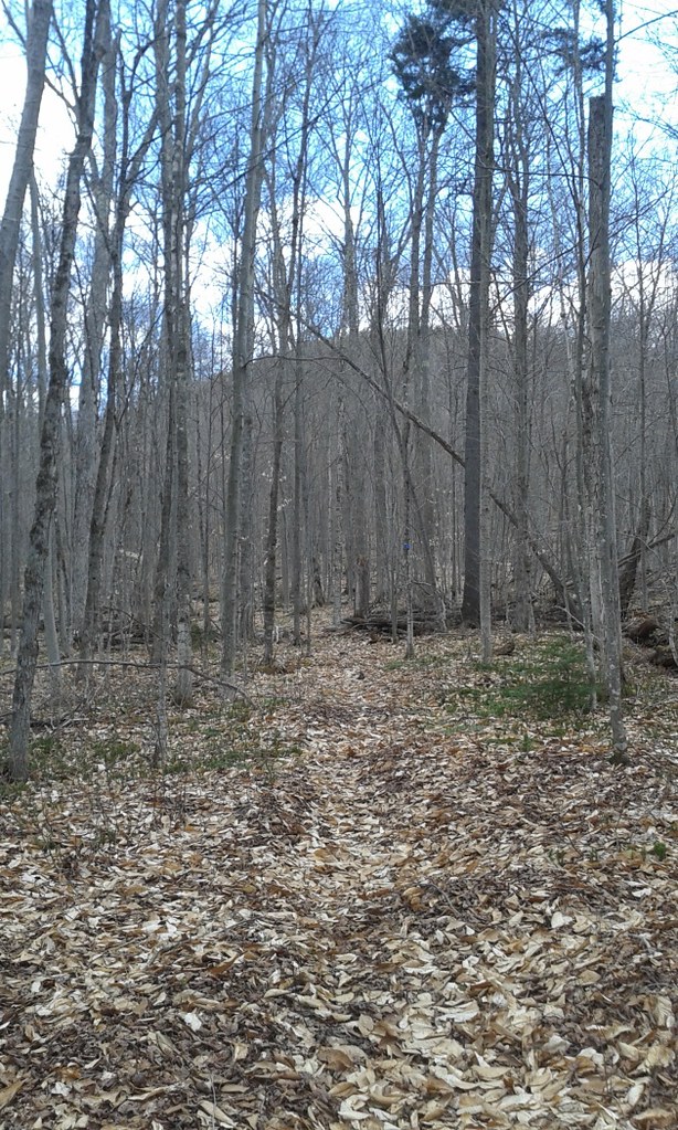 Photo: andyarthur, CC BY 2.0 (via Flickr)
Elizabeth Point Spur Trail
~8 min drive
0.31-mile point-to-point trail in New York with 120 ft of elevation loss.
 Photo: Coasterlover1994, CC BY-SA 4.0 (via Wikimedia Commons)
Snowy Mountain Trail
~12 min drive
7.12-mile out-and-back trail in New York with 2,270 ft elevation gain
HIKE
East Branch Sacandaga River Trail
~11 min drive
6.27-mile out-and-back trail along East Branch Sacandaga River in New York
 Photo: Steve Starer, CC BY 2.0 (via Flickr)
Paisley Falls ski trail
~10 min drive
2.12-mile out-and-back ski trail in New York with 342 ft elevation gain
 Photo: Russ Nelson, CC BY-SA 2.0 (via Flickr)
Rabbit Pond Ski Trail
~16 min drive
2.8-mile out-and-back ski trail in New York with 1,020 ft gain/loss.
Photo: Coasterlover1994, CC BY-SA 4.0 (via Wikimedia Commons)Watch Hill XC Ski/Foot Loop Trail (Blue)
~12 min drive
2.92-mile out-and-back XC ski/foot out-and-back in New York with 716 ft gain
HIKE
Puffer Pond Trail
~6 min drive
4.16-mile out-and-back trail in New York with 883 ft elevation gain.
Map and trail data © OpenStreetMap contributors

