Elizabeth Point Campsite
Campground
Campground · 0.7 mi from the trail
 Photo: USDAgov, Public Domain Mark (via Flickr)
Peaked Mountain Trail is a 3.3-mile hike in New York's Siamese Ponds Wilderness, managed by the State Department of Conservation. The route rises from about 1,750 feet to a high point of 2,896 feet, with a total elevation gain of 1,206 feet. It is rated easy, and the climb is point to point rather than a loop. Summer is the most comfortable time to go. Typical averages from a nearby weather station at Indian Lake run to highs around 75°F in July, while temperatures on the summit run cooler. Winter is cold, with January highs near 25°F. The trail is not wheelchair accessible, and bikes and horses are not allowed. Plan on about 1.5 hours for the trip. Nearby, the Elizabeth Point Spur Trail is less than a mile away, and the Hour Pond Trail and Botheration Pond Trail #22 are both within about 2 miles. Climbers can find Chimney Mountain about 4 miles off.
Elizabeth Point Campsite
Campground
Log House Restaurant and Pub
Restaurant
Places © OpenStreetMap contributors
More in Schroon LakeNot on Roamze yet. Their page has how to reach them.
No month here meets our mild-weather rule. Best months have typical highs of 55–85 °F, lows of 30 °F or warmer (32 °F where the station doesn't record snow), at most one snowy day and no more than 12 wet days.
Jan
25° / 6°
17 wet
Feb
28° / 7°
14 wet
Mar
36° / 15°
14 wet
Apr
49° / 28°
14 wet
May
63° / 40°
16 wet
Jun
71° / 49°
15 wet
Jul
75° / 54°
15 wet
Aug
73° / 53°
13 wet
Sep
67° / 45°
13 wet
Oct
54° / 35°
16 wet
Nov
41° / 25°
16 wet
Dec
31° / 14°
17 wet
Typical high / low (°F) and days with rain or snow, 1991–2020. Measured at Indian Lake 2sw, NY, 8 mi away at 1,670 ft. The station sits about 1,200 ft lower than this place, so expect it a little cooler here. This station doesn't record snowfall. Source: NOAA NCEI U.S. Climate Normals 1991–2020.
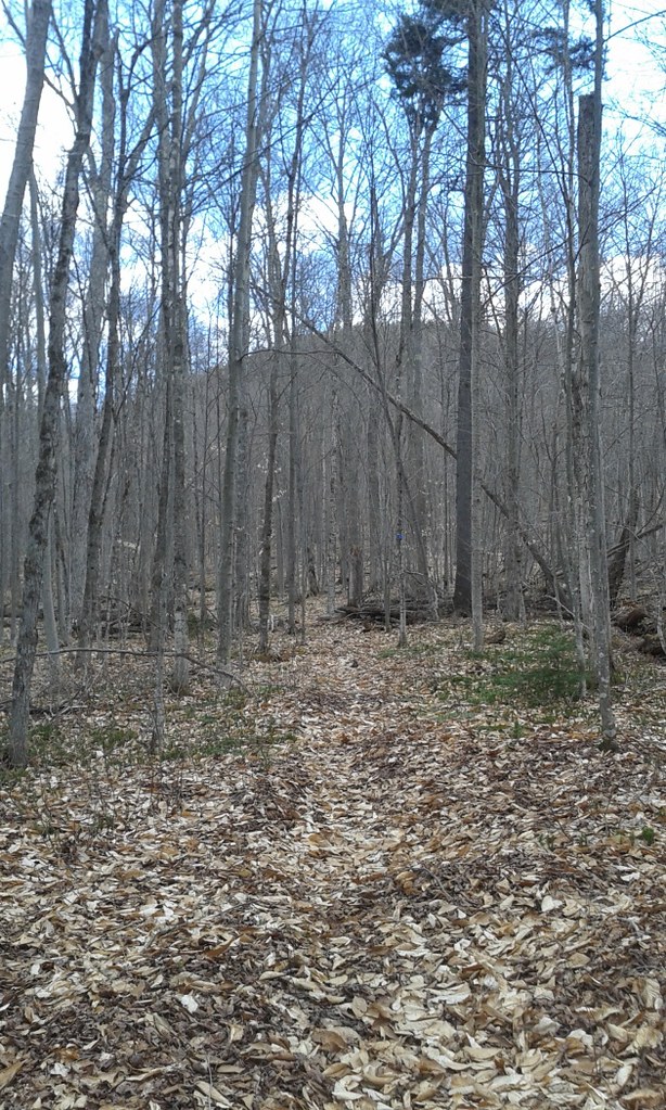 Photo: andyarthur, CC BY 2.0 (via Flickr)
Elizabeth Point Spur Trail
~1 min drive
0.31-mile point-to-point trail in New York with 120 ft of elevation loss.
 Photo: Russ Nelson, CC BY-SA 2.0 (via Flickr)
Rabbit Pond Ski Trail
~10 min drive
2.8-mile out-and-back ski trail in New York with 1,020 ft gain/loss.
Photo: Russ Nelson, CC BY-SA 2.0 (via Flickr)Raymond Brook Ski Trail
~10 min drive
7.39-mile out-and-back ski trail in New York with 1,877 ft gain
 Photo: Steve Starer, CC BY 2.0 (via Flickr)
Paisley Falls ski trail
~16 min drive
2.12-mile out-and-back ski trail in New York with 342 ft elevation gain
Photo: Russ Nelson, CC BY-SA 2.0 (via Flickr)Long Trail (bike)
~11 min drive
5.04-mile out-and-back trail in New York with 1,715 ft elevation gain
HIKE
East Branch Sacandaga River Trail
~7 min drive
6.27-mile out-and-back trail along East Branch Sacandaga River in New York
 Photo: Andy Arthur, CC BY 2.0 (via Wikimedia Commons)
East Branch Gorge Trail
~17 min drive
1.02-mile point-to-point trail in New York with 237 ft elevation gain
 Photo: ceonyc, CC BY-SA 2.0 (via Flickr)
Schaefer Foot Trail
~11 min drive
6.4-mile out-and-back trail in New York with 2,023 ft elevation gain
HIKE
Botheration Pond Trail #22
~4 min drive
3.01-mile out-and-back hike in New York with 856 ft elevation gain.
 Photo: Coasterlover1994, CC BY-SA 4.0 (via Wikimedia Commons)
Watch Hill XC Ski/Foot Loop Trail (Blue)
~18 min drive
2.92-mile out-and-back XC ski/foot out-and-back in New York with 716 ft gain
About 3.3 mi.
About 1,206 ft of climbing round trip.
It is rated easy.
About 2 hours round trip.
Daily highs and lows, wind and the chance of precipitation at the summit and route start for the next 7 days, from the Open-Meteo model.
Map and trail data © OpenStreetMap contributors


