Dofasco 2000 Trail
 Photo: the-road-is-life, CC BY-SA 2.0 (via Flickr)
- 5.9 mi
- one way
- 32 ft
- climb
- 644 ft
- high point
- Point to point
- route
- Jun–Sep
- best months
Dofasco 2000 Trail is a point-to-point hike in New York, about 5.9 miles long, with a total elevation gain of 32 feet. It runs between a low of about 600 feet and a high of about 640 feet, with the steepest stretch at around mile 2, where the grade reaches 6 percent. The trail is rated moderate. The route is close to Youngstown, about 36 miles away. Bikes are allowed, which makes it an option for riders as well as hikers. For comfortable weather, aim for late spring through early fall. Typical averages from the nearby Niagara Falls weather station show highs around 69°F in May and 74°F in September, with July the warmest month at about 82°F. Several other trails sit within a short distance. Devil's Punchbowl Side Trail is about 0.2 miles away and the Bruce Trail - Iroquoia Section is about 0.4 miles away. The Heritage Green Community Trust (Hgct) Trail is about 0.8 miles away.
Best time to go · Jun–Sep
Best time to visit Dofasco 2000 Trail
Best months: June–September. Best months have typical highs of 55–85 °F, lows of 30 °F or warmer (32 °F where the station doesn't record snow), at most one snowy day and no more than 12 wet days.
Jan
33° / 19°
18 wet
Feb
35° / 19°
15 wet
Mar
43° / 26°
14 wet
Apr
56° / 36°
13 wet
May
69° / 48°
13 wet
Jun
78° / 58°
11 wet
Jul
82° / 63°
11 wet
Aug
80° / 61°
10 wet
Sep
74° / 54°
10 wet
Oct
61° / 43°
13 wet
Nov
49° / 33°
14 wet
Dec
39° / 25°
16 wet
Typical high / low (°F) and days with rain or snow, 1991–2020. Measured at Niagara Falls, NY, 40.5 mi away at 588 ft. This station doesn't record snowfall. Source: NOAA NCEI U.S. Climate Normals 1991–2020.
Keep exploring — more trails worth the drive
Photo: the-road-is-life, CC BY-SA 2.0 (via Flickr)Devil's Punchbowl Side Trail
Next door
0.59-mile loop with 107 ft gain in New York.
 Photo: Doug Kerr from Albany, NY, United States, CC BY-SA 2.0 (via Wikimedia Commons)
Red Hill Valley Trail
~4 min drive
An out-and-back trail, 0.6 miles each way (1.3 miles round trip) in Ontario, Canada.
 Photo: ethan.gosnell2, CC BY-SA 2.0 (via Flickr)
Cataract Trail
~33 min drive
A moderate 0.39-mile out-and-back trail in New York that connects to a network of nearby hiking routes.
 Photo: Mustang Joe, Public Domain Dedication (CC0) (via Flickr)
Laura Secord Legacy Trail
~44 min drive
A 15.12-mile point-to-point trail in New York connected to the Welland Trail system, ideal for hikers seeking a substantial backcountry route.
Photo: the-road-is-life, CC BY-SA 2.0 (via Flickr)Heritage Green Community Trust (Hgct) Trail
~1 min drive
0.68-mile point-to-point trail in New York with 33 ft gain.
HIKE
Red Hill Valley Trail
~4 min drive
An out-and-back trail, 1.2 miles each way (2.4 miles round trip) in Ontario, Canada.
HIKE
Mccraney Creek Trail
~27 min drive
A moderate 0.34-mile out-and-back gravel trail in New York that links to the West Side Trail at 16 Mile Creek.
HIKE
Bruce Trail - Iroquoia Section
Next door
A 74.92-mile point-to-point section of the Bruce Trail in New York that connects with the Ian Reid Side Trail, South Bridle Trail, and Grindstone Marshes Trail.
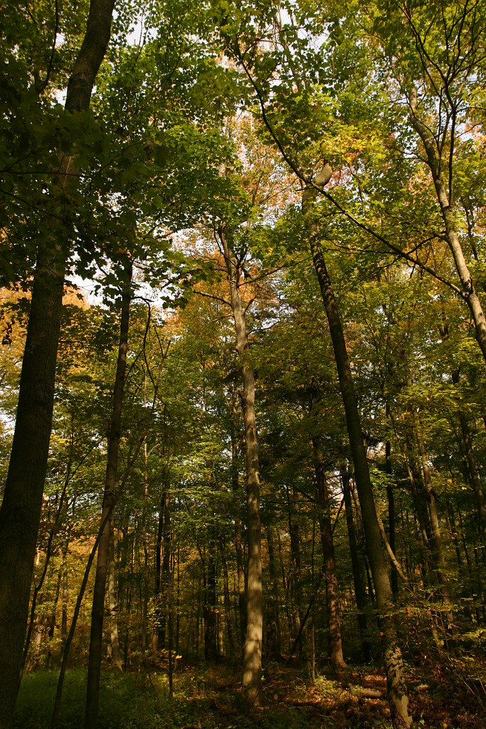 Photo: Martin Cathrae, CC BY-SA 2.0 (via Flickr)
Bruce Trail Side Trails - Iroquoia Section
~16 min drive
0.50-mile point-to-point trail in New York with 24 ft gain and 145 ft loss.
HIKE
Hamilton-Brantford Rail Trail
~16 min drive
A 19-mile point-to-point route in Ontario, Canada.
Also worth it near here
CLIMB
Devil's Punchbowl (ICE)
Next door
 Photo: Eric Marshall, CC BY 3.0 (via Wikimedia Commons)
Devil's Punchbowl Falls
Next door
 Photo: Jeff Hitchcock from Seattle, WA, USA, CC BY 2.0 (via Wikimedia Commons)
Van Wagners Beach
~6 min drive
 Photo: Laslovarga, CC BY-SA 3.0 (via Wikimedia Commons)
Burlington Heights
~14 min drive
 Photo: Good Free Photos, CC BY 3.0 (via Wikimedia Commons)
Bronte Creek Campground access point
~25 min drive
Map and trail data © OpenStreetMap contributors
