Boardwalk Connector Trail
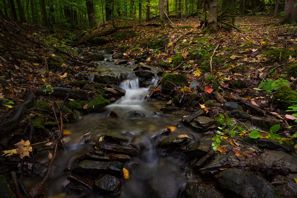 Photo: John Brighenti, CC BY 2.0 (via Flickr)
- 1.1 mi
- round trip
- 435 ft
- climb
- 1,724 ft
- high point
- Out and back
- route
- Aug–Sep
- best months
Boardwalk Connector Trail is an easy out-and-back hike in New York, about 3.7 miles from the town of Slaterville Springs. The trail is 2.1 miles long and runs from a low point of about 1,465 feet to a high of 1,724 feet, with an overall elevation gain of 435 feet on the way up and the same on the way back. The trail is a short, low-commitment outing, and the climb is gentle except for a steeper stretch around 0.74 miles in, where the grade reaches about 12%. Summer and early fall are the most comfortable times to go. Typical averages from a nearby weather station in Ithaca, which sits roughly 496 feet lower than the trail, show July highs around 79°F and September highs near 70°F, with lows in the upper 40s. Winter is much colder, with January highs around 30°F. The hike takes about an hour to complete. The trail makes a good base for exploring the surrounding network of walks. Winter Trail is about 1.2 miles away, Phenology Trail about 1.7 miles, and Jim Schug Trail about 2.7 miles. Boiceville Nature Walk is about 4.5 miles off.
- Winter TrailHikingPhoto: John Brighenti, CC BY 2.0 (via Flickr)1.2 mi
- Phenology TrailHiking1.7 mi
 Jim Schug TrailHikingPhoto: javajoe6, CC BY-SA 3.0 (via Wikimedia Commons)2.7 mi
- Boiceville Nature WalkHiking4.5 mi
 Irvin TrailHikingPhoto: javajoe6, CC BY-SA 3.0 (via Wikimedia Commons)4.5 mi
 English Loop EastHikingPhoto: javajoe6, CC BY-SA 3.0 (via Wikimedia Commons)4.6 mi
 Swedish Loop TrailHikingPhoto: javajoe6, CC BY-SA 3.0 (via Wikimedia Commons)5.2 mi
 Spanish Loop TrailHikingPhoto: javajoe6, CC BY-SA 3.0 (via Wikimedia Commons)5.6 mi
Source: Roamze catalog (indexable pages within 10 miles, PostGIS distance)
- Winter TrailHiking · ~2 min drivePhoto: John Brighenti, CC BY 2.0 (via Flickr)
 Cayuga TrailHiking · ~11 min drivePhoto: seabamirum, CC BY 2.0 (via Flickr)
 Dabes Diversion LoopHiking · ~12 min drivePhoto: javajoe6, CC BY-SA 3.0 (via Wikimedia Commons)
- Jim Schug TrailHiking · ~5 min drivePhoto: javajoe6, CC BY-SA 3.0 (via Wikimedia Commons)
 Lake Treman TrailHiking · ~19 min drivePhoto: vwcampin, CC BY 2.0 (via Flickr)
- English Loop WestHiking · ~7 min drivePhoto: javajoe6, CC BY-SA 3.0 (via Wikimedia Commons)
 Abbott LoopHiking · ~21 min drivePhoto: javajoe6, CC BY-SA 3.0 (via Wikimedia Commons)
- Irvin TrailHiking · ~8 min drivePhoto: javajoe6, CC BY-SA 3.0 (via Wikimedia Commons)
 Gorge TrailHiking · ~25 min drivePhoto: vwcampin, CC BY 2.0 (via Flickr)
- English Loop EastHiking · ~8 min drivePhoto: javajoe6, CC BY-SA 3.0 (via Wikimedia Commons)
Best time to visit Boardwalk Connector Trail
Best months: August–September. Best months have typical highs of 55–85 °F, lows of 30 °F or warmer (32 °F where the station doesn't record snow), at most one snowy day and no more than 12 wet days.
Jan
30° / 13°
19 wet
Feb
32° / 14°
17 wet
Mar
41° / 22°
17 wet
Apr
54° / 33°
15 wet
May
67° / 43°
14 wet
Jun
75° / 52°
13 wet
Jul
79° / 56°
13 wet
Aug
77° / 54°
12 wet
Sep
70° / 48°
12 wet
Oct
58° / 38°
15 wet
Nov
46° / 29°
15 wet
Dec
35° / 21°
19 wet
Typical high / low (°F) and days with rain or snow, 1991–2020. Measured at Ithaca 13 E, NY, 3 mi away at 1,228 ft. This station doesn't record snowfall. Source: NOAA NCEI U.S. Climate Normals 1991–2020.
Map and trail data © OpenStreetMap contributors
