Bear Trail
- 0.8 mi
- round trip
- 354 ft
- climb
- 932 ft
- high point
- Out and back
- route
- Aug–Sep
- best months
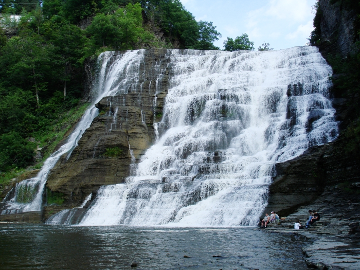
Bear Trail is a short, easy hike in Buttermilk Falls State Park in New York, managed by State Park and Recreation. The trail is about 0.8 miles long and rises about 52 feet from a low point of 878 feet to a high of 932 feet. It is an out-and-back route, and the total round-trip distance is about 1.7 miles. Summer and early fall are the most comfortable times to go. Typical averages from a nearby weather station in Ithaca show July highs around 80°F and September highs near 72°F, with no snow days from May through September. Winters are cold and snowy, with January highs around 31°F and snow on about 12 days that month. The Rim Trail starts just 0.1 mile away, and the Campground Trail and Owl Creek Trail are both within half a mile. The Finger Lakes Trail (Eastern Finger Lakes Region) passes about 1.3 miles off.
Best time to go · Aug–Sep
Best time to visit Bear Trail
Best months: August–September. Best months have typical highs of 55–85 °F, lows of 30 °F or warmer (32 °F where the station doesn't record snow), at most one snowy day and no more than 12 wet days.
Jan
31° / 15°
16 wet · 12 snow
Feb
33° / 15°
13 wet · 10 snow
Mar
41° / 22°
14 wet · 7 snow
Apr
54° / 33°
14 wet · 2 snow
May
67° / 44°
14 wet
Jun
76° / 53°
13 wet
Jul
80° / 58°
13 wet
Aug
79° / 56°
12 wet
Sep
72° / 49°
12 wet
Oct
59° / 39°
15 wet
Nov
47° / 30°
15 wet · 4 snow
Dec
36° / 22°
15 wet · 9 snow
Typical high / low (°F) and days with rain or snow, 1991–2020. Measured at Ithaca Cornell Univ, NY, 4.3 mi away at 960 ft. Source: NOAA NCEI U.S. Climate Normals 1991–2020.
Keep exploring — more trails worth the drive
 Photo: vwcampin, CC BY 2.0 (via Flickr)
Lake Treman Trail
~1 min drive
Easy out-and-back hike to a scenic glacial lake in the Finger Lakes.
 Photo: javajoe6, CC BY-SA 3.0 (via Wikimedia Commons)
Finger Lakes Trail (Eastern Finger Lakes Region)
~2 min drive
0.30-mile point-to-point trail in New York with 121 ft gain and 453 ft loss.
 Photo: seabamirum, CC BY 2.0 (via Flickr)
Cayuga Trail
~10 min drive
Nearly 8-mile point-to-point trail near Cayuga Lake in New York's Finger Lakes.
 Photo: vwcampin, CC BY 2.0 (via Flickr)
Gorge Trail
~6 min drive
3.68-mile out-and-back hike in New York with 1,603 ft elevation gain
Photo: javajoe6, CC BY-SA 3.0 (via Wikimedia Commons)Finger Lakes Trail Spur - Buttermilk Falls
~2 min drive
1.97-mile point-to-point trail in New York with 325 ft gain.
 Photo: javajoe6, CC BY-SA 3.0 (via Wikimedia Commons)
Backbone Trail
~26 min drive
11.22-mile out-and-back trail in New York with 1,127 ft elevation gain
 Photo: Russ Nelson, CC BY-SA 2.0 (via Flickr)
Yellow Trail
~9 min drive
A short point-to-point trail perfect for a quick New York hike.
Photo: javajoe6, CC BY-SA 3.0 (via Wikimedia Commons)Finger Lakes Trail Spur - Lick Brook
~2 min drive
0.46-mile point-to-point trail in New York with 135 ft gain.
 Photo: Seabamirum from Ithaca, CC BY 2.0 (via Wikimedia Commons)
Interloken Trail
~26 min drive
A 10.91-mile point-to-point New York trail through scenic terrain.
 Photo: javajoe6, CC BY-SA 3.0 (via Wikimedia Commons)
Abbott Loop
~11 min drive
A 6.77-mile point-to-point trail through New York's natural landscapes.
Map and trail data © OpenStreetMap contributors
