Pino
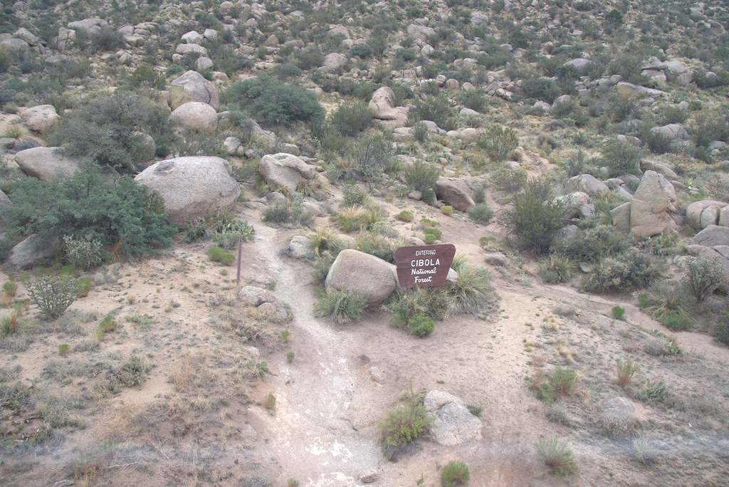
 Photo: maximalideal, CC BY-SA 2.0 (via Flickr)
- 8.1 mi
- round trip
- 2,506 ft
- climb
- 9,248 ft
- high point
- Out and back
- route
Caution today
Agency alerts are in effect for this area; weather is marginal · USFS, OpenWeather · checked just now
Is Pino open right now?
Closure in the area
There's a closure order in Sandia Ranger District. It doesn't name Pino, so check the source for the area it covers (3 listed).
Area Closure for Recreation Residence Structures and Property at 91 Casa Loma Road
Agency closure covering Sandia Ranger District · Order 03-03-05-26-14 · USFS · Sandia Ranger District
Area Closure for Recreation Residence Structures and Property at 69 Casa Loma Road
Agency closure covering Sandia Ranger District · Order 03-03-05-26-13 · USFS · Sandia Ranger District
Area Closure for Sandia Crest “Switchback” Hazard Tree and Fuel Reduction Project
Agency closure covering Sandia Ranger District · Order 03-03-05-26-02 · USFS · Sandia Ranger District
Sandia Ranger District Road & Area Closure for National Forest Road 462 Maintenance
Agency alert covering Sandia Ranger District · Order 03-03-05-26-24 · USFS · Sandia Ranger District
Mountainair and Sandia Ranger Districts Stage 1 Fire Restriction Lifted
Agency alert covering Sandia Ranger District · Order 03-03-00-26-20 · USFS · Sandia Ranger District
As of · Source: USFS · Sandia Ranger District. Agencies don't list every closure — check before you go.
Pino is a hard hike in the Sandia Mountain Wilderness, part of the Sandia Ranger District of Cibola National Forest in New Mexico. The route is an out-and-back that climbs from about 6,700 feet to nearly 9,250 feet, with a total elevation gain of about 2,500 feet over a distance of roughly 8 miles. The Elena Gallegos picnic area sits among the land units that make up this corner of the wilderness. The trail is natural-surface and not accessible. Bikes are not allowed. The land is managed as city land, and the hike is open year-round. The climb is a significant one, and the route is rated hard. The high point of 9,248 feet makes it a destination for those prepared for a long, steep day. The Elena Gallegos picnic area is close by, and the North Pino Canyon Route starts just 0.1 mile away. Climbers will find the Main Area and Upper Simms within a few tenths of a mile. The Nature Trail and Five Stones Nature Trail are both about 0.7 mile off.
Local outfitters
- Turquoise Trail Campground5 mi away
Not on Roamze yet. Their page has how to reach them.
- Main AreaRock climbing0.1 mi
- North Pino Canyon RouteHikingPhoto: maximalideal, CC BY-SA 2.0 (via Flickr)0.1 mi
- Upper SimmsRock climbing0.3 mi
- Simms Park (Elena Gallegos Picnic Area)Rock climbing0.4 mi
 Nature TrailHikingPhoto: eekim, CC BY 2.0 (via Flickr)0.7 mi
- Five Stones Nature TrailHiking0.7 mi
- Pino Trail (140)HikingPhoto: maximalideal, CC BY-SA 2.0 (via Flickr)0.7 mi
 Sandia MountainsRock climbingPhoto: Kevin Stroup, CC BY 3.0 (via Wikimedia Commons)0.8 mi
Source: Roamze catalog (indexable pages within 10 miles, PostGIS distance)
- North Pino Canyon RouteHiking · Next doorPhoto: maximalideal, CC BY-SA 2.0 (via Flickr)
- Nature TrailHiking · ~1 min drivePhoto: eekim, CC BY 2.0 (via Flickr)
- South Crest TrailHiking · ~4 min drive
- Canoncito Trail (150)Hiking · ~4 min drive
 Domingo BacaHiking · ~3 min drivePhoto: Ktr101, CC BY-SA 2.0 (via Flickr)
- Pino Trail (140)Hiking · ~1 min drivePhoto: maximalideal, CC BY-SA 2.0 (via Flickr)
 Foothills Trail NorthHiking · ~3 min drivePhoto: Ktr101, CC BY-SA 2.0 (via Flickr)
- Kiwanis Picnic Area TrailHiking · ~2 min drivePhoto: eekim, CC BY 2.0 (via Flickr)
 EmbuditoHiking · ~4 min drivePhoto: Matt Lavin, CC BY-SA 2.0 (via Flickr)
- Trail 230BHiking · ~2 min drivePhoto: eekim, CC BY 2.0 (via Flickr)
