Lucero
- 6.9 mi
- round trip
- 444 ft
- climb
- 10,158 ft
- high point
- Out and back
- route
- May–Jun, Sep
- best months
Caution today
Agency alerts are in effect for this area; weather is good · USFS, OpenWeather · checked 8 h ago
Is Lucero open right now?
Closure in the area
There's a closure order in Cuba Ranger District. It doesn't name Lucero, so check the source for the area it covers.
NFSR 313 Closed Due to Washout Near NM Highway 112
Agency closure covering Cuba Ranger District · USFS · Cuba Ranger District
Road Conditions
Agency alert covering Santa Fe National Forest · USFS · Santa Fe National Forest
As of · Source: USFS · Cuba Ranger District. Agencies don't list every closure — check before you go.
Lucero is a hard hike in the San Pedro Parks Wilderness, part of the Cuba Ranger District of the Santa Fe National Forest in northern New Mexico. The nearest town is Upper La Jara, about 3.4 miles away. The trail is a natural-surface out-and-back of about 6.9 miles, with a one-way climb of 444 feet from a low point of about 9,810 feet to a high of about 10,158 feet. Horses are allowed, but bikes are not. Summer is the most comfortable time to go. Typical averages from a nearby weather station at Los Alamos put July highs around 74°F with lows near 45°F, though that station sits well below the trail, so temperatures on the route run cooler. Winter is harsh, with January highs around 36°F and lows near 9°F. The Anastacio trail starts just 0.1 mile away, and Las Vacas Trail (51) and Los Pinos are both within about 2 miles. For an overnight stay, Rio De Las Vacas Campground lies roughly 8 miles off.
- AnastacioHiking0.1 mi
- Las Vacas Trail (51)Hiking1.9 mi
- Los PinosHiking2.2 mi
- Penas Negras Trail (32)Hiking2.5 mi
- Clear Creek CgCamping7.3 mi
- Clear Creek GcgCamping7.4 mi
- Rio De Las Vacas CampgroundCamping7.9 mi
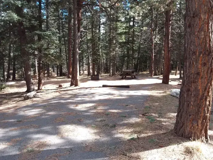 Clear Creek Campground (nm)CampingPhoto: Recreation.gov (RIDB) / public domain8.4 mi
Source: Roamze catalog (indexable pages within 10 miles, PostGIS distance)
 Cdt - New Mexico SectionHiking · ~20 min drivePhoto: John Fowler from Placitas, NM, USA, CC BY 2.0 (via Wikimedia Commons)
- Los PinosHiking · ~4 min drive
- Upper GallinaHiking · ~5 min drive
- Las Vacas Trail (51)Hiking · ~3 min drive
- Upper Clear CreekHiking · ~5 min drive
- DamianHiking · ~7 min drive
- Penas Negras Trail (32)Hiking · ~4 min drive
- Rio Capulin Trail (31)Hiking · ~5 min drive
- Old Cecelia TrailHiking · ~8 min drive
- Penas NegrasHiking · ~5 min drive
Best time to visit Lucero
Best months: May–June and September. Best months have typical highs of 55–85 °F, lows of 30 °F or warmer (32 °F where the station doesn't record snow), at most one snowy day and no more than 12 wet days.
Jan
36° / 9°
9 wet
Feb
38° / 12°
9 wet
Mar
44° / 20°
9 wet
Apr
52° / 25°
8 wet
May
62° / 32°
8 wet
Jun
72° / 39°
8 wet
Jul
74° / 45°
15 wet
Aug
71° / 43°
15 wet
Sep
66° / 35°
11 wet
Oct
57° / 26°
7 wet
Nov
45° / 17°
6 wet
Dec
36° / 9°
9 wet
Typical high / low (°F) and days with rain or snow, 1991–2020. Measured at Los Alamos 13 W, NM, 25.5 mi away at 8,716 ft. The station sits about 1,400 ft lower than this place, so expect it a little cooler here. This station doesn't record snowfall. Source: NOAA NCEI U.S. Climate Normals 1991–2020.
