Los Pinos Trail Head (95)
- 0.3 mi
- round trip
- 95 ft
- climb
- 7,480 ft
- high point
- Out and back
- route
- May–Jun, Aug–Oct
- best months
Is Los Pinos Trail Head (95) open right now?
Closure in the area
There's a closure order in Cuba Ranger District. It doesn't name Los Pinos Trail Head (95), so check the source for the area it covers.
NFSR 313 Closed Due to Washout Near NM Highway 112
Agency closure covering Cuba Ranger District · USFS · Cuba Ranger District
Road Conditions
Agency alert covering Santa Fe National Forest · USFS · Santa Fe National Forest
As of · Source: USFS · Cuba Ranger District. Agencies don't list every closure — check before you go.
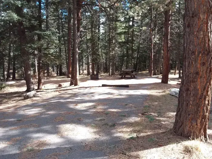
Los Pinos Trail Head (95) is a short, easy out-and-back hike in the Cuba Ranger District of New Mexico's Santa Fe National Forest, managed by the Forest Service. The trail rises about 95 feet over roughly 0.66 miles, from a low point of about 7,376 feet to a high of about 7,480 feet. It makes a quick stop for anyone already on the forest's road network in this part of the district. Spring and fall are the most comfortable times to go. Typical averages from the nearby Cuba weather station show May highs around 74°F and October highs around 67°F, while July averages reach 87°F and January lows drop to 14°F. That station sits roughly 600 feet lower than the trail's high point, so expect temperatures on the trail to run a bit cooler. Other hikes close by include Los Pinos, about 2.2 miles away, and Lucero and Anastacio, each about 4 miles away. For an overnight stay, Clear Creek Campground is about 8.3 miles away.
- Los PinosHiking2.2 mi
- LuceroHiking4 mi
- AnastacioHiking4 mi
- Fisher TrailHiking4.6 mi
- Clear Creek CgCamping8.3 mi
- Clear Creek GcgCamping8.4 mi
- Rio De Las Vacas CampgroundCamping9.2 mi
 Clear Creek Campground (nm)CampingPhoto: Recreation.gov (RIDB) / public domain9.5 mi
Source: Roamze catalog (indexable pages within 10 miles, PostGIS distance)
 Cdt - New Mexico SectionHiking · ~15 min drivePhoto: John Fowler from Placitas, NM, USA, CC BY 2.0 (via Wikimedia Commons)
- Los PinosHiking · ~4 min drive
- DamianHiking · ~10 min drive
 Hal Baxter Memorial TrailHiking · ~31 min drivePhoto: cogdogblog, CC0 (via Wikimedia Commons)
- LuceroHiking · ~7 min drive
- Upper GallinaHiking · ~10 min drive
- WATER TANK LOOPHiking · ~6 min drive
- Upper Clear CreekHiking · ~9 min drive
- PalomasHiking · ~13 min drive
- AnastacioHiking · ~7 min drive
Best time to visit Los Pinos Trail Head (95)
Best months: May–June and August–October. Best months have typical highs of 55–85 °F, lows of 30 °F or warmer (32 °F where the station doesn't record snow), at most one snowy day and no more than 12 wet days.
Jan
43° / 14°
3 wet · 3 snow
Feb
47° / 19°
4 wet · 2 snow
Mar
56° / 25°
4 wet · 2 snow
Apr
64° / 29°
3 wet · 1 snow
May
74° / 36°
4 wet
Jun
85° / 45°
4 wet
Jul
87° / 54°
7 wet
Aug
84° / 53°
9 wet
Sep
79° / 44°
6 wet
Oct
67° / 31°
4 wet
Nov
54° / 23°
3 wet · 1 snow
Dec
44° / 16°
4 wet · 3 snow
Typical high / low (°F) and days with rain or snow, 1991–2020. Measured at Cuba, NM, 6.3 mi away at 6,908 ft. The station sits about 600 ft lower than this place, so expect it a little cooler here. Source: NOAA NCEI U.S. Climate Normals 1991–2020.
Map and trail data © OpenStreetMap contributors
