Historic Route 66
- 5.2 mi
- round trip
- 116 ft
- climb
- 6,450 ft
- high point
- Out and back
- route
- May, Sep–Oct
- best months
Historic Route 66 is an easy out-and-back hike in New Mexico, about 2.7 miles from the town of Anzac. The route is managed by the Bureau of Indian Affairs and runs roughly 10.4 miles round trip, with a low point of 6,325 feet and a high of 6,450 feet. The climb is gentle, with an elevation gain of 116 feet one way. Spring and fall are the most comfortable times to go. Typical averages from a nearby weather station at Grants show May highs around 80°F and October highs around 73°F, while July and August average in the low 90s and bring the most wet days of the year. El Malpais Road starts just 0.1 mile away, and East Santa Fe Avenue is about 5 miles off. The Continental Divide Trail passes within about 7 miles, and Mount Taylor RD, a fishing spot, is roughly 6.7 miles away.
Local outfitters
- El Morro RV Park & Cabins31 mi away
Not on Roamze yet. Their page has how to reach them.
- El Malpais RoadHiking0.1 mi
- East Santa Fe AvenueHiking5.1 mi
- Roosevelt AvenueHiking6.4 mi
- Lobo Canyon RoadHiking6.4 mi
- 1St StreetHiking6.6 mi
- Mount Taylor RDLake fishing6.7 mi
- Continental Divide TrailHiking7.2 mi
- Cdt - New Mexico SectionHiking7.3 mi
Source: Roamze catalog (indexable pages within 10 miles, PostGIS distance)
 El Calderon Loop TrailHiking · ~27 min drivePhoto: Fredlyfish4, CC BY-SA 4.0 (via Wikimedia Commons)
- Double SinksHiking · ~27 min drive
 The Narrows Rim TrailHiking · ~28 min drivePhoto: RuggyBearLA, CC BY-SA 2.0 (via Flickr)
- El Malpais RoadHiking · Next door
- Cdt-Alt Ley BushwhackHiking · ~28 min drivePhoto: RuggyBearLA, CC BY-SA 2.0 (via Flickr)
- El Calderon Lava TrenchHiking · ~28 min drive
- Lobo Canyon RoadHiking · ~11 min drive
- Continental Divide TrailHiking · ~12 min drive
- El Calderon TrailHiking · ~28 min drivePhoto: Fredlyfish4, CC BY-SA 4.0 (via Wikimedia Commons)
- Life on the EdgeHiking · ~28 min drive
Also worth it near here
- Lavaland RV ParkCamping · ~8 min drive
- Mount Taylor RDLake fishing · ~11 min drive
- Sandstone Bluffs ArchNatural arch · ~17 min drive
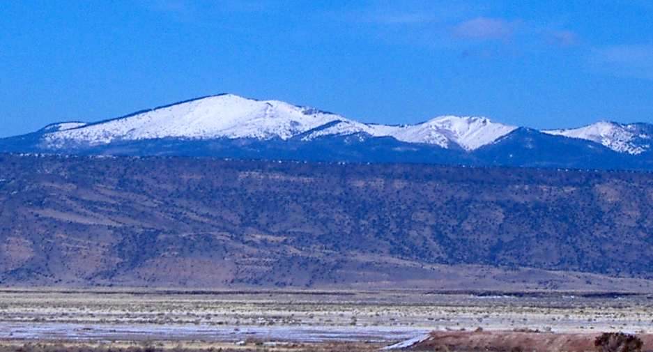 Mount TaylorSummit · ~24 min drivePhoto: ANNAfoxlover at English Wikipedia / Later version(s) were uploaded by Casito at English Wikipedia., Public domain (via Wikimedia Commons)
Best time to visit Historic Route 66
Best months: May and September–October. Best months have typical highs of 55–85 °F, lows of 30 °F or warmer (32 °F where the station doesn't record snow), at most one snowy day and no more than 12 wet days.
Jan
50° / 15°
4 wet
Feb
56° / 17°
3 wet
Mar
64° / 23°
3 wet
Apr
70° / 31°
3 wet
May
80° / 39°
3 wet
Jun
90° / 48°
4 wet
Jul
92° / 55°
8 wet
Aug
89° / 53°
10 wet
Sep
83° / 45°
6 wet
Oct
73° / 32°
4 wet
Nov
60° / 21°
4 wet
Dec
50° / 14°
4 wet
Typical high / low (°F) and days with rain or snow, 1991–2020. Measured at Grants Ap, NM, 9.2 mi away at 6,520 ft. This station doesn't record snowfall. Source: NOAA NCEI U.S. Climate Normals 1991–2020.
Map and trail data © OpenStreetMap contributors
