Juniper Campground Loop A
Campground
Campground · 1.0 mi from the trail
 Photo: NPS
Alert in the area
The National Park Service lists an alert for Bandelier National Monument.
The Use of GPS is NOT Recommended
Park alert covering Bandelier National Monument · NPS · Bandelier National Monument
As of · Source: NPS · Bandelier National Monument. Agencies don't list every closure — check before you go.
Exiting Tyuonyi Pueblo Loop Trail Stop 9 is a stop on the Tyuonyi Pueblo Loop Trail in Bandelier National Monument, managed by the National Park Service in New Mexico. The trail exits the Tyuonyi area, and the stop is a place to pause and look back at the village setting before excavations. The trail here is short, and the stop sits among several other trail stops within about a tenth of a mile, including Stop 8, Stop 6 and Stop 12. The site is a small slope with abundant plant life, and it offers a view of the cliff ahead. At least one of the three ladders leading to a cavate or human-excavated cave is visible from here. The rock is relatively soft, but carving these openings would have been a difficult task using basalt tools. Spring and fall are the most comfortable times to visit. Typical averages from a nearby weather station at Cochiti Dam show April highs around 71°F and October highs around 74°F, while July and August average highs near 94°F. A fee is charged for this stop.
Juniper Campground Loop A
Campground
Sirphey at Bandelier Restaurant
Fast food
 If it rainsNewMexicophotographer1, CC BY-SA 4.0 · Wikimedia Commons
Places © OpenStreetMap contributors · Photos: NewMexicophotographer1, CC BY-SA 4.0 (commons)
More in Santo Domingo PuebloNot on Roamze yet. Their page has how to reach them.
Best months: March–May and October. Best months have typical highs of 55–85 °F, lows of 30 °F or warmer (32 °F where the station doesn't record snow), at most one snowy day and no more than 12 wet days.
Jan
50° / 20°
4 wet · 1 snow
Feb
56° / 24°
4 wet · 1 snow
Mar
64° / 30°
4 wet
Apr
71° / 37°
4 wet
May
81° / 46°
5 wet
Jun
92° / 56°
5 wet
Jul
94° / 61°
10 wet
Aug
92° / 59°
10 wet
Sep
86° / 52°
6 wet
Oct
74° / 39°
5 wet
Nov
60° / 28°
4 wet
Dec
50° / 20°
4 wet · 1 snow
Typical high / low (°F) and days with rain or snow, 1991–2020. Measured at Cochiti Dam, NM, 10.3 mi away at 5,560 ft. The station sits about 600 ft lower than this place, so expect it a little cooler here. Source: NOAA NCEI U.S. Climate Normals 1991–2020.
HIKE
Entering Tyuonyi Pueblo Loop Trail Stop 7
Next door
You are now standing in the central plaza of the village. Can you hear the dogs barking and the laughter of children playing or chasing the domesticated turkeys? This would have been a very active and noisy place during Ancestral Pueblo times. One theory suggests that this vil…
HIKE
Native Plants Pueblo Loop Trail Stop 6
Next door
You are approaching the remains of the village of Tyuonyi (QU-weh-nee). Once the walls of the village would have stood one to two stories tall in front of you but now only the base layers remain. Around the village two important plants still grow, four-winged saltbush and pale…
 Photo: MARELBU, CC BY 3.0 (via Wikimedia Commons)
Burro Trail
Next door
5.89-mile out-and-back trail in New Mexico with 188 ft elevation gain.
 Photo: olekinderhook, CC BY 3.0 (via Wikimedia Commons)
Pueblo Loop Trail
Next door
Compact 1.33-mile loop with steep elevation gain near Pueblo, NM.
HIKE
Talus House Pueblo Loop Trail Stop 12
Next door
This is Talus House, reconstructed in 1920 to show the structures that would have been found in front of many of the cavates when the Ancestral Pueblo people were still occupying the canyon. For many years park staff believed the reconstruction was inaccurate due to what appea…
 Photo: davidwilson1949, CC BY 2.0 (via Flickr)
Main Loop
Next door
0.15-mile lollipop trail with 44 ft gain in New Mexico.
HIKE
Frijoles Canyon Pueblo Loop Trail Stop 13
Next door
Stop and look out over the canyon. Does it look lush, and green compared to the mesa above it? As we discussed earlier this is a riparian area that has greater diversity of plants and wildlife than other nearby areas. Although much farming was done on the surrounding mesas som…
Photo: davidwilson1949, CC BY 2.0 (via Flickr)Long Trail
Next door
1.04-mile out-and-back trail in New Mexico with 1,224 ft of elevation gain.
HIKE
Cavate Pueblo Loop Trail Stop 14
Next door
Have you notice anything different about the cavates you have entered by climbing ladders? They all have concrete floors. Without the concrete to protect them from our footwear, the natural cavate floors would have been worn deeply by our entering these significant features. R…
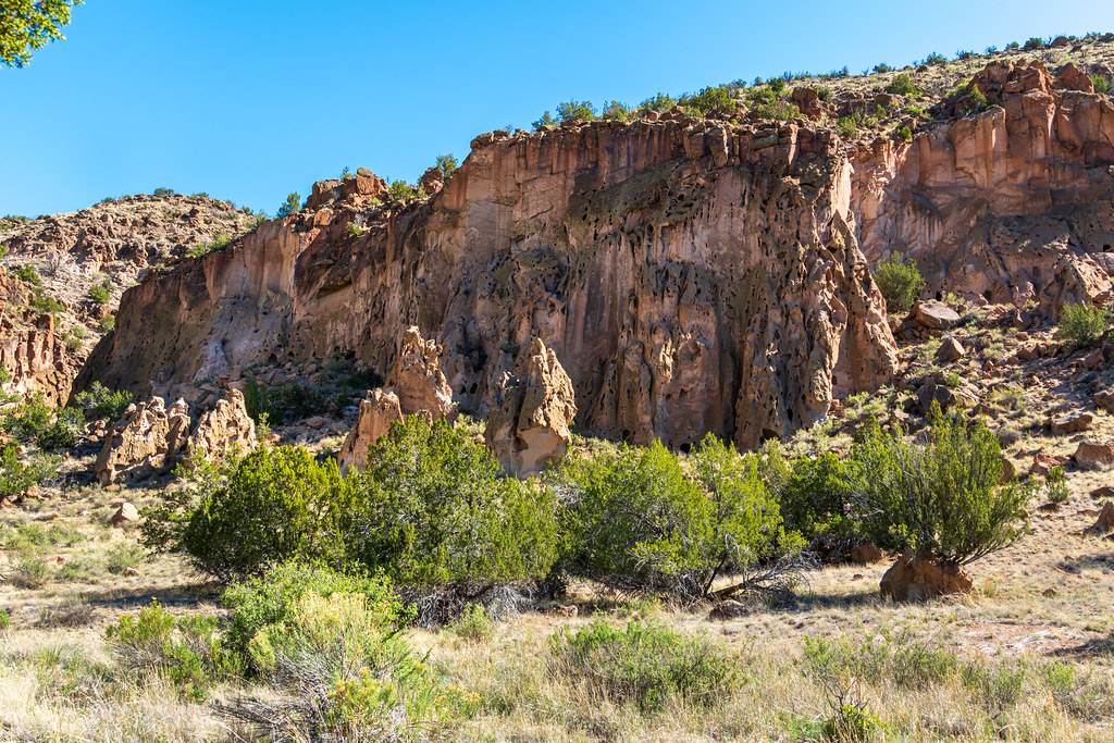 Photo: dconvertini, CC BY-SA 2.0 (via Flickr)
Alcove House Trail
Next door
0.63-mile out-and-back hike in New Mexico with 347 ft elevation gain.
