Collapsed Lava Tube at Capulin Volcano
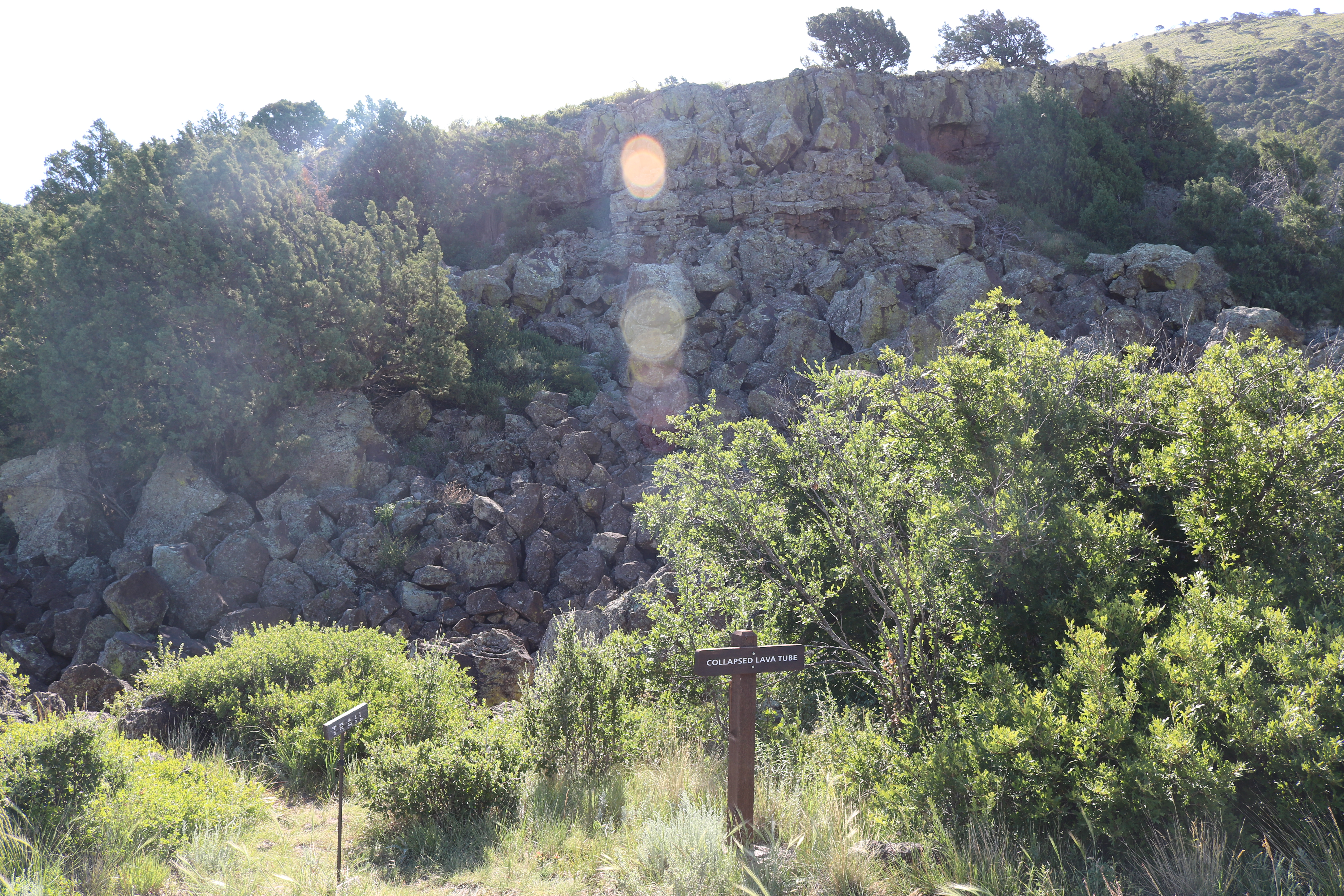 Photo: NPS Photo
- May–Jun, Aug–Oct
- best months
Clear today
Weather is good · OpenWeather · checked 8 h ago
Is Collapsed Lava Tube at Capulin Volcano open right now?
Closure in the area
There's a closure order in Capulin Volcano National Monument. It doesn't name Collapsed Lava Tube at Capulin Volcano, so check the source for the area it covers.
Volcano Top Access Closed to Vehicles over 26 feet long and to all Trailers
Park closure covering Capulin Volcano National Monument · NPS · Capulin Volcano National Monument
Bicycles and Pedestrians now allowed on Volcano Road
Park alert covering Capulin Volcano National Monument · NPS · Capulin Volcano National Monument
As of · Source: NPS · Capulin Volcano National Monument. Agencies don't list every closure — check before you go.
Collapsed Lava Tube at Capulin Volcano is a hike within Capulin Volcano National Monument in New Mexico, managed by the National Park Service. The site sits among a cluster of other short routes, with the Crater Rim Trail about 0.3 miles away and the Crater Vent at Capulin Volcano, the Historic Chimney at Capulin Volcano and the Top of Capulin Volcano all within about 0.4 miles. A fee is charged for the visit, according to the National Park Service. Spring and fall are the most comfortable times to go. Typical averages from a nearby weather station in Capulin, at a similar elevation, show May highs around 74°F and October highs around 67°F, while July averages about 86°F and January highs sit near 46°F. The station sits a few hundred feet lower than the lava tube, so temperatures at the site run slightly cooler. The other routes close by make it easy to pair this stop with a longer outing.
Best time to go · May–Jun, Aug–Oct
Best time to visit Collapsed Lava Tube at Capulin Volcano
Best months: May–June and August–October. Best months have typical highs of 55–85 °F, lows of 30 °F or warmer (32 °F where the station doesn't record snow), at most one snowy day and no more than 12 wet days.
Jan
46° / 15°
5 wet
Feb
49° / 18°
5 wet
Mar
57° / 24°
6 wet
Apr
64° / 31°
6 wet
May
74° / 40°
8 wet
Jun
83° / 49°
10 wet
Jul
86° / 54°
13 wet
Aug
83° / 53°
11 wet
Sep
77° / 46°
7 wet
Oct
67° / 33°
5 wet
Nov
54° / 22°
4 wet
Dec
46° / 14°
5 wet
Typical high / low (°F) and days with rain or snow, 1991–2020. Measured at Capulin, NM, 3.5 mi away at 6,840 ft. The station sits about 600 ft lower than this place, so expect it a little cooler here. This station doesn't record snowfall. Source: NOAA NCEI U.S. Climate Normals 1991–2020.
Keep exploring — more trails worth the drive
HIKE
Crater Vent at Capulin Volcano
Next door
Walk down into the crater of an extinct cinder cone volcano! Capulin Volcano built from this vent which was plugged after the eruption with solidified lava. Rising 415 feet (126 meters) above the vent at it's highest point, the rim of the crater has a bowl shape with a…
HIKE
Historic Chimney at Capulin Volcano
Next door
Visit a historic chimney along the Boca Trail! The remains of an old picnic area and campground, the chimney is made of basalt lava rock from the surrounding area. Nearby, past a gambel oak thicket, is another collapsed lava tube. This lava tube formed when the molten lava flo…
HIKE
Santa Fe Trail
~46 min drive
6.86-mile out-and-back trail in New Mexico with 217 ft elevation gain/loss
HIKE
Santa Fe Trail
~56 min drive
13.78-mile out-and-back trail in New Mexico with 542 ft gain/loss.
HIKE
Goldenrod Trail
~1h 4m drive
9.22-mile out-and-back hike in Colorado with 2,347 ft elevation gain
 Photo: skua47, CC BY 2.0 (via Flickr)
Boca Trail
Next door
1.63-mile loop in New Mexico with 252 ft elevation gain.
HIKE
Top of Capulin Volcano
Next door
Hike to the top of an extinct cinder cone volcano! By hiking along the Crater Rim Trail, you can get to the highest elevation at Capulin Volcano National Monument at 8182 feet (or 2494 meters). From this point, the northern part of the Raton-Clayton Volcanic Field can be…
HIKE
Trail D
~46 min drive
3.60-mile out-and-back trail in Colorado with 1,317 ft gain
HIKE
Santa Fe Trail
~56 min drive
15.06-mile out-and-back trail in New Mexico with 197 ft elevation gain
Photo: skua47, CC BY 2.0 (via Flickr)Lava Flow Trail
~1 min drive
1.7-mile out-and-back trail in New Mexico with 125 ft of elevation gain.

