Arbolitos Trail
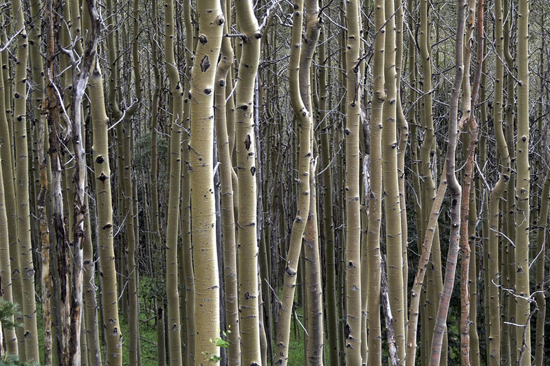
 Photo: T100Timlen, Public Domain Dedication (CC0) (via Flickr)
- 0.4 mi
- round trip
- 35 ft
- climb
- 7,348 ft
- high point
- Out and back
- route
- Apr–Jun, Aug–Oct
- best months
Arbolitos Trail is a short, easy out-and-back hike in New Mexico, about 1.4 miles from the community of Tano Road. The trail is just under 0.8 miles long, with a low point of 7,293 feet and a high of 7,348 feet, so the climb is gentle, rising about 35 feet from start to finish. Spring and fall are the most comfortable times to go. Typical averages from a nearby weather station in Santa Fe show May highs around 73°F and October highs around 66°F, while July and August bring the most wet days of the year. Several other trails sit close by. Thornburg Trail is about 0.3 miles away and Ridgetop Trail about 0.4 miles. The City of Santa Fe Open Space Trail is roughly 0.7 miles off, and the Santa Fe Area climbing area is about 3.6 miles away.
Local outfitters
- Turquoise Trail Campground47 mi away
Not on Roamze yet. Their page has how to reach them.
- Thornburg TrailHiking0.3 mi
- Ridgetop TrailHiking0.4 mi
- City of Santa Fe Open Space TrailHiking0.7 mi
- Piñon Ridge TrailHiking0.8 mi
- Santa Fe AreaRock climbing3.6 mi
- Black Canyon (New)CgCamping6.1 mi
- Big TesuqueCamping8.3 mi
- Aspen BasinCamping9.3 mi
Source: Roamze catalog (indexable pages within 10 miles, PostGIS distance)
 Hustle and FlowHiking · ~2 min drivePhoto: Paul and Jill, CC BY 2.0 (via Flickr)
 Galbaldon TrailHiking · ~9 min drivePhoto: awsheffield, CC BY 2.0 (via Flickr)
- Wee Whoop-Tees TrailHiking · ~3 min drivePhoto: Paul and Jill, CC BY 2.0 (via Flickr)
 AtalayaHiking · ~8 min drivePhoto: Bryan Ungard from Santa Fe, New Mexico, USA, CC BY-SA 2.0 (via Wikimedia Commons)
- La Tierra Trail NetworkHiking · ~4 min drivePhoto: Paul and Jill, CC BY 2.0 (via Flickr)
 SaddlebackHiking · ~9 min drivePhoto: Michael Zanussi, CC BY 2.0 (via Flickr)
 Ann Nitze Hiking TrailHiking · ~4 min drivePhoto: KathyKnorr - Santa Fe - New Mexico, CC BY-SA 2.0 (via Flickr)
- South Summit TrailHiking · ~5 min drive
 Aztec Springs TrailHiking · ~7 min drivePhoto: Pete Stewart from Perth, Australia, CC BY-SA 2.0 (via Wikimedia Commons)
- JuanHiking · ~6 min drive
Best time to visit Arbolitos Trail
Best months: April–June and August–October. Best months have typical highs of 55–85 °F, lows of 30 °F or warmer (32 °F where the station doesn't record snow), at most one snowy day and no more than 12 wet days.
Jan
43° / 21°
5 wet
Feb
47° / 23°
5 wet
Mar
56° / 29°
5 wet
Apr
63° / 34°
4 wet
May
73° / 44°
4 wet
Jun
84° / 54°
6 wet
Jul
86° / 57°
11 wet
Aug
83° / 56°
11 wet
Sep
77° / 50°
7 wet
Oct
66° / 39°
6 wet
Nov
52° / 28°
5 wet
Dec
42° / 21°
6 wet
Typical high / low (°F) and days with rain or snow, 1991–2020. Measured at Santa Fe Seton, NM, 8.5 mi away at 7,000 ft. This station doesn't record snowfall. Source: NOAA NCEI U.S. Climate Normals 1991–2020.
Map and trail data © OpenStreetMap contributors
