Mountain · 1 route
Mount Tom
4,046 ft · New Hampshire
- Summit
- 4,046 ft
- Routes
- 1 way up
Route up Mount Tom
About Mount Tom
Mount Tom is a summit of 4,046 feet in the Pemigewasset Ranger District of White Mountain National Forest in New Hampshire, about 12 miles from the town of Bartlett. Several trails start close by. The A-Z hike is under a mile away, and the Willey Range Trail and the MT TOM - MT FIELD LOOP SNOMO route are each about a mile off. Climbers can find Elephant's Head about 2 miles away.
Forecast on Mount Tom
Daily highs and lows, wind and the chance of precipitation at the summit and route start for the next 7 days, from the Open-Meteo model.
Questions about Mount Tom
How tall is Mount Tom?
4,046 ft (1,233 m).
How many routes go to the summit of Mount Tom?
One: Mount Tom.
Mountains nearby
- Mount Field4,323 ft · New Hampshire2 routes1.2 mi away
 Mount Willard2,847 ft · New Hampshire1 route1.7 mi awayPhoto: Ken Gallager, CC BY-SA 4.0 (via Wikimedia Commons)
 Mount Willey4,296 ft · New Hampshire1 route2.2 mi awayPhoto: wwoods, CC BY-SA 3.0 (via Wikimedia Commons)
 Mount Hale4,063 ft · New Hampshire3 routes3.4 mi awayPhoto: Ken Gallager, CC BY-SA 4.0 (via Wikimedia Commons)
- Mount Jackson4,049 ft · New Hampshire2 routes3.5 mi away
- Mount Pierce4,310 ft · New Hampshire2 routes4.1 mi away
Facts about this place
Where it is
- Pemigewasset Ranger District · Ranger district
- White Mountain National Forest · National forest
- Nearest town
- Bartlett, New Hampshire · 12 mi
Conditions
Active alerts for Pemigewasset Ranger District as of Oct 9, 2026:
Rattlesnake Fire – Pemigewasset Ranger District
fire-restriction · posted Aug 27, 2026
Source: USFS forest alerts
Nearby
 A-ZHikingPhoto: Cliff from Arlington, Virginia, USA, CC BY 2.0 (via Wikimedia Commons)0.7 mi
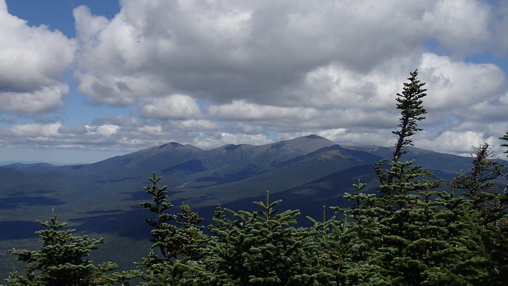 Willey Range TrailHikingPhoto: Northfoot Adventures, CC BY 2.0 (via Flickr)1 mi
- MT TOM - MT FIELD LOOP SNOMOHiking1.2 mi
- Elephant's HeadRock climbing2 mi
- Mt. WillardRock climbing2 mi
- Ethan Pond ShelterCamping2.5 mi
 Omni Mount Washington Resort, Bretton WoodsLake fishing3.5 mi
- Nauman TentsiteCamping3.9 mi
Source: Roamze catalog (indexable pages within 10 miles, PostGIS distance)
Is Mount Tom open right now?
Closure in the area
There's a closure order in White Mountain National Forest. It doesn't name Mount Tom, so check the source for the area it covers.
Rattlesnake Fire – Pemigewasset Ranger District
Agency closure covering White Mountain National Forest · USFS · White Mountain National Forest
Town Hall Road Camping and Fire Restrictions
Agency alert covering White Mountain National Forest · USFS · White Mountain National Forest
Lincoln Woods Trail Closure
Agency alert covering White Mountain National Forest · USFS · White Mountain National Forest
Forest Roads Status
Agency alert covering White Mountain National Forest · USFS · White Mountain National Forest
Sawyer River Road Temporarily Closed
Agency alert covering White Mountain National Forest · USFS · White Mountain National Forest
As of · Source: USFS · White Mountain National Forest. Agencies don't list every closure — check before you go.
