Jericho Mountain State Park Boat Ramp
- Aug–Sep
- best months
Is Jericho Mountain State Park Boat Ramp open right now?
Closure in the area
There's a closure order in White Mountain National Forest. It doesn't name Jericho Mountain State Park Boat Ramp, so check the source for the area it covers (2 listed).
Wild River Fire - Androscoggin Ranger District
Agency closure covering White Mountain National Forest · USFS · White Mountain National Forest
Rattlesnake Fire – Pemigewasset Ranger District
Agency closure covering White Mountain National Forest · USFS · White Mountain National Forest
Town Hall Road Camping and Fire Restrictions
Agency alert covering White Mountain National Forest · USFS · White Mountain National Forest
Lincoln Woods Trail Closure
Agency alert covering White Mountain National Forest · USFS · White Mountain National Forest
Forest Roads Status
Agency alert covering White Mountain National Forest · USFS · White Mountain National Forest
As of · Source: USFS · White Mountain National Forest. Agencies don't list every closure — check before you go.
Jericho Mountain State Park Boat Ramp is a boat launch in New Hampshire, set within the Androscoggin Ranger District of the White Mountain National Forest. The nearest town is Berlin, about 1.4 miles away. Summer is the most comfortable time to get on the water. Typical averages from the nearby York Pond weather station show July highs around 76°F with lows near 53°F, while winter highs stay in the 20s. Several other outdoor spots lie within a few miles. Cates Hill Trail and Mt. Jasper Trail are both hikes about 3.5 miles away, and the Upper Ammonoosuc River offers more paddling at about 3.8 miles. For an overnight stay, Rogers Ledge Tent Site is roughly 5.9 miles off.
 Cates Hill TrailHikingPhoto: Magicpiano, CC BY-SA 4.0 (via Wikimedia Commons)3.4 mi
- Mt. Jasper TrailHikingPhoto: Magicpiano, CC BY-SA 4.0 (via Wikimedia Commons)3.6 mi
 Mount ForistRock climbingPhoto: Jon Platek, CC BY-SA 3.0 (via Wikimedia Commons)3.7 mi
- Madigan AreaRock climbingPhoto: Jon Platek, CC BY-SA 3.0 (via Wikimedia Commons)3.7 mi
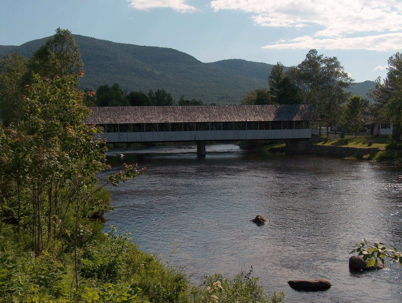 Upper Ammonoosuc RiverCanoeingPhoto: Ken Gallager at English Wikipedia, Public domain (via Wikimedia Commons)3.8 mi
- Rogers Ledge Tent SiteCamping5.9 mi
- Unknown Pond Tent SiteCamping6.7 mi
 Androscoggin RiverCanoeingPhoto: Mike Cline, CC BY-SA 3.0 (via Wikimedia Commons)8 mi
Source: Roamze catalog (indexable pages within 10 miles, PostGIS distance)
- Upper Ammonoosuc RiverCanoeing · ~6 min drivePhoto: Ken Gallager at English Wikipedia, Public domain (via Wikimedia Commons)
- Nansen Wayside State Park Boat RampBoat launch · ~9 min drive
- Androscoggin RiverCanoeing · ~14 min drivePhoto: Mike Cline, CC BY-SA 3.0 (via Wikimedia Commons)
- Cedar Pond Boat AccessBoat launch · ~11 min drive
- Androscoggin RiverCanoeing · ~14 min drivePhoto: Mike Cline, CC BY-SA 3.0 (via Wikimedia Commons)
- Boffinger Conservation Area Boat RampBoat launch · ~14 min drive
- Androscoggin RiverCanoeing · ~14 min drivePhoto: Mike Cline, CC BY-SA 3.0 (via Wikimedia Commons)
- Success Pond Boat RampBoat launch · ~20 min drive
- Androscoggin RiverCanoeing · ~14 min drivePhoto: Mike Cline, CC BY-SA 3.0 (via Wikimedia Commons)
- Martin Meadow Pond Boat LaunchBoat launch · ~29 min drive
Also worth it near here
 Jericho MountainSummit · ~5 min drivePhoto: Sirberlinnh, CC BY-SA 4.0 (via Wikimedia Commons)
- Cates Hill TrailHiking · ~6 min drivePhoto: Magicpiano, CC BY-SA 4.0 (via Wikimedia Commons)
- Mount ForistRock climbing · ~6 min drivePhoto: Jon Platek, CC BY-SA 3.0 (via Wikimedia Commons)
- Milan State Park CampgroundCamping · ~9 min drive
Best time to visit Jericho Mountain State Park Boat Ramp
Best months: August–September. Best months have typical highs of 55–85 °F, lows of 30 °F or warmer (32 °F where the station doesn't record snow), at most one snowy day and no more than 12 wet days.
Jan
25° / 4°
15 wet
Feb
28° / 5°
12 wet
Mar
36° / 15°
12 wet
Apr
49° / 27°
12 wet
May
63° / 39°
15 wet
Jun
71° / 48°
14 wet
Jul
76° / 53°
14 wet
Aug
75° / 51°
12 wet
Sep
68° / 43°
12 wet
Oct
54° / 33°
14 wet
Nov
41° / 24°
13 wet
Dec
30° / 12°
16 wet
Typical high / low (°F) and days with rain or snow, 1991–2020. Measured at York Pond, NH, 3.7 mi away at 1,519 ft. This station doesn't record snowfall. Source: NOAA NCEI U.S. Climate Normals 1991–2020.
Map and trail data © OpenStreetMap contributors
