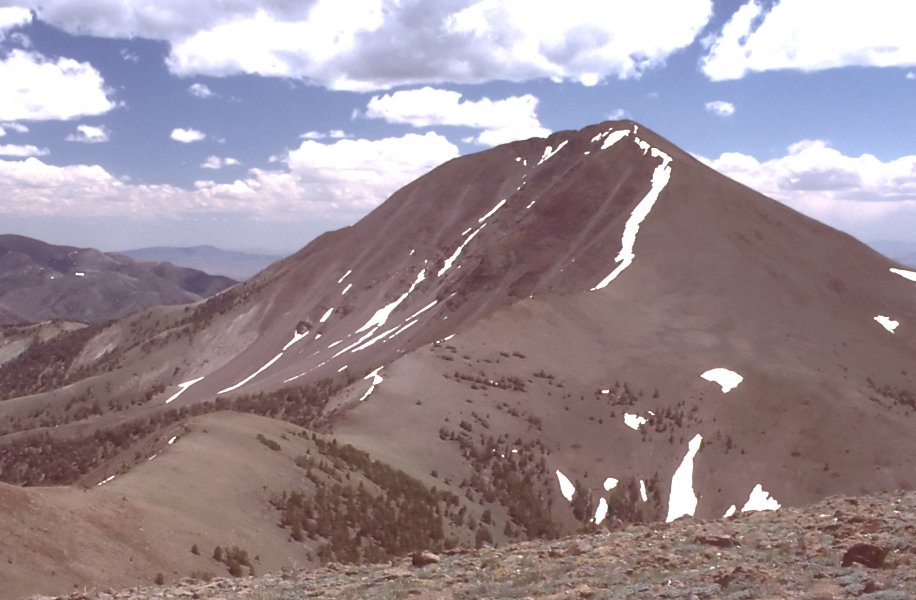
Table Mountain
- 10,888 ft
- summit
- 1
- way up
Is Table Mountain open right now?
Closure in the area
There's a closure order in Humboldt-Toiyabe National Forest. It doesn't name Table Mountain, so check the source for the area it covers.
Elephant Fire Closure
Agency closure covering Humboldt-Toiyabe National Forest · Order 04-17-26-01-04 · USFS · Humboldt-Toiyabe National Forest
Area, Road, and Trail Closures (Spring Mountains National Recreation Area)
Agency alert covering Humboldt-Toiyabe National Forest · Order 04-17-25-04 · USFS · Humboldt-Toiyabe National Forest
Year-Round Fire Restrictions (Spring Mountains National Recreation Area)
Agency alert covering Humboldt-Toiyabe National Forest · Order 04-17-24-01 · USFS · Humboldt-Toiyabe National Forest
Vehicle Snow Chain Requirements during Inclement Weather (Spring Mountains National Recreation Area)
Agency alert covering Humboldt-Toiyabe National Forest · Order 04-17-23-01 · USFS · Humboldt-Toiyabe National Forest
Rainbow Canyon Flood Diversion Structure Closure (Spring Mountains National Recreation Area)
Agency alert covering Humboldt-Toiyabe National Forest · Order 04-17-15-01 · USFS · Humboldt-Toiyabe National Forest
As of · Source: USFS · Humboldt-Toiyabe National Forest. Agencies don't list every closure — check before you go.
Table Mountain is a summit in Nevada, set within the Table Mountain Wilderness on the Austin-Tonopah Ranger District of the Humboldt-Toiyabe National Forest. The nearest town is Flowers Camp, about 20 miles away. Several hikes start close by. Table Mountain Skyline is about 2 miles away, and Danville Canyon is just under 3 miles off. South Morgan Basin and Morgan Basin Trail both lie within about 3.5 miles.
Conditions and forecast
Daily highs and lows, wind and the chance of precipitation at the summit and route start for the next 7 days, from the Open-Meteo model.
- Summit elevation
- 10,888 ft
Elevation from USGS 3D Elevation Program terrain data (about 10 m resolution).
Map © Mapbox © OpenStreetMap contributors Questions about Table Mountain
How tall is Table Mountain?
10,888 ft (3,319 m).
How many routes go to the summit of Table Mountain?
One: Table Mountain Skyline.
When is the best time to climb Table Mountain?
June 15 – October 30.
- Table Mountain SkylineHiking2.1 mi
- Danville CanyonHiking2.9 mi
- South Morgan BasinHiking3.1 mi
- Morgan Basin TrailHiking3.4 mi
- Tuille CreekHiking3.5 mi
- Cottonwood Creek 2Hiking4.2 mi
- Clear CreekHiking4.4 mi
- North Fork Mosquito CreekHiking4.8 mi
Source: Roamze catalog (indexable pages within 10 miles, PostGIS distance)