Boundary Peak
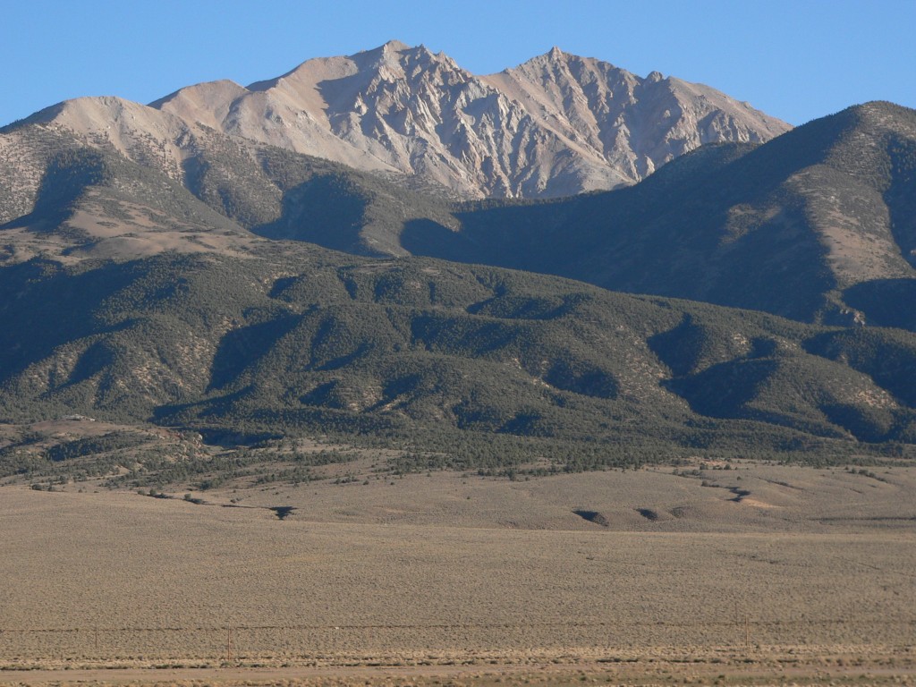 Photo: An63ca (talk · contribs), Public domain (via Wikimedia Commons)
- 13,132 ft
- summit
- 1
- way up
- Forest Service
- managed by
Is Boundary Peak open right now?
Alert in the area
The Forest Service lists 3 alerts for Inyo National Forest.
Help Halt Golden Mussel Invasion
Agency alert covering Inyo National Forest · USFS · Inyo National Forest
Ansel Adams and John Muir Wilderness Campfire Restrictions
Agency alert covering Inyo National Forest · Order 05-04-50-25-04 · USFS · Inyo National Forest
Golden Trout and Hoover Wilderness Campfire Restrictions
Agency alert covering Inyo National Forest · Order 05-04-50-25-05 · USFS · Inyo National Forest
As of · Source: USFS · Inyo National Forest. Agencies don't list every closure — check before you go.
Boundary Peak is a summit in Nevada, standing within the Boundary Peak Wilderness on the White Mountain Ranger District of Inyo National Forest, land managed by the Forest Service. The nearest town is Benton, California, about 7.6 miles away. The Boundary Peak Trail lies about 1.3 miles away, and Indian Creek Stock is about 8.7 miles off.
Conditions and forecast
Daily highs and lows, wind and the chance of precipitation at the summit and route start for the next 7 days, from the Open-Meteo model.
- Summit elevation
- 13,132 ft
- Land manager
- Forest Service
Elevation from USGS 3D Elevation Program terrain data (about 10 m resolution).
Map © Mapbox © OpenStreetMap contributors Questions about Boundary Peak
How tall is Boundary Peak?
13,132 ft (4,003 m).
How many routes go to the summit of Boundary Peak?
One: Boundary Peak.
 White Mountain Peak14,243 ft · California2 routes16 mi awayPhoto: JonathanLamb (talk · contribs), CC BY 3.0 (via Wikimedia Commons)
- Broken Finger Peak13,087 ft · California1 route36 mi away
 Red Slate Mountain13,164 ft · California1 route37 mi awayPhoto: Poppy (talk · contribs), CC BY-SA 3.0 (via Wikimedia Commons)
 Mount Tom13,643 ft · California1 route39 mi awayPhoto: Eeekster, CC BY-SA 4.0 (via Wikimedia Commons)
- Panorama Dome8,898 ft · California2 routes39 mi away
 Mount Abbot13,690 ft · California1 route40 mi awayPhoto: self, CC BY 3.0 (via Wikimedia Commons)
 Boundary Peak TrailHikingPhoto: Ken Lund, CC BY-SA 2.0 (via Flickr)1.3 mi
- Indian Creek StockHiking8.7 mi
Source: Roamze catalog (indexable pages within 10 miles, PostGIS distance)
 Mount DuboisSummit · ~7 min drivePhoto: Martin Stiburek, CC BY-SA 4.0 (via Wikimedia Commons)
- White Mountain PeakSummit · ~27 min drivePhoto: JonathanLamb (talk · contribs), CC BY 3.0 (via Wikimedia Commons)
 Glass MountainSummit · ~35 min drivePhoto: Eeekster, CC BY 3.0 (via Wikimedia Commons)
 Mount MorganSummit · ~56 min drivePhoto: Thumb10.40, CC BY-SA 4.0 (via Wikimedia Commons)
 Mount MorrisonSummit · ~58 min drivePhoto: The original uploader was Geographer at English Wikipedia., CC BY 1.0 (via Wikimedia Commons)
 Laurel MountainSummit · ~60 min drivePhoto: Frank Kovalchek from Anchorage, Alaska, USA, CC BY 2.0 (via Wikimedia Commons)
 Mount BaldwinSummit · ~60 min drivePhoto: Channel City Camera Club from Santa Barbara, US, CC BY 2.0 (via Wikimedia Commons)
 Bloody MountainSummit · ~1h 2m drivePhoto: Adorabutton, CC BY-SA 3.0 (via Wikimedia Commons)
 Mount HopkinsSummit · ~1h 3m drivePhoto: Fred Hsu from San Jose, United States, CC BY 2.0 (via Wikimedia Commons)
 Mount MorganSummit · ~1h 3m drivePhoto: Gregory Bryson from San Diego, CA, USA, CC BY 2.0 (via Wikimedia Commons)

