Boundary Peak
- 7.7 mi
- round trip
- 4,890 ft
- climb
- 13,146 ft
- high point
- Out and back
- route
Is Boundary Peak open right now?
Alert in the area
The Forest Service lists 3 alerts for Inyo National Forest.
Help Halt Golden Mussel Invasion
Agency alert covering Inyo National Forest · USFS · Inyo National Forest
Ansel Adams and John Muir Wilderness Campfire Restrictions
Agency alert covering Inyo National Forest · Order 05-04-50-25-04 · USFS · Inyo National Forest
Golden Trout and Hoover Wilderness Campfire Restrictions
Agency alert covering Inyo National Forest · Order 05-04-50-25-05 · USFS · Inyo National Forest
As of · Source: USFS · Inyo National Forest. Agencies don't list every closure — check before you go.
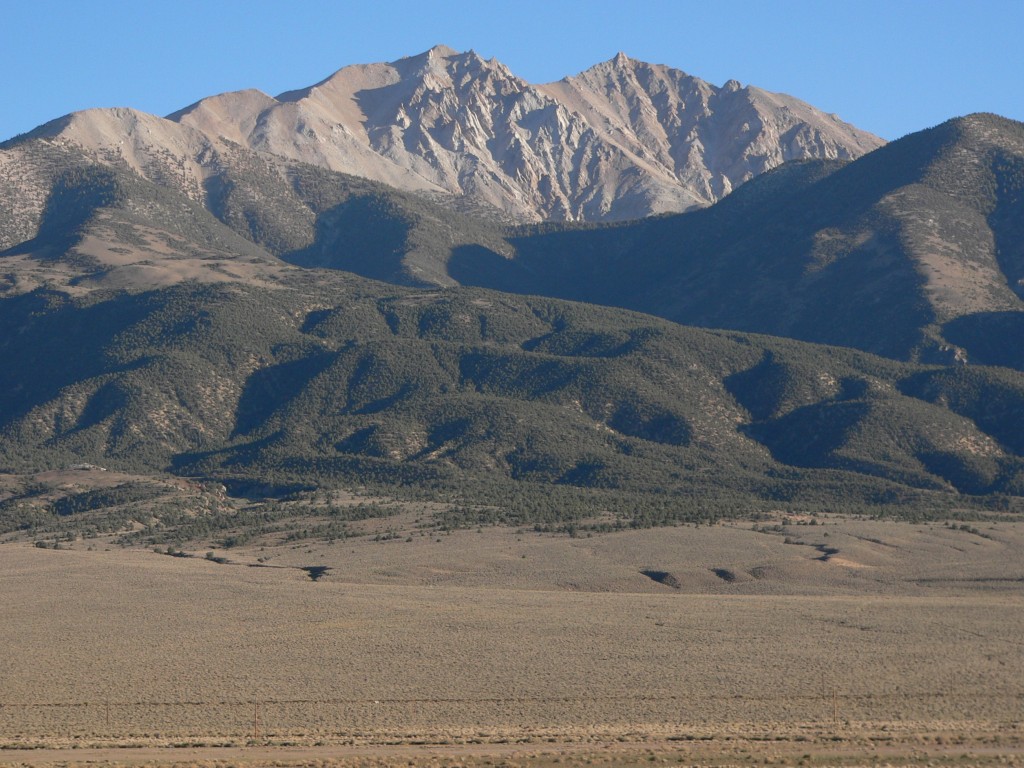
Boundary Peak is a high, steep out-and-back hike in Nevada's White Mountain Ranger District of Inyo National Forest, managed by the Forest Service. The route is about 7.7 miles long, with a total elevation gain of 4,890 feet, and the summit sits at 13,146 feet. The climb is rated expert, and the trip is estimated to take about five hours. The hike is a long, demanding day. The route gains about 4,890 feet in total, and the high point is reached at the summit. The trail is an out-and-back, so the same gain is covered on the way down. The Boundary Peak Trail lies about 2 miles away and is the closest nearby option.
Local outfitters
- Mammoth Lakes Pack Outfit42 mi away
- Bishop Pack Outfitters48 mi away
Not on Roamze yet. Their page has how to reach them.
Conditions and forecast on Boundary Peak
Daily highs and lows, wind and the chance of precipitation at the summit and route start for the next 7 days, from the Open-Meteo model.
Source: Roamze catalog (indexable pages within 10 miles, PostGIS distance)
 Boundary Peak TrailHiking · ~3 min drivePhoto: Ken Lund, CC BY-SA 2.0 (via Flickr)
 White Mountain PeakHiking · ~39 min drivePhoto: ilya_ktsn, CC BY 2.0 (via Flickr)
 Cottonwood Basin Overlook LoopHiking · ~43 min drivePhoto: RuggyBearLA, CC BY 2.0 (via Flickr)
 Blanco MountainHiking · ~48 min drivePhoto: Jim Morefield, CC BY-SA 2.0 (via Flickr)
 Lower Rock CreekHiking · ~50 min drivePhoto: GSEC, CC BY 2.0 (via Flickr)
- Cottonwood StockHiking · ~45 min drive
- Patriarch/ancients Vis LoopHiking · ~43 min drivePhoto: RuggyBearLA, CC BY 2.0 (via Flickr)
 STATION PEAK STOCKHiking · ~49 min drivePhoto: Jim Morefield, CC BY-SA 2.0 (via Flickr)
- Indian Creek StockHiking · ~17 min drive
 COTTONWOOD CREEK TRAILHiking · ~46 min drivePhoto: Jim Morefield, CC BY-SA 2.0 (via Flickr)

Route details
- Distance
- 7.7 mi round trip
- Climbing
- About 4,890 ft
- Summit
- 13,132 ft
- Difficulty
- Expert
Questions about this route
How long is the Boundary Peak on Boundary Peak?
About 7.7 mi round trip.
How much elevation gain is on the Boundary Peak?
About 4,890 ft of climbing round trip.
How hard is the Boundary Peak?
It is rated expert.
© openrouteservice.org by HeiGIT | Map data © OpenStreetMap contributors
